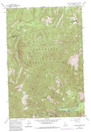
Cayuse Junction Topo Map Idaho
To zoom in, hover over the map of Cayuse Junction
USGS Topo Quad 46114e7 - 1:24,000 scale
| Topo Map Name: | Cayuse Junction |
| USGS Topo Quad ID: | 46114e7 |
| Print Size: | ca. 21 1/4" wide x 27" high |
| Southeast Coordinates: | 46.5° N latitude / 114.75° W longitude |
| Map Center Coordinates: | 46.5625° N latitude / 114.8125° W longitude |
| U.S. State: | ID |
| Filename: | o46114e7.jpg |
| Download Map JPG Image: | Cayuse Junction topo map 1:24,000 scale |
| Map Type: | Topographic |
| Topo Series: | 7.5´ |
| Map Scale: | 1:24,000 |
| Source of Map Images: | United States Geological Survey (USGS) |
| Alternate Map Versions: |
Cayuse Junction ID 1966, updated 1969 Download PDF Buy paper map Cayuse Junction ID 1966, updated 1984 Download PDF Buy paper map Cayuse Junction ID 1994, updated 1997 Download PDF Buy paper map Cayuse Junction ID 2011 Download PDF Buy paper map Cayuse Junction ID 2013 Download PDF Buy paper map |
| FStopo: | US Forest Service topo Cayuse Junction is available: Download FStopo PDF Download FStopo TIF |
1:24,000 Topo Quads surrounding Cayuse Junction
> Back to 46114e1 at 1:100,000 scale
> Back to 46114a1 at 1:250,000 scale
> Back to U.S. Topo Maps home
Cayuse Junction topo map: Gazetteer
Cayuse Junction: Gaps
Cold Storage Saddle elevation 1334m 4376′Wacamyoos Likoolam Saddle elevation 1418m 4652′
Cayuse Junction: Lakes
Cayuse Lake elevation 1545m 5068′Whitehouse Pond elevation 1008m 3307′
Cayuse Junction: Parks
Middle Fork Clearwater Wild and Scenic River elevation 1114m 3654′Cayuse Junction: Populated Places
Cayuse Junction elevation 1622m 5321′Cayuse Junction: Ridges
Wendover Ridge elevation 1553m 5095′Cayuse Junction: Streams
Badger Creek elevation 970m 3182′Cold Storage Creek elevation 989m 3244′
Eagle Creek elevation 977m 3205′
East Fork 'Imnamatnoon Creek elevation 1069m 3507′
East Fork Waw’aalamnime Creek elevation 1242m 4074′
'Imnamatnoon Creek elevation 1006m 3300′
Moss Creek elevation 1543m 5062′
Parachute Creek elevation 1042m 3418′
Robin Creek elevation 1001m 3284′
Silver Creek elevation 1567m 5141′
Wendover Creek elevation 991m 3251′
West Fork 'Imnamatnoon Creek elevation 1069m 3507′
West Fork Waw’aalamnime Creek elevation 1138m 3733′
West Fork Wendover Creek elevation 1074m 3523′
Cayuse Junction digital topo map on disk
Buy this Cayuse Junction topo map showing relief, roads, GPS coordinates and other geographical features, as a high-resolution digital map file on DVD:


