Granite Pass Topo Map Idaho
To zoom in, hover over the map of Granite Pass
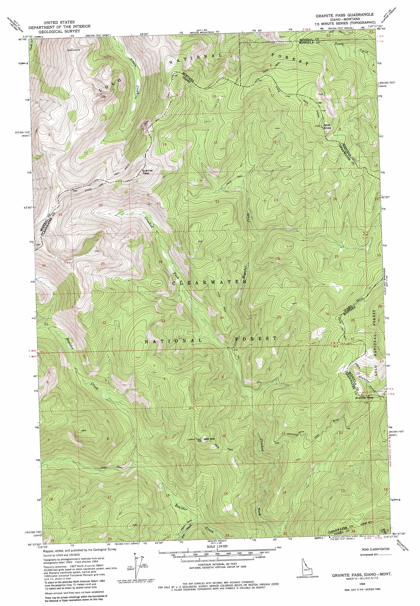
USGS Topo Quad 46114f6 - 1:24,000 scale
| Topo Map Name: | Granite Pass |
| USGS Topo Quad ID: | 46114f6 |
| Print Size: | ca. 21 1/4" wide x 27" high |
| Southeast Coordinates: | 46.625° N latitude / 114.625° W longitude |
| Map Center Coordinates: | 46.6875° N latitude / 114.6875° W longitude |
| U.S. States: | ID, MT |
| Filename: | o46114f6.jpg |
| Download Map JPG Image: | Granite Pass topo map 1:24,000 scale |
| Map Type: | Topographic |
| Topo Series: | 7.5´ |
| Map Scale: | 1:24,000 |
| Source of Map Images: | United States Geological Survey (USGS) |
| Alternate Map Versions: |
Granite Pass ID 1964, updated 1967 Download PDF Buy paper map Granite Pass ID 1964, updated 1981 Download PDF Buy paper map Granite Pass ID 1994, updated 1997 Download PDF Buy paper map Granite Pass ID 2011 Download PDF Buy paper map Granite Pass ID 2013 Download PDF Buy paper map |
| FStopo: | US Forest Service topo Granite Pass is available: Download FStopo PDF Download FStopo TIF |
1:24,000 Topo Quads surrounding Granite Pass
Straight Peak |
Saint Patrick Peak |
Williams Peak |
Deer Peak |
Petty Mountain |
Bruin Hill |
Schley Mountain |
White Mountain |
Lupine Creek |
Garden Point |
Toboggan Ridge |
Rhodes Peak |
Granite Pass |
Lolo Hot Springs |
West Fork Butte |
Indian Postoffice |
Cayuse Junction |
Rocky Point |
Roundtop |
Ranger Peak |
Bear Mountain |
Tom Beal Peak |
Grave Peak |
Savage Ridge |
White Sand Lake |
> Back to 46114e1 at 1:100,000 scale
> Back to 46114a1 at 1:250,000 scale
> Back to U.S. Topo Maps home
Granite Pass topo map: Gazetteer
Granite Pass: Gaps
Granite Pass elevation 1736m 5695′Granite Pass elevation 1736m 5695′
Granite Pass: Streams
Fox Creek elevation 1435m 4708′Hopeful Creek elevation 1577m 5173′
Granite Pass: Summits
BM Hill elevation 1935m 6348′Granite Peak elevation 2306m 7565′
Granite Peak elevation 2279m 7477′
Pilot Knob elevation 2204m 7230′
Pilot Knob elevation 2203m 7227′
Rocky Peak elevation 2021m 6630′
Granite Pass: Trails
State Line Trail elevation 2160m 7086′Granite Pass digital topo map on disk
Buy this Granite Pass topo map showing relief, roads, GPS coordinates and other geographical features, as a high-resolution digital map file on DVD: