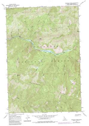
Toboggan Ridge Topo Map Idaho
To zoom in, hover over the map of Toboggan Ridge
USGS Topo Quad 46114f8 - 1:24,000 scale
| Topo Map Name: | Toboggan Ridge |
| USGS Topo Quad ID: | 46114f8 |
| Print Size: | ca. 21 1/4" wide x 27" high |
| Southeast Coordinates: | 46.625° N latitude / 114.875° W longitude |
| Map Center Coordinates: | 46.6875° N latitude / 114.9375° W longitude |
| U.S. State: | ID |
| Filename: | o46114f8.jpg |
| Download Map JPG Image: | Toboggan Ridge topo map 1:24,000 scale |
| Map Type: | Topographic |
| Topo Series: | 7.5´ |
| Map Scale: | 1:24,000 |
| Source of Map Images: | United States Geological Survey (USGS) |
| Alternate Map Versions: |
Toboggan Ridge ID 1966, updated 1969 Download PDF Buy paper map Toboggan Ridge ID 1966, updated 1984 Download PDF Buy paper map Toboggan Ridge ID 1994, updated 1997 Download PDF Buy paper map Toboggan Ridge ID 2011 Download PDF Buy paper map Toboggan Ridge ID 2013 Download PDF Buy paper map |
| FStopo: | US Forest Service topo Toboggan Ridge is available: Download FStopo PDF Download FStopo TIF |
1:24,000 Topo Quads surrounding Toboggan Ridge
> Back to 46114e1 at 1:100,000 scale
> Back to 46114a1 at 1:250,000 scale
> Back to U.S. Topo Maps home
Toboggan Ridge topo map: Gazetteer
Toboggan Ridge: Flats
Hanson Meadows elevation 1115m 3658′Toboggan Ridge: Pillars
Kellys Thumb elevation 1639m 5377′Toboggan Ridge: Ridges
Deer Ridge elevation 1992m 6535′Hanson Ridge elevation 1855m 6085′
Little Moose Ridge elevation 1603m 5259′
Toboggan Ridge elevation 1856m 6089′
Toboggan Ridge: Streams
Bear Creek elevation 1068m 3503′Bedrock Creek elevation 1101m 3612′
Box Creek elevation 1035m 3395′
Cub Creek elevation 1219m 3999′
Deer Creek elevation 1150m 3772′
Grasser Creek elevation 1067m 3500′
Hanson Creek elevation 1120m 3674′
Kodiak Creek elevation 1121m 3677′
Negro Creek elevation 1199m 3933′
Polar Creek elevation 1109m 3638′
Rapid Creek elevation 1205m 3953′
Rock Garden Creek elevation 1409m 4622′
Snake Creek elevation 1048m 3438′
Toboggan Ridge: Summits
Toboggan Hill elevation 1873m 6145′Toboggan Ridge digital topo map on disk
Buy this Toboggan Ridge topo map showing relief, roads, GPS coordinates and other geographical features, as a high-resolution digital map file on DVD:


