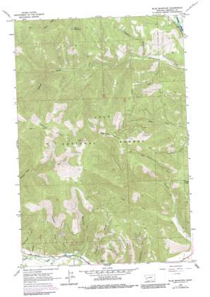
Blue Mountain Topo Map Montana
To zoom in, hover over the map of Blue Mountain
USGS Topo Quad 46114g2 - 1:24,000 scale
| Topo Map Name: | Blue Mountain |
| USGS Topo Quad ID: | 46114g2 |
| Print Size: | ca. 21 1/4" wide x 27" high |
| Southeast Coordinates: | 46.75° N latitude / 114.125° W longitude |
| Map Center Coordinates: | 46.8125° N latitude / 114.1875° W longitude |
| U.S. State: | MT |
| Filename: | o46114g2.jpg |
| Download Map JPG Image: | Blue Mountain topo map 1:24,000 scale |
| Map Type: | Topographic |
| Topo Series: | 7.5´ |
| Map Scale: | 1:24,000 |
| Source of Map Images: | United States Geological Survey (USGS) |
| Alternate Map Versions: |
Blue Mountain MT 1964, updated 1978 Download PDF Buy paper map Blue Mountain MT 1964, updated 1983 Download PDF Buy paper map Blue Mountain MT 1999, updated 2003 Download PDF Buy paper map Blue Mountain MT 2011 Download PDF Buy paper map Blue Mountain MT 2014 Download PDF Buy paper map |
| FStopo: | US Forest Service topo Blue Mountain is available: Download FStopo PDF Download FStopo TIF |
1:24,000 Topo Quads surrounding Blue Mountain
> Back to 46114e1 at 1:100,000 scale
> Back to 46114a1 at 1:250,000 scale
> Back to U.S. Topo Maps home
Blue Mountain topo map: Gazetteer
Blue Mountain: Mines
Chickaman Mine elevation 1086m 3562′Chickaman Mine elevation 1140m 3740′
Blue Mountain: Streams
Mill Creek elevation 1049m 3441′North Fork Sleeman Creek elevation 1160m 3805′
South Fork Sleeman Creek elevation 1078m 3536′
Tevis Creek elevation 1061m 3480′
Westerman Creek elevation 1045m 3428′
Blue Mountain: Summits
Black Mountain elevation 1787m 5862′Blue Mountain elevation 1962m 6437′
Blue Mountain: Valleys
Anderson Gulch elevation 1088m 3569′Hagerty Gulch elevation 1081m 3546′
Lick Gulch elevation 1103m 3618′
Lyon Gulch elevation 1032m 3385′
Mailbox Gulch elevation 1109m 3638′
Blue Mountain: Wells
13N20W21DA__01 Well elevation 946m 3103′Blue Mountain digital topo map on disk
Buy this Blue Mountain topo map showing relief, roads, GPS coordinates and other geographical features, as a high-resolution digital map file on DVD:


