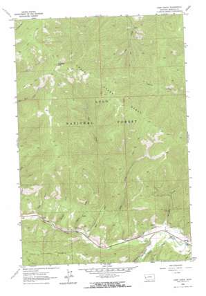
Camp Creek Topo Map Montana
To zoom in, hover over the map of Camp Creek
USGS Topo Quad 46114g3 - 1:24,000 scale
| Topo Map Name: | Camp Creek |
| USGS Topo Quad ID: | 46114g3 |
| Print Size: | ca. 21 1/4" wide x 27" high |
| Southeast Coordinates: | 46.75° N latitude / 114.25° W longitude |
| Map Center Coordinates: | 46.8125° N latitude / 114.3125° W longitude |
| U.S. State: | MT |
| Filename: | o46114g3.jpg |
| Download Map JPG Image: | Camp Creek topo map 1:24,000 scale |
| Map Type: | Topographic |
| Topo Series: | 7.5´ |
| Map Scale: | 1:24,000 |
| Source of Map Images: | United States Geological Survey (USGS) |
| Alternate Map Versions: |
Camp Creek MT 1964, updated 1967 Download PDF Buy paper map Camp Creek MT 1964, updated 1967 Download PDF Buy paper map Camp Creek MT 1999, updated 2003 Download PDF Buy paper map Camp Creek MT 2011 Download PDF Buy paper map Camp Creek MT 2014 Download PDF Buy paper map |
| FStopo: | US Forest Service topo Camp Creek is available: Download FStopo PDF Download FStopo TIF |
1:24,000 Topo Quads surrounding Camp Creek
> Back to 46114e1 at 1:100,000 scale
> Back to 46114a1 at 1:250,000 scale
> Back to U.S. Topo Maps home
Camp Creek topo map: Gazetteer
Camp Creek: Canals
Williams Preston Hovet Ditch elevation 1091m 3579′Camp Creek: Mines
Lawyers Combination elevation 1096m 3595′Lawyers Combination Mine elevation 1167m 3828′
Lolo Creek Mine elevation 1168m 3832′
Sheldon elevation 1221m 4005′
Sheldon Mine elevation 1161m 3809′
Triantler elevation 1160m 3805′
Triantler Mine elevation 1151m 3776′
Upper Lolo Creek Mine elevation 1214m 3982′
Upper Triantler Mine elevation 1206m 3956′
Woodman Mine elevation 1070m 3510′
Camp Creek: Post Offices
Woodman Post Office (historical) elevation 1080m 3543′Camp Creek: Ranges
Grave Creek Range elevation 1870m 6135′Camp Creek: Streams
Bear Creek elevation 1110m 3641′Camp Creek elevation 1098m 3602′
Sheldon Creek elevation 1130m 3707′
Smith Creek elevation 1117m 3664′
South Fork Lolo Creek elevation 1073m 3520′
West Fork Butte Creek elevation 1114m 3654′
Woodman Creek elevation 1075m 3526′
Camp Creek: Summits
Telephone Butte elevation 2098m 6883′Camp Creek: Valleys
Potato Gulch elevation 1134m 3720′Schoolhouse Gulch elevation 1123m 3684′
Camp Creek digital topo map on disk
Buy this Camp Creek topo map showing relief, roads, GPS coordinates and other geographical features, as a high-resolution digital map file on DVD:


