Schley Mountain Topo Map Montana
To zoom in, hover over the map of Schley Mountain
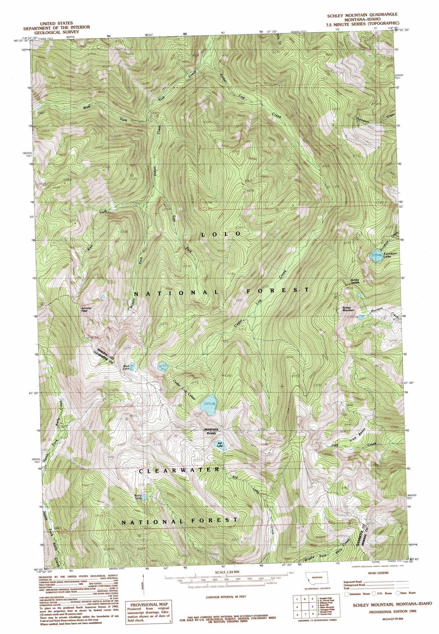
USGS Topo Quad 46114g7 - 1:24,000 scale
| Topo Map Name: | Schley Mountain |
| USGS Topo Quad ID: | 46114g7 |
| Print Size: | ca. 21 1/4" wide x 27" high |
| Southeast Coordinates: | 46.75° N latitude / 114.75° W longitude |
| Map Center Coordinates: | 46.8125° N latitude / 114.8125° W longitude |
| U.S. States: | MT, ID |
| Filename: | o46114g7.jpg |
| Download Map JPG Image: | Schley Mountain topo map 1:24,000 scale |
| Map Type: | Topographic |
| Topo Series: | 7.5´ |
| Map Scale: | 1:24,000 |
| Source of Map Images: | United States Geological Survey (USGS) |
| Alternate Map Versions: |
Schley Mountain MT 1985, updated 1985 Download PDF Buy paper map Schley Mountain MT 1985, updated 1985 Download PDF Buy paper map Schley Mountain MT 1999, updated 2003 Download PDF Buy paper map Schley Mountain MT 2011 Download PDF Buy paper map Schley Mountain MT 2014 Download PDF Buy paper map |
| FStopo: | US Forest Service topo Schley Mountain is available: Download FStopo PDF Download FStopo TIF |
1:24,000 Topo Quads surrounding Schley Mountain
Illinois Peak |
Landowner Mountain |
Lozeau |
Tarkio |
Stark South |
Hoodoo Pass |
Straight Peak |
Saint Patrick Peak |
Williams Peak |
Deer Peak |
Osier Ridge |
Bruin Hill |
Schley Mountain |
White Mountain |
Lupine Creek |
Gorman Hill |
Toboggan Ridge |
Rhodes Peak |
Granite Pass |
Lolo Hot Springs |
Horseshoe Lake |
Indian Postoffice |
Cayuse Junction |
Rocky Point |
Roundtop |
> Back to 46114e1 at 1:100,000 scale
> Back to 46114a1 at 1:250,000 scale
> Back to U.S. Topo Maps home
Schley Mountain topo map: Gazetteer
Schley Mountain: Basins
Irish Basin elevation 1669m 5475′Schley Mountain: Gaps
Schley Saddle elevation 2069m 6788′Schley Mountain: Lakes
Cedar Log Lakes elevation 1823m 5980′Kelly Lake elevation 1887m 6190′
Kid Lake elevation 1912m 6272′
Mud Lake elevation 1899m 6230′
Surveyor Lake elevation 1817m 5961′
Schley Mountain: Mines
Snowshoe Mine elevation 2036m 6679′Schley Mountain: Streams
Cedar Log Creek elevation 1184m 3884′East Fork Indian Creek elevation 1359m 4458′
Indian Creek elevation 1275m 4183′
Middle Fork Indian Creek elevation 1354m 4442′
West Fork Indian Creek elevation 1354m 4442′
Schley Mountain: Summits
Admiral Peak elevation 2211m 7253′Schley Mountain elevation 2230m 7316′
Schley Mountain digital topo map on disk
Buy this Schley Mountain topo map showing relief, roads, GPS coordinates and other geographical features, as a high-resolution digital map file on DVD: