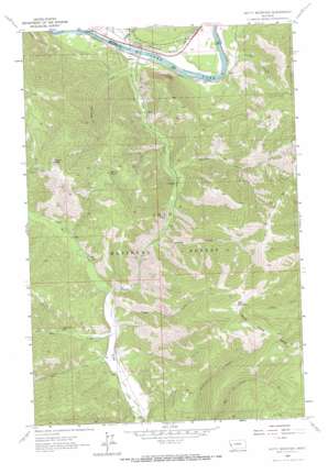
Petty Mountain Topo Map Montana
To zoom in, hover over the map of Petty Mountain
USGS Topo Quad 46114h4 - 1:24,000 scale
| Topo Map Name: | Petty Mountain |
| USGS Topo Quad ID: | 46114h4 |
| Print Size: | ca. 21 1/4" wide x 27" high |
| Southeast Coordinates: | 46.875° N latitude / 114.375° W longitude |
| Map Center Coordinates: | 46.9375° N latitude / 114.4375° W longitude |
| U.S. State: | MT |
| Filename: | o46114h4.jpg |
| Download Map JPG Image: | Petty Mountain topo map 1:24,000 scale |
| Map Type: | Topographic |
| Topo Series: | 7.5´ |
| Map Scale: | 1:24,000 |
| Source of Map Images: | United States Geological Survey (USGS) |
| Alternate Map Versions: |
Petty Mountain MT 1964, updated 1967 Download PDF Buy paper map Petty MountaIn MT 1999, updated 2003 Download PDF Buy paper map Petty Mountain MT 2011 Download PDF Buy paper map Petty Mountain MT 2014 Download PDF Buy paper map |
| FStopo: | US Forest Service topo Petty Mountain is available: Download FStopo PDF Download FStopo TIF |
1:24,000 Topo Quads surrounding Petty Mountain
> Back to 46114e1 at 1:100,000 scale
> Back to 46114a1 at 1:250,000 scale
> Back to U.S. Topo Maps home
Petty Mountain topo map: Gazetteer
Petty Mountain: Crossings
Interchange 77 elevation 918m 3011′Petty Mountain: Mines
Coppersmith Mine elevation 1158m 3799′Coppersmith Mine elevation 1152m 3779′
Inverness Group Mine elevation 1192m 3910′
Teller Barite Mine elevation 1132m 3713′
Petty Mountain: Populated Places
Lothrop elevation 903m 2962′Shangville (historical) elevation 946m 3103′
Petty Mountain: Post Offices
Lothrop Post Office (historical) elevation 903m 2962′Petty Mountain: Springs
Martin Spring elevation 1457m 4780′Petty Mountain: Streams
Bruce Creek elevation 1083m 3553′Eds Creek elevation 1071m 3513′
Johns Creek elevation 1122m 3681′
Kirchey Creek elevation 903m 2962′
Petty Creek elevation 903m 2962′
Reservoir Creek elevation 903m 2962′
West Fork Petty Creek elevation 1050m 3444′
Petty Mountain: Summits
Martin Point elevation 1834m 6017′Petty Mountain elevation 2212m 7257′
Petty Mountain: Valleys
Madison Gulch elevation 976m 3202′Peppard Gulch elevation 930m 3051′
Spring Gulch elevation 1022m 3353′
Tucker Gulch elevation 1073m 3520′
Petty Mountain: Wells
14N22W08BBDA01 Well elevation 932m 3057′14N22W08BDDA01 Well elevation 918m 3011′
Petty Mountain digital topo map on disk
Buy this Petty Mountain topo map showing relief, roads, GPS coordinates and other geographical features, as a high-resolution digital map file on DVD:


