Deer Peak Topo Map Montana
To zoom in, hover over the map of Deer Peak
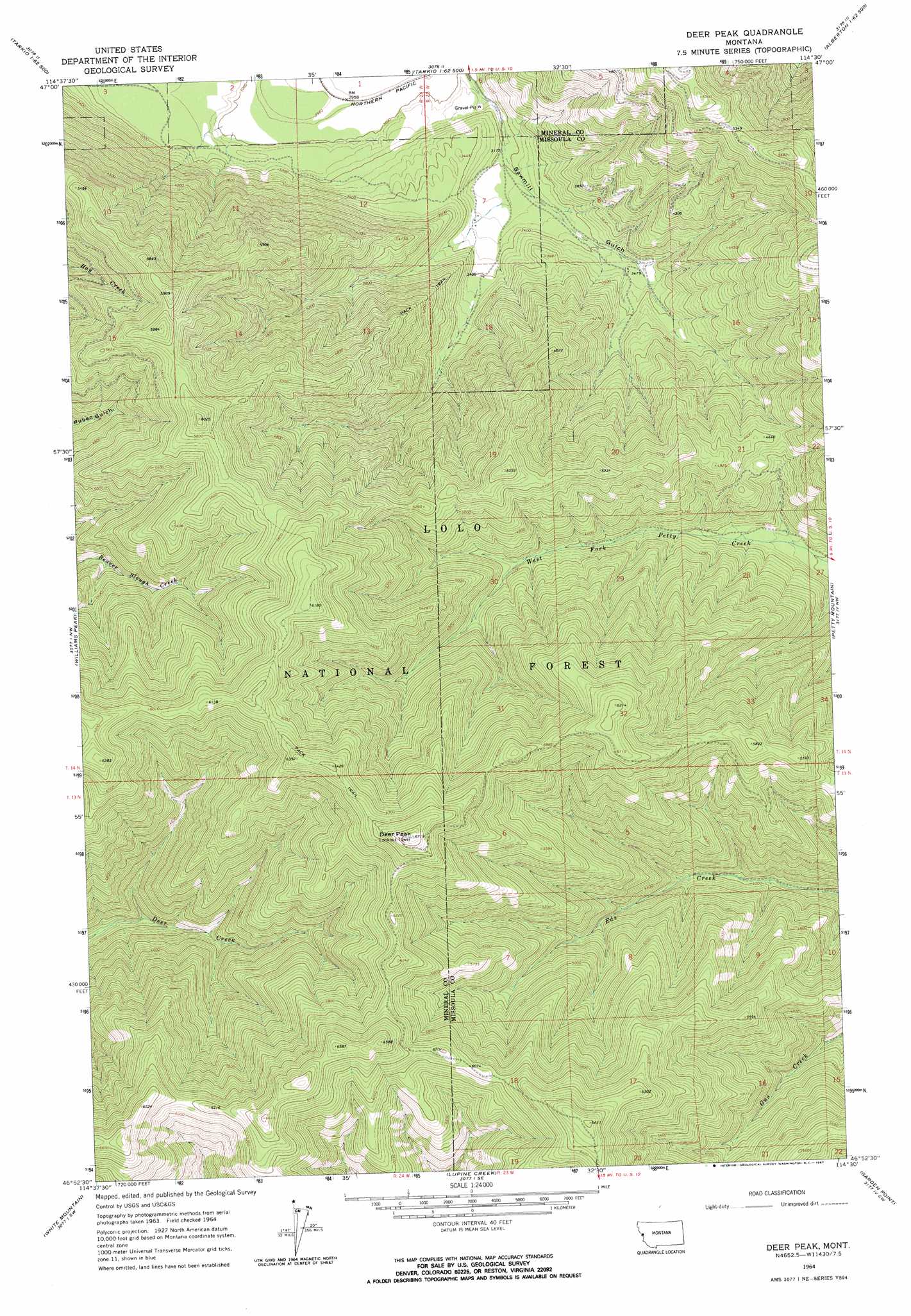
USGS Topo Quad 46114h5 - 1:24,000 scale
| Topo Map Name: | Deer Peak |
| USGS Topo Quad ID: | 46114h5 |
| Print Size: | ca. 21 1/4" wide x 27" high |
| Southeast Coordinates: | 46.875° N latitude / 114.5° W longitude |
| Map Center Coordinates: | 46.9375° N latitude / 114.5625° W longitude |
| U.S. State: | MT |
| Filename: | o46114h5.jpg |
| Download Map JPG Image: | Deer Peak topo map 1:24,000 scale |
| Map Type: | Topographic |
| Topo Series: | 7.5´ |
| Map Scale: | 1:24,000 |
| Source of Map Images: | United States Geological Survey (USGS) |
| Alternate Map Versions: |
Deer Peak MT 1964, updated 1967 Download PDF Buy paper map Deer Peak MT 1964, updated 1967 Download PDF Buy paper map Deer Peak MT 1999, updated 2003 Download PDF Buy paper map Deer Peak MT 2011 Download PDF Buy paper map Deer Peak MT 2014 Download PDF Buy paper map |
| FStopo: | US Forest Service topo Deer Peak is available: Download FStopo PDF Download FStopo TIF |
1:24,000 Topo Quads surrounding Deer Peak
Idaho Gulch |
Horsehead Peak |
Stark North |
Mccormick Peak |
Hewolf Mountain |
Lozeau |
Tarkio |
Stark South |
Alberton |
Huson |
Saint Patrick Peak |
Williams Peak |
Deer Peak |
Petty Mountain |
Diamond Point |
Schley Mountain |
White Mountain |
Lupine Creek |
Garden Point |
Camp Creek |
Rhodes Peak |
Granite Pass |
Lolo Hot Springs |
West Fork Butte |
Dick Creek |
> Back to 46114e1 at 1:100,000 scale
> Back to 46114a1 at 1:250,000 scale
> Back to U.S. Topo Maps home
Deer Peak topo map: Gazetteer
Deer Peak: Summits
Deer Peak elevation 2043m 6702′Deer Peak: Valleys
Sawmill Gulch elevation 916m 3005′Deer Peak digital topo map on disk
Buy this Deer Peak topo map showing relief, roads, GPS coordinates and other geographical features, as a high-resolution digital map file on DVD: