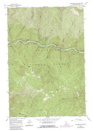
Stillman Point Topo Map Idaho
To zoom in, hover over the map of Stillman Point
USGS Topo Quad 46115a4 - 1:24,000 scale
| Topo Map Name: | Stillman Point |
| USGS Topo Quad ID: | 46115a4 |
| Print Size: | ca. 21 1/4" wide x 27" high |
| Southeast Coordinates: | 46° N latitude / 115.375° W longitude |
| Map Center Coordinates: | 46.0625° N latitude / 115.4375° W longitude |
| U.S. State: | ID |
| Filename: | o46115a4.jpg |
| Download Map JPG Image: | Stillman Point topo map 1:24,000 scale |
| Map Type: | Topographic |
| Topo Series: | 7.5´ |
| Map Scale: | 1:24,000 |
| Source of Map Images: | United States Geological Survey (USGS) |
| Alternate Map Versions: |
Stillman Point ID 1966, updated 1968 Download PDF Buy paper map Stillman Point ID 1966, updated 1987 Download PDF Buy paper map Stillman Point ID 1995, updated 1999 Download PDF Buy paper map Stillman Point ID 2011 Download PDF Buy paper map Stillman Point ID 2013 Download PDF Buy paper map |
| FStopo: | US Forest Service topo Stillman Point is available: Download FStopo PDF Download FStopo TIF |
1:24,000 Topo Quads surrounding Stillman Point
> Back to 46115a1 at 1:100,000 scale
> Back to 46114a1 at 1:250,000 scale
> Back to U.S. Topo Maps home
Stillman Point topo map: Gazetteer
Stillman Point: Bars
Twentyfive Mile Bar elevation 504m 1653′Twentymile Bar elevation 482m 1581′
Stillman Point: Cliffs
Stillman Point elevation 1541m 5055′Stillman Point: Islands
Rock Island elevation 488m 1601′Stillman Point: Ridges
Saddle Ridge elevation 1526m 5006′Stillman Point: Streams
Boyd Creek elevation 489m 1604′Cache Creek elevation 513m 1683′
Dave Creek elevation 482m 1581′
Fern Creek elevation 474m 1555′
Island Creek elevation 488m 1601′
Nineteenmile Creek elevation 480m 1574′
Rackliff Creek elevation 472m 1548′
Slide Creek elevation 487m 1597′
Twentythree Mile Creek elevation 496m 1627′
Wash Creek elevation 492m 1614′
Stillman Point: Summits
O'Hara Point elevation 1723m 5652′Sob Point elevation 1712m 5616′
Stillman Point digital topo map on disk
Buy this Stillman Point topo map showing relief, roads, GPS coordinates and other geographical features, as a high-resolution digital map file on DVD:


