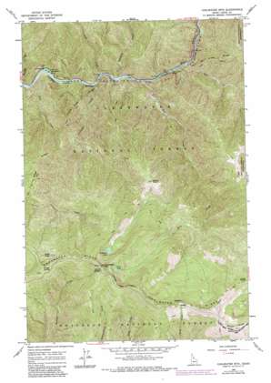
Coolwater Mountain Topo Map Idaho
To zoom in, hover over the map of Coolwater Mountain
USGS Topo Quad 46115b4 - 1:24,000 scale
| Topo Map Name: | Coolwater Mountain |
| USGS Topo Quad ID: | 46115b4 |
| Print Size: | ca. 21 1/4" wide x 27" high |
| Southeast Coordinates: | 46.125° N latitude / 115.375° W longitude |
| Map Center Coordinates: | 46.1875° N latitude / 115.4375° W longitude |
| U.S. State: | ID |
| Filename: | o46115b4.jpg |
| Download Map JPG Image: | Coolwater Mountain topo map 1:24,000 scale |
| Map Type: | Topographic |
| Topo Series: | 7.5´ |
| Map Scale: | 1:24,000 |
| Source of Map Images: | United States Geological Survey (USGS) |
| Alternate Map Versions: |
Coolwater Mtn ID 1966, updated 1968 Download PDF Buy paper map Coolwater Mtn ID 1966, updated 1984 Download PDF Buy paper map Coolwater Mountain ID 1994, updated 1997 Download PDF Buy paper map Coolwater Mountain ID 2011 Download PDF Buy paper map Coolwater Mountain ID 2014 Download PDF Buy paper map |
| FStopo: | US Forest Service topo Coolwater Mountain is available: Download FStopo PDF Download FStopo TIF |
1:24,000 Topo Quads surrounding Coolwater Mountain
> Back to 46115a1 at 1:100,000 scale
> Back to 46114a1 at 1:250,000 scale
> Back to U.S. Topo Maps home
Coolwater Mountain topo map: Gazetteer
Coolwater Mountain: Bridges
Split Creek Bridge elevation 523m 1715′Coolwater Mountain: Gaps
Glover Saddle elevation 1792m 5879′Remount elevation 1975m 6479′
Coolwater Mountain: Lakes
Andys Lakes elevation 1717m 5633′Coolwater Lake elevation 1835m 6020′
Fire Lake elevation 1923m 6309′
Coolwater Mountain: Ridges
Knife Edge Ridge elevation 1478m 4849′Coolwater Mountain: Streams
Bimerick Creek elevation 520m 1706′Coolwater Creek elevation 507m 1663′
Fire Creek elevation 523m 1715′
Split Creek elevation 533m 1748′
Stub Creek elevation 500m 1640′
Tick Creek elevation 514m 1686′
Coolwater Mountain: Summits
Andys Hump elevation 1990m 6528′Coolwater Mountain elevation 2113m 6932′
Round Top Mountain elevation 2075m 6807′
Sheep Hill elevation 1724m 5656′
Coolwater Mountain: Trails
Major Fenn Nature Nautral Recreation Trail elevation 501m 1643′Coolwater Mountain: Valleys
Black Canyon elevation 521m 1709′Coolwater Mountain digital topo map on disk
Buy this Coolwater Mountain topo map showing relief, roads, GPS coordinates and other geographical features, as a high-resolution digital map file on DVD:


