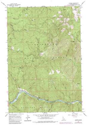
Syringa Topo Map Idaho
To zoom in, hover over the map of Syringa
USGS Topo Quad 46115b6 - 1:24,000 scale
| Topo Map Name: | Syringa |
| USGS Topo Quad ID: | 46115b6 |
| Print Size: | ca. 21 1/4" wide x 27" high |
| Southeast Coordinates: | 46.125° N latitude / 115.625° W longitude |
| Map Center Coordinates: | 46.1875° N latitude / 115.6875° W longitude |
| U.S. State: | ID |
| Filename: | o46115b6.jpg |
| Download Map JPG Image: | Syringa topo map 1:24,000 scale |
| Map Type: | Topographic |
| Topo Series: | 7.5´ |
| Map Scale: | 1:24,000 |
| Source of Map Images: | United States Geological Survey (USGS) |
| Alternate Map Versions: |
Syringa ID 1966, updated 1968 Download PDF Buy paper map Syringa ID 1966, updated 1984 Download PDF Buy paper map Syringa ID 1994, updated 1997 Download PDF Buy paper map Syringa ID 2011 Download PDF Buy paper map Syringa ID 2013 Download PDF Buy paper map |
| FStopo: | US Forest Service topo Syringa is available: Download FStopo PDF Download FStopo TIF |
1:24,000 Topo Quads surrounding Syringa
> Back to 46115a1 at 1:100,000 scale
> Back to 46114a1 at 1:250,000 scale
> Back to U.S. Topo Maps home
Syringa topo map: Gazetteer
Syringa: Cliffs
Jungle Point elevation 1185m 3887′Syringa: Gaps
Fan Creek Saddle elevation 1259m 4130′Smith Saddle elevation 1038m 3405′
Syringa: Mines
Smith Mine elevation 1280m 4199′Syringa: Parks
Three Devils Picnic Area elevation 440m 1443′Syringa: Populated Places
Syringa elevation 430m 1410′Syringa: Rapids
Big Hill Rapids elevation 429m 1407′Indian Rapids elevation 428m 1404′
Syringa: Streams
Big Smith Creek elevation 426m 1397′Bridge Creek elevation 436m 1430′
Decker Creek elevation 435m 1427′
Higgins Creek elevation 666m 2185′
Little Smith Creek elevation 428m 1404′
Lodge Creek elevation 433m 1420′
Nan Creek elevation 1002m 3287′
Number One Creek elevation 430m 1410′
Placer Creek elevation 599m 1965′
Polar Creek elevation 780m 2559′
Rat Creek elevation 1038m 3405′
Stray Creek elevation 1031m 3382′
Swan Creek elevation 424m 1391′
Three Devils Creek elevation 439m 1440′
Walde Creek elevation 729m 2391′
Syringa: Summits
Big Hill elevation 1237m 4058′Higgins Hump elevation 1359m 4458′
Walde Mountain elevation 1590m 5216′
Syringa digital topo map on disk
Buy this Syringa topo map showing relief, roads, GPS coordinates and other geographical features, as a high-resolution digital map file on DVD:


