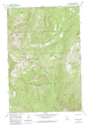
Fish Lake Topo Map Idaho
To zoom in, hover over the map of Fish Lake
USGS Topo Quad 46115c1 - 1:24,000 scale
| Topo Map Name: | Fish Lake |
| USGS Topo Quad ID: | 46115c1 |
| Print Size: | ca. 21 1/4" wide x 27" high |
| Southeast Coordinates: | 46.25° N latitude / 115° W longitude |
| Map Center Coordinates: | 46.3125° N latitude / 115.0625° W longitude |
| U.S. State: | ID |
| Filename: | o46115c1.jpg |
| Download Map JPG Image: | Fish Lake topo map 1:24,000 scale |
| Map Type: | Topographic |
| Topo Series: | 7.5´ |
| Map Scale: | 1:24,000 |
| Source of Map Images: | United States Geological Survey (USGS) |
| Alternate Map Versions: |
Fish Lake ID 1966, updated 1969 Download PDF Buy paper map Fish Lake ID 1966, updated 1985 Download PDF Buy paper map Fish Lake ID 1966, updated 1987 Download PDF Buy paper map Fish Lake ID 1995, updated 1999 Download PDF Buy paper map Fish Lake ID 2011 Download PDF Buy paper map Fish Lake ID 2014 Download PDF Buy paper map |
| FStopo: | US Forest Service topo Fish Lake is available: Download FStopo PDF Download FStopo TIF |
1:24,000 Topo Quads surrounding Fish Lake
> Back to 46115a1 at 1:100,000 scale
> Back to 46114a1 at 1:250,000 scale
> Back to U.S. Topo Maps home
Fish Lake topo map: Gazetteer
Fish Lake: Airports
Fish Lake Airport elevation 1720m 5643′Fish Lake: Cliffs
Doe Point elevation 1820m 5971′Fish Lake: Flats
Gold Meadows elevation 1880m 6167′Sponge Meadows elevation 1806m 5925′
Wounded Doe Licks elevation 1609m 5278′
Fish Lake: Gaps
Fish Lake Saddle elevation 2068m 6784′Tribulation Saddle elevation 2033m 6669′
Fish Lake: Lakes
California Lake elevation 1910m 6266′Eagle Mountain Lake elevation 2031m 6663′
Fish Lake elevation 1718m 5636′
Heslip Lake elevation 1791m 5875′
Pollywog Lake elevation 2007m 6584′
Sponge Lake elevation 1835m 6020′
Fish Lake: Ridges
Barren Ridge elevation 2200m 7217′Fish Lake: Summits
Eagle Mountain elevation 2254m 7395′End Butte elevation 2210m 7250′
Rhoda Point elevation 2099m 6886′
Sponge Mountain elevation 2234m 7329′
Fish Lake digital topo map on disk
Buy this Fish Lake topo map showing relief, roads, GPS coordinates and other geographical features, as a high-resolution digital map file on DVD:


