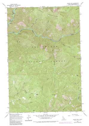
Scurvy Mountain Topo Map Idaho
To zoom in, hover over the map of Scurvy Mountain
USGS Topo Quad 46115f2 - 1:24,000 scale
| Topo Map Name: | Scurvy Mountain |
| USGS Topo Quad ID: | 46115f2 |
| Print Size: | ca. 21 1/4" wide x 27" high |
| Southeast Coordinates: | 46.625° N latitude / 115.125° W longitude |
| Map Center Coordinates: | 46.6875° N latitude / 115.1875° W longitude |
| U.S. State: | ID |
| Filename: | o46115f2.jpg |
| Download Map JPG Image: | Scurvy Mountain topo map 1:24,000 scale |
| Map Type: | Topographic |
| Topo Series: | 7.5´ |
| Map Scale: | 1:24,000 |
| Source of Map Images: | United States Geological Survey (USGS) |
| Alternate Map Versions: |
Scurvy Mtn. ID 1965, updated 1967 Download PDF Buy paper map Scurvy Mtn ID 1965, updated 1984 Download PDF Buy paper map Scurvy Mountain ID 1994, updated 1997 Download PDF Buy paper map Scurvy Mountain ID 2011 Download PDF Buy paper map Scurvy Mountain ID 2013 Download PDF Buy paper map |
| FStopo: | US Forest Service topo Scurvy Mountain is available: Download FStopo PDF Download FStopo TIF |
1:24,000 Topo Quads surrounding Scurvy Mountain
> Back to 46115e1 at 1:100,000 scale
> Back to 46114a1 at 1:250,000 scale
> Back to U.S. Topo Maps home
Scurvy Mountain topo map: Gazetteer
Scurvy Mountain: Lakes
Scurvy Lake elevation 1811m 5941′Scurvy Mountain: Streams
Barn Creek elevation 1153m 3782′Barnard Creek elevation 886m 2906′
Jeanne Creek elevation 910m 2985′
Joan Creek elevation 916m 3005′
Junction Creek elevation 850m 2788′
Lookout Creek elevation 1191m 3907′
Monroe Creek elevation 1134m 3720′
Paradise Creek elevation 1400m 4593′
Pete Ott Creek elevation 899m 2949′
Pie Creek elevation 857m 2811′
Pony Creek elevation 1111m 3645′
Slide Creek elevation 879m 2883′
Slippery Creek elevation 929m 3047′
Trout Creek elevation 1350m 4429′
Scurvy Mountain: Summits
Moose Creek Buttes elevation 1964m 6443′Scurvy Mountain elevation 2031m 6663′
Switchback Hill elevation 1950m 6397′
Scurvy Mountain digital topo map on disk
Buy this Scurvy Mountain topo map showing relief, roads, GPS coordinates and other geographical features, as a high-resolution digital map file on DVD:


