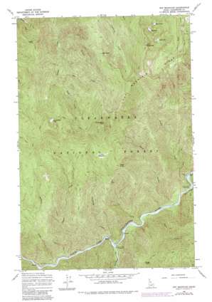
Pot Mountain Topo Map Idaho
To zoom in, hover over the map of Pot Mountain
USGS Topo Quad 46115f4 - 1:24,000 scale
| Topo Map Name: | Pot Mountain |
| USGS Topo Quad ID: | 46115f4 |
| Print Size: | ca. 21 1/4" wide x 27" high |
| Southeast Coordinates: | 46.625° N latitude / 115.375° W longitude |
| Map Center Coordinates: | 46.6875° N latitude / 115.4375° W longitude |
| U.S. State: | ID |
| Filename: | o46115f4.jpg |
| Download Map JPG Image: | Pot Mountain topo map 1:24,000 scale |
| Map Type: | Topographic |
| Topo Series: | 7.5´ |
| Map Scale: | 1:24,000 |
| Source of Map Images: | United States Geological Survey (USGS) |
| Alternate Map Versions: |
Pot Mountain ID 1965, updated 1967 Download PDF Buy paper map Pot Mountain ID 1965, updated 1984 Download PDF Buy paper map Pot Mountain ID 1994, updated 1997 Download PDF Buy paper map Pot Mountain ID 2011 Download PDF Buy paper map Pot Mountain ID 2013 Download PDF Buy paper map |
| FStopo: | US Forest Service topo Pot Mountain is available: Download FStopo PDF Download FStopo TIF |
1:24,000 Topo Quads surrounding Pot Mountain
> Back to 46115e1 at 1:100,000 scale
> Back to 46114a1 at 1:250,000 scale
> Back to U.S. Topo Maps home
Pot Mountain topo map: Gazetteer
Pot Mountain: Lakes
Jack Lake elevation 1799m 5902′Pot Lake elevation 1824m 5984′
Pot Mountain: Ranges
Bitterroot Range elevation 2172m 7125′Pot Mountain: Streams
Cub Creek elevation 725m 2378′Death Creek elevation 734m 2408′
Fawn Creek elevation 727m 2385′
Fisher Creek elevation 743m 2437′
Fourth of July Creek elevation 755m 2477′
Jackknife Creek elevation 707m 2319′
Rush Creek elevation 1093m 3585′
Sprague Creek elevation 692m 2270′
Sun Creek elevation 1135m 3723′
Teakweh Creek elevation 695m 2280′
Weitas Creek elevation 708m 2322′
Pot Mountain: Summits
Bugle Point elevation 1406m 4612′Pot Mountain elevation 2149m 7050′
Pot Mountain digital topo map on disk
Buy this Pot Mountain topo map showing relief, roads, GPS coordinates and other geographical features, as a high-resolution digital map file on DVD:


