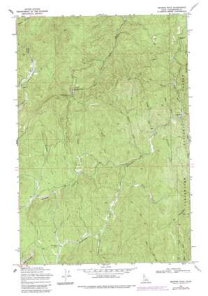
Browns Rock Topo Map Idaho
To zoom in, hover over the map of Browns Rock
USGS Topo Quad 46115f6 - 1:24,000 scale
| Topo Map Name: | Browns Rock |
| USGS Topo Quad ID: | 46115f6 |
| Print Size: | ca. 21 1/4" wide x 27" high |
| Southeast Coordinates: | 46.625° N latitude / 115.625° W longitude |
| Map Center Coordinates: | 46.6875° N latitude / 115.6875° W longitude |
| U.S. State: | ID |
| Filename: | o46115f6.jpg |
| Download Map JPG Image: | Browns Rock topo map 1:24,000 scale |
| Map Type: | Topographic |
| Topo Series: | 7.5´ |
| Map Scale: | 1:24,000 |
| Source of Map Images: | United States Geological Survey (USGS) |
| Alternate Map Versions: |
Browns Rock ID 1969, updated 1971 Download PDF Buy paper map Browns Rock ID 1969, updated 1981 Download PDF Buy paper map Browns Rock ID 1969, updated 1985 Download PDF Buy paper map Browns Rock ID 2011 Download PDF Buy paper map Browns Rock ID 2013 Download PDF Buy paper map |
| FStopo: | US Forest Service topo Browns Rock is available: Download FStopo PDF Download FStopo TIF |
1:24,000 Topo Quads surrounding Browns Rock
> Back to 46115e1 at 1:100,000 scale
> Back to 46114a1 at 1:250,000 scale
> Back to U.S. Topo Maps home
Browns Rock topo map: Gazetteer
Browns Rock: Flats
Camp Ten Meadow elevation 1070m 3510′Browns Rock: Gaps
Browns Rock Saddle elevation 1364m 4475′Deadhorse Saddle elevation 1384m 4540′
Browns Rock: Pillars
Browns Rock elevation 1378m 4520′Browns Rock: Ridges
Scofield Divide elevation 1170m 3838′Browns Rock: Streams
Bertha Creek elevation 966m 3169′Bradbury Creek elevation 1083m 3553′
Bush Creek elevation 1135m 3723′
Flannery Creek elevation 1085m 3559′
Flume Creek elevation 984m 3228′
Kinney Creek elevation 1141m 3743′
Lodge Creek elevation 1063m 3487′
Middleton Creek elevation 1141m 3743′
Moose Creek elevation 1131m 3710′
Otter Creek elevation 1098m 3602′
Rettig Creek elevation 1132m 3713′
Scofield Creek elevation 1107m 3631′
Tepee Creek elevation 1061m 3480′
Trapper Creek elevation 1145m 3756′
Browns Rock: Summits
Deadhorse Mountain elevation 1426m 4678′Elk Mountain elevation 1614m 5295′
Browns Rock: Valleys
Water Draw elevation 1072m 3517′Browns Rock digital topo map on disk
Buy this Browns Rock topo map showing relief, roads, GPS coordinates and other geographical features, as a high-resolution digital map file on DVD:


