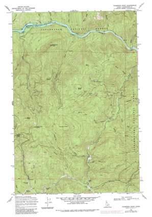
Thompson Point Topo Map Idaho
To zoom in, hover over the map of Thompson Point
USGS Topo Quad 46115g6 - 1:24,000 scale
| Topo Map Name: | Thompson Point |
| USGS Topo Quad ID: | 46115g6 |
| Print Size: | ca. 21 1/4" wide x 27" high |
| Southeast Coordinates: | 46.75° N latitude / 115.625° W longitude |
| Map Center Coordinates: | 46.8125° N latitude / 115.6875° W longitude |
| U.S. State: | ID |
| Filename: | o46115g6.jpg |
| Download Map JPG Image: | Thompson Point topo map 1:24,000 scale |
| Map Type: | Topographic |
| Topo Series: | 7.5´ |
| Map Scale: | 1:24,000 |
| Source of Map Images: | United States Geological Survey (USGS) |
| Alternate Map Versions: |
Thompson Point ID 1969, updated 1971 Download PDF Buy paper map Thompson Point ID 1969, updated 1985 Download PDF Buy paper map Thompson Point ID 1994, updated 1997 Download PDF Buy paper map Thompson Point ID 2011 Download PDF Buy paper map Thompson Point ID 2013 Download PDF Buy paper map |
| FStopo: | US Forest Service topo Thompson Point is available: Download FStopo PDF Download FStopo TIF |
1:24,000 Topo Quads surrounding Thompson Point
> Back to 46115e1 at 1:100,000 scale
> Back to 46114a1 at 1:250,000 scale
> Back to U.S. Topo Maps home
Thompson Point topo map: Gazetteer
Thompson Point: Gaps
Bingo Saddle elevation 1285m 4215′Butte Creek Saddle elevation 1395m 4576′
Hanson Saddle elevation 1268m 4160′
Kauffman Saddle elevation 1168m 3832′
Thompson Point: Populated Places
Bingo Creek Landing elevation 966m 3169′Isabella Landing elevation 517m 1696′
Thompson Point: Streams
Bingo Creek elevation 946m 3103′Bonner Creek elevation 829m 2719′
Butte Creek elevation 489m 1604′
Charlie Creek elevation 697m 2286′
Cooper Creek elevation 814m 2670′
Doyle Creek elevation 823m 2700′
East Fork Beaver Creek elevation 853m 2798′
Falls Creek elevation 918m 3011′
Harlan Creek elevation 877m 2877′
Idaho Creek elevation 676m 2217′
Isabella Creek elevation 510m 1673′
Lightning Creek elevation 997m 3270′
Marquette Creek elevation 511m 1676′
Milk Creek elevation 489m 1604′
Montana Creek elevation 627m 2057′
Salmon Creek elevation 489m 1604′
Sheep Mountain Creek elevation 871m 2857′
Sourdough Creek elevation 671m 2201′
Sousie Creek elevation 707m 2319′
Steep Creek elevation 585m 1919′
Syringa Creek elevation 498m 1633′
Thompson Creek elevation 489m 1604′
West Fork Butte Creek elevation 656m 2152′
White Pine Creek elevation 729m 2391′
Thompson Point: Summits
Beaver Butte elevation 1524m 5000′Micky Point elevation 1597m 5239′
Swan Point elevation 1417m 4648′
Thompson Butte elevation 1517m 4977′
Thompson Point elevation 1122m 3681′
Thompson Point digital topo map on disk
Buy this Thompson Point topo map showing relief, roads, GPS coordinates and other geographical features, as a high-resolution digital map file on DVD:


