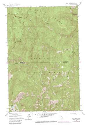
Pole Mountain Topo Map Idaho
To zoom in, hover over the map of Pole Mountain
USGS Topo Quad 46115h4 - 1:24,000 scale
| Topo Map Name: | Pole Mountain |
| USGS Topo Quad ID: | 46115h4 |
| Print Size: | ca. 21 1/4" wide x 27" high |
| Southeast Coordinates: | 46.875° N latitude / 115.375° W longitude |
| Map Center Coordinates: | 46.9375° N latitude / 115.4375° W longitude |
| U.S. State: | ID |
| Filename: | o46115h4.jpg |
| Download Map JPG Image: | Pole Mountain topo map 1:24,000 scale |
| Map Type: | Topographic |
| Topo Series: | 7.5´ |
| Map Scale: | 1:24,000 |
| Source of Map Images: | United States Geological Survey (USGS) |
| Alternate Map Versions: |
Pole Mtn ID 1963, updated 1964 Download PDF Buy paper map Pole Mtn ID 1963, updated 1983 Download PDF Buy paper map Pole Mtn ID 1963, updated 1985 Download PDF Buy paper map Pole Mountain ID 1994, updated 1997 Download PDF Buy paper map Pole Mountain ID 2011 Download PDF Buy paper map Pole Mountain ID 2013 Download PDF Buy paper map |
| FStopo: | US Forest Service topo Pole Mountain is available: Download FStopo PDF Download FStopo TIF |
1:24,000 Topo Quads surrounding Pole Mountain
> Back to 46115e1 at 1:100,000 scale
> Back to 46114a1 at 1:250,000 scale
> Back to U.S. Topo Maps home
Pole Mountain topo map: Gazetteer
Pole Mountain: Lakes
Cliff Lake elevation 1768m 5800′Slide Lake elevation 1866m 6122′
Steve Lake elevation 1839m 6033′
Pole Mountain: Ridges
Avalanche Ridge elevation 1868m 6128′Lost Ridge elevation 1568m 5144′
Pole Mountain: Streams
Avalanche Creek elevation 1082m 3549′Cliff Creek elevation 766m 2513′
Drift Creek elevation 834m 2736′
Fire Creek elevation 722m 2368′
Heather Creek elevation 943m 3093′
My Creek elevation 1244m 4081′
Perry Creek elevation 938m 3077′
Spud Creek elevation 835m 2739′
Pole Mountain: Summits
Collins Peak elevation 1935m 6348′Otter Peak elevation 1937m 6354′
Pole Mountain elevation 1975m 6479′
Surveyors Peak elevation 1984m 6509′
Pole Mountain digital topo map on disk
Buy this Pole Mountain topo map showing relief, roads, GPS coordinates and other geographical features, as a high-resolution digital map file on DVD:


