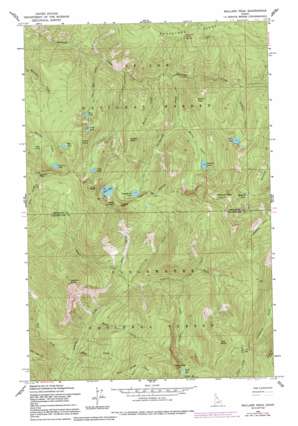
Mallard Peak Topo Map Idaho
To zoom in, hover over the map of Mallard Peak
USGS Topo Quad 46115h5 - 1:24,000 scale
| Topo Map Name: | Mallard Peak |
| USGS Topo Quad ID: | 46115h5 |
| Print Size: | ca. 21 1/4" wide x 27" high |
| Southeast Coordinates: | 46.875° N latitude / 115.5° W longitude |
| Map Center Coordinates: | 46.9375° N latitude / 115.5625° W longitude |
| U.S. State: | ID |
| Filename: | o46115h5.jpg |
| Download Map JPG Image: | Mallard Peak topo map 1:24,000 scale |
| Map Type: | Topographic |
| Topo Series: | 7.5´ |
| Map Scale: | 1:24,000 |
| Source of Map Images: | United States Geological Survey (USGS) |
| Alternate Map Versions: |
Mallard Peak ID 1963, updated 1964 Download PDF Buy paper map Mallard Peak ID 1963, updated 1977 Download PDF Buy paper map Mallard Peak ID 1963, updated 1984 Download PDF Buy paper map Mallard Peak ID 1963, updated 1991 Download PDF Buy paper map Mallard Peak ID 1994, updated 1997 Download PDF Buy paper map Mallard Peak ID 2011 Download PDF Buy paper map Mallard Peak ID 2013 Download PDF Buy paper map |
| FStopo: | US Forest Service topo Mallard Peak is available: Download FStopo PDF Download FStopo TIF |
1:24,000 Topo Quads surrounding Mallard Peak
> Back to 46115e1 at 1:100,000 scale
> Back to 46114a1 at 1:250,000 scale
> Back to U.S. Topo Maps home
Mallard Peak topo map: Gazetteer
Mallard Peak: Areas
Black Buttes elevation 1805m 5921′Mallard Peak: Capes
Martin Peak elevation 1712m 5616′Mallard Peak: Lakes
Black Lake elevation 1948m 6391′Blue Lake elevation 1624m 5328′
Crag Lake elevation 1788m 5866′
Fawn Lake elevation 1802m 5912′
Gnat Lake elevation 1811m 5941′
Heart Lake elevation 1824m 5984′
Hero Lake elevation 1590m 5216′
Larkins Lake elevation 1703m 5587′
Mallard Lake elevation 1753m 5751′
Mud Lake elevation 1787m 5862′
Northbound Lake elevation 1654m 5426′
Skyland Lake elevation 1459m 4786′
Mallard Peak: Parks
Mallard Larkins Pioneer Park elevation 1704m 5590′Mallard Peak: Streams
Black Creek elevation 751m 2463′Cataract Creek elevation 1096m 3595′
Crimper Creek elevation 1118m 3667′
Elmer Creek elevation 935m 3067′
Falls Creek elevation 1210m 3969′
Goat Creek elevation 686m 2250′
Greenie Creek elevation 1356m 4448′
John Creek elevation 1013m 3323′
Jug Creek elevation 929m 3047′
Martin Creek elevation 1299m 4261′
Northbound Creek elevation 1111m 3645′
Old Man Creek elevation 1018m 3339′
Wash Creek elevation 683m 2240′
Wasset Creek elevation 1113m 3651′
Mallard Peak: Summits
Black Mountain elevation 2151m 7057′Crag Peak elevation 2063m 6768′
East Sister elevation 2155m 7070′
Gnat Point elevation 1972m 6469′
Heart Peak elevation 2075m 6807′
Isabella Point elevation 1849m 6066′
Larkins Peak elevation 1995m 6545′
Mallard Peak elevation 2094m 6870′
Wasset Peak elevation 1870m 6135′
Mallard Peak digital topo map on disk
Buy this Mallard Peak topo map showing relief, roads, GPS coordinates and other geographical features, as a high-resolution digital map file on DVD:


