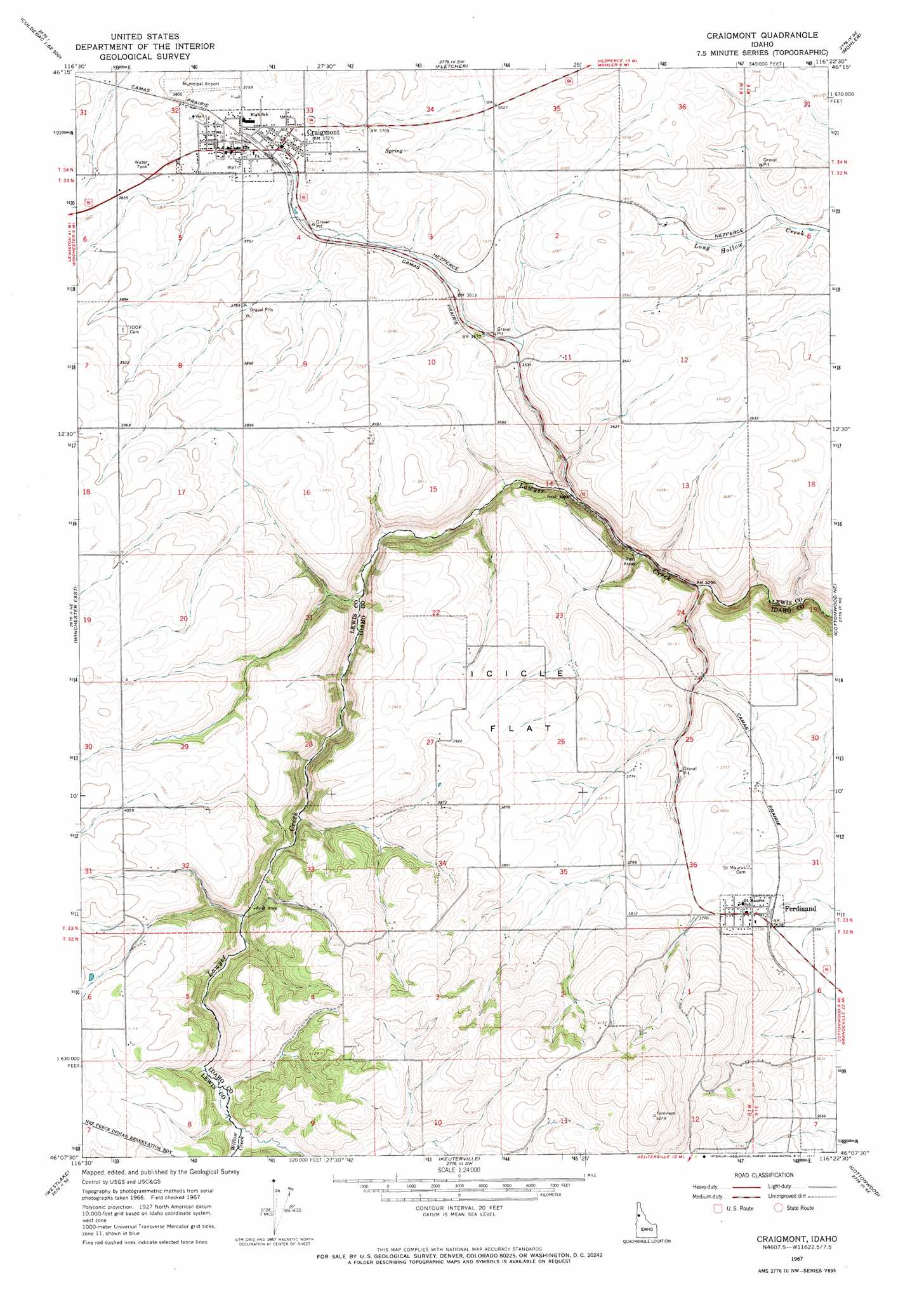
Craigmont Topo Map Idaho
To zoom in, hover over the map of Craigmont
USGS Topo Quad 46116b4 - 1:24,000 scale
| Topo Map Name: | Craigmont |
| USGS Topo Quad ID: | 46116b4 |
| Print Size: | ca. 21 1/4" wide x 27" high |
| Southeast Coordinates: | 46.125° N latitude / 116.375° W longitude |
| Map Center Coordinates: | 46.1875° N latitude / 116.4375° W longitude |
| U.S. State: | ID |
| Filename: | o46116b4.jpg |
| Download Map JPG Image: | Craigmont topo map 1:24,000 scale |
| Map Type: | Topographic |
| Topo Series: | 7.5´ |
| Map Scale: | 1:24,000 |
| Source of Map Images: | United States Geological Survey (USGS) |
| Alternate Map Versions: |
Craigmont ID 1967, updated 1971 Download PDF Buy paper map Craigmont ID 2010 Download PDF Buy paper map Craigmont ID 2013 Download PDF Buy paper map |
1:24,000 Topo Quads surrounding Craigmont
Culdesac North |
Gifford |
Peck |
Orofino West |
Orofino East |
Culdesac South |
Reubens |
Fletcher |
Mohler |
Sixmile Creek |
Winchester West |
Winchester East |
Craigmont |
Cottonwood Ne |
Nezperce |
Hoover Point |
Westlake |
Keuterville |
Cottonwood |
Nezperce Sw |
Rattlesnake Ridge |
Boles |
Moughmer Point |
Fenn |
Grangeville West |
> Back to 46116a1 at 1:100,000 scale
> Back to 46116a1 at 1:250,000 scale
> Back to U.S. Topo Maps home
Craigmont topo map: Gazetteer
Craigmont: Airports
Craigmont Municipal Airport elevation 1154m 3786′Craigmont: Flats
Icicle Flat elevation 1183m 3881′Craigmont: Populated Places
Craigmont elevation 1140m 3740′Ferdinand elevation 1134m 3720′
Ilo (historical) elevation 1160m 3805′
Vollmer elevation 1142m 3746′
Craigmont: Streams
Willow Creek elevation 1173m 3848′Craigmont digital topo map on disk
Buy this Craigmont topo map showing relief, roads, GPS coordinates and other geographical features, as a high-resolution digital map file on DVD: