Woodland Topo Map Idaho
To zoom in, hover over the map of Woodland
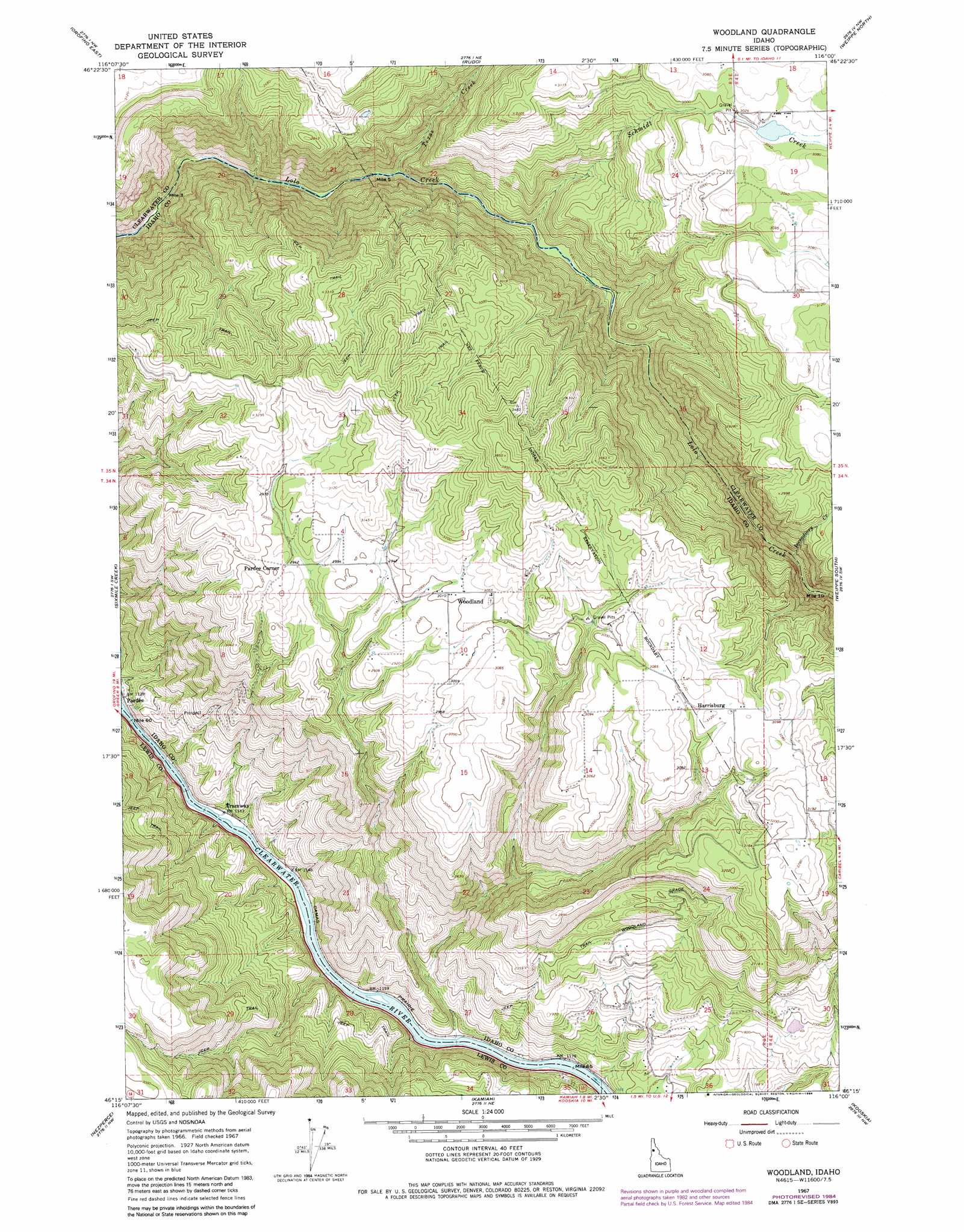
USGS Topo Quad 46116c1 - 1:24,000 scale
| Topo Map Name: | Woodland |
| USGS Topo Quad ID: | 46116c1 |
| Print Size: | ca. 21 1/4" wide x 27" high |
| Southeast Coordinates: | 46.25° N latitude / 116° W longitude |
| Map Center Coordinates: | 46.3125° N latitude / 116.0625° W longitude |
| U.S. State: | ID |
| Filename: | o46116c1.jpg |
| Download Map JPG Image: | Woodland topo map 1:24,000 scale |
| Map Type: | Topographic |
| Topo Series: | 7.5´ |
| Map Scale: | 1:24,000 |
| Source of Map Images: | United States Geological Survey (USGS) |
| Alternate Map Versions: |
Woodland ID 1967, updated 1971 Download PDF Buy paper map Woodland ID 1967, updated 1983 Download PDF Buy paper map Woodland ID 1967, updated 1984 Download PDF Buy paper map Woodland ID 1994, updated 1998 Download PDF Buy paper map Woodland ID 2011 Download PDF Buy paper map Woodland ID 2014 Download PDF Buy paper map |
| FStopo: | US Forest Service topo Woodland is available: Download FStopo PDF Download FStopo TIF |
1:24,000 Topo Quads surrounding Woodland
Ahsahka |
Dent |
Grangemont |
Whiskey Butte |
Jaype |
Orofino West |
Orofino East |
Rudo |
Weippe North |
Pierce |
Mohler |
Sixmile Creek |
Woodland |
Weippe South |
Brown Creek Ridge |
Cottonwood Ne |
Nezperce |
Kamiah |
Kooskia |
Glenwood |
Cottonwood |
Nezperce Sw |
Nezperce Se |
Stites |
Big Cedar |
> Back to 46116a1 at 1:100,000 scale
> Back to 46116a1 at 1:250,000 scale
> Back to U.S. Topo Maps home
Woodland topo map: Gazetteer
Woodland: Populated Places
Harrisburg elevation 939m 3080′Pardee Corner elevation 902m 2959′
Tramway elevation 351m 1151′
Woodland elevation 918m 3011′
Woodland: Streams
East Fork Woodland Grade Creek elevation 391m 1282′Incendiary Creek elevation 583m 1912′
Schmidt Creek elevation 475m 1558′
Texas Creek elevation 436m 1430′
West Fork Woodland Grade Creek elevation 391m 1282′
Woodland Grade Creek elevation 352m 1154′
Woodland digital topo map on disk
Buy this Woodland topo map showing relief, roads, GPS coordinates and other geographical features, as a high-resolution digital map file on DVD: