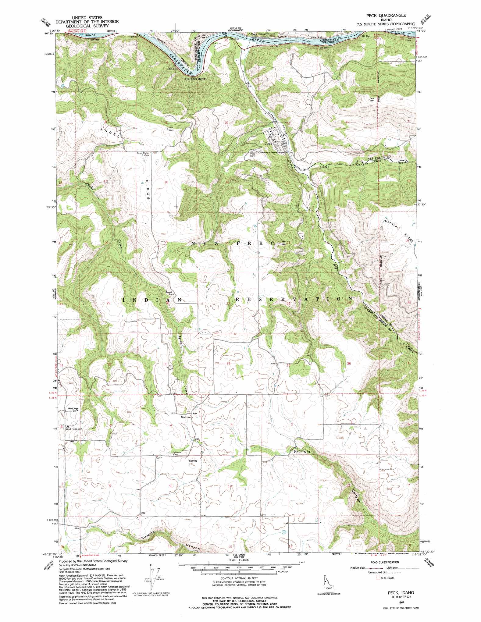
Peck Topo Map Idaho
To zoom in, hover over the map of Peck
USGS Topo Quad 46116d4 - 1:24,000 scale
| Topo Map Name: | Peck |
| USGS Topo Quad ID: | 46116d4 |
| Print Size: | ca. 21 1/4" wide x 27" high |
| Southeast Coordinates: | 46.375° N latitude / 116.375° W longitude |
| Map Center Coordinates: | 46.4375° N latitude / 116.4375° W longitude |
| U.S. State: | ID |
| Filename: | o46116d4.jpg |
| Download Map JPG Image: | Peck topo map 1:24,000 scale |
| Map Type: | Topographic |
| Topo Series: | 7.5´ |
| Map Scale: | 1:24,000 |
| Source of Map Images: | United States Geological Survey (USGS) |
| Alternate Map Versions: |
Peck ID 1967, updated 1971 Download PDF Buy paper map Peck ID 2010 Download PDF Buy paper map Peck ID 2013 Download PDF Buy paper map |
1:24,000 Topo Quads surrounding Peck
Little Bear Ridge |
Texas Ridge |
Park |
Alderman Ridge |
Elk Creek Falls |
Juliaetta |
Lenore |
Southwick |
Ahsahka |
Dent |
Culdesac North |
Gifford |
Peck |
Orofino West |
Orofino East |
Culdesac South |
Reubens |
Fletcher |
Mohler |
Sixmile Creek |
Winchester West |
Winchester East |
Craigmont |
Cottonwood Ne |
Nezperce |
> Back to 46116a1 at 1:100,000 scale
> Back to 46116a1 at 1:250,000 scale
> Back to U.S. Topo Maps home
Peck topo map: Gazetteer
Peck: Bends
Harpers Bend elevation 279m 915′Peck: Dams
Thompson Dam elevation 540m 1771′Peck: Islands
Snells Island elevation 389m 1276′Peck: Populated Places
Melrose elevation 973m 3192′Peck elevation 332m 1089′
Peck elevation 292m 958′
Peck: Ridges
Angel Ridge elevation 892m 2926′Peck: Streams
Big Canyon Creek elevation 285m 935′Little Canyon Creek elevation 365m 1197′
Peck digital topo map on disk
Buy this Peck topo map showing relief, roads, GPS coordinates and other geographical features, as a high-resolution digital map file on DVD: