Culdesac North Topo Map Idaho
To zoom in, hover over the map of Culdesac North
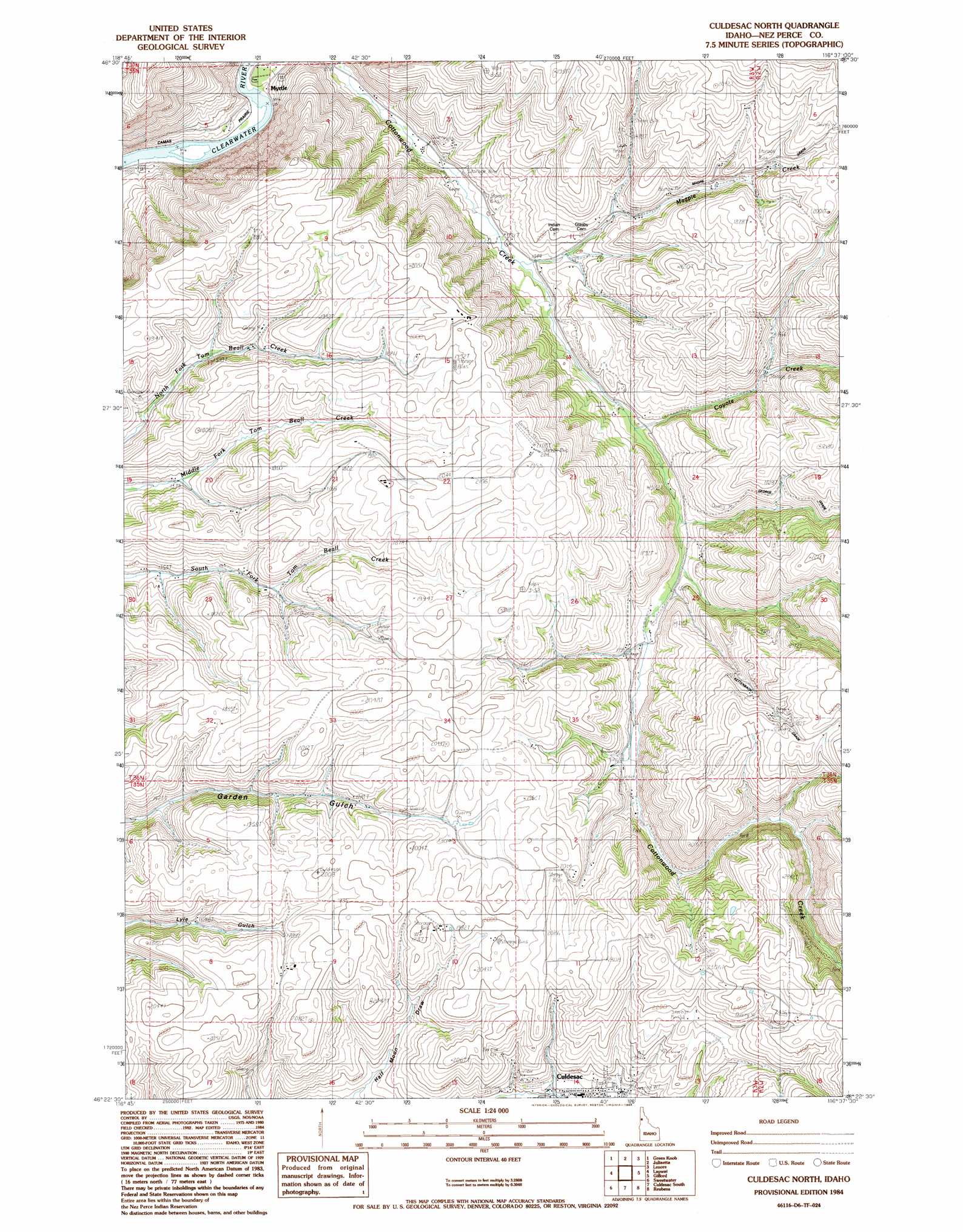
USGS Topo Quad 46116d6 - 1:24,000 scale
| Topo Map Name: | Culdesac North |
| USGS Topo Quad ID: | 46116d6 |
| Print Size: | ca. 21 1/4" wide x 27" high |
| Southeast Coordinates: | 46.375° N latitude / 116.625° W longitude |
| Map Center Coordinates: | 46.4375° N latitude / 116.6875° W longitude |
| U.S. State: | ID |
| Filename: | o46116d6.jpg |
| Download Map JPG Image: | Culdesac North topo map 1:24,000 scale |
| Map Type: | Topographic |
| Topo Series: | 7.5´ |
| Map Scale: | 1:24,000 |
| Source of Map Images: | United States Geological Survey (USGS) |
| Alternate Map Versions: |
Culdesac North ID 1984, updated 1985 Download PDF Buy paper map Culdesac North ID 2010 Download PDF Buy paper map Culdesac North ID 2013 Download PDF Buy paper map |
1:24,000 Topo Quads surrounding Culdesac North
Moscow East |
Troy |
Little Bear Ridge |
Texas Ridge |
Park |
Genesee |
Green Knob |
Juliaetta |
Lenore |
Southwick |
Lewiston Orchards North |
Lapwai |
Culdesac North |
Gifford |
Peck |
Lewiston Orchards South |
Sweetwater |
Culdesac South |
Reubens |
Fletcher |
Captain John Rapids |
Waha |
Winchester West |
Winchester East |
Craigmont |
> Back to 46116a1 at 1:100,000 scale
> Back to 46116a1 at 1:250,000 scale
> Back to U.S. Topo Maps home
Culdesac North topo map: Gazetteer
Culdesac North: Populated Places
Myrtle elevation 258m 846′Culdesac North: Streams
Cottonwood Creek elevation 259m 849′Coyote Creek elevation 351m 1151′
Magpie Creek elevation 316m 1036′
Culdesac North digital topo map on disk
Buy this Culdesac North topo map showing relief, roads, GPS coordinates and other geographical features, as a high-resolution digital map file on DVD: