Little Green Mountain Topo Map Idaho
To zoom in, hover over the map of Little Green Mountain
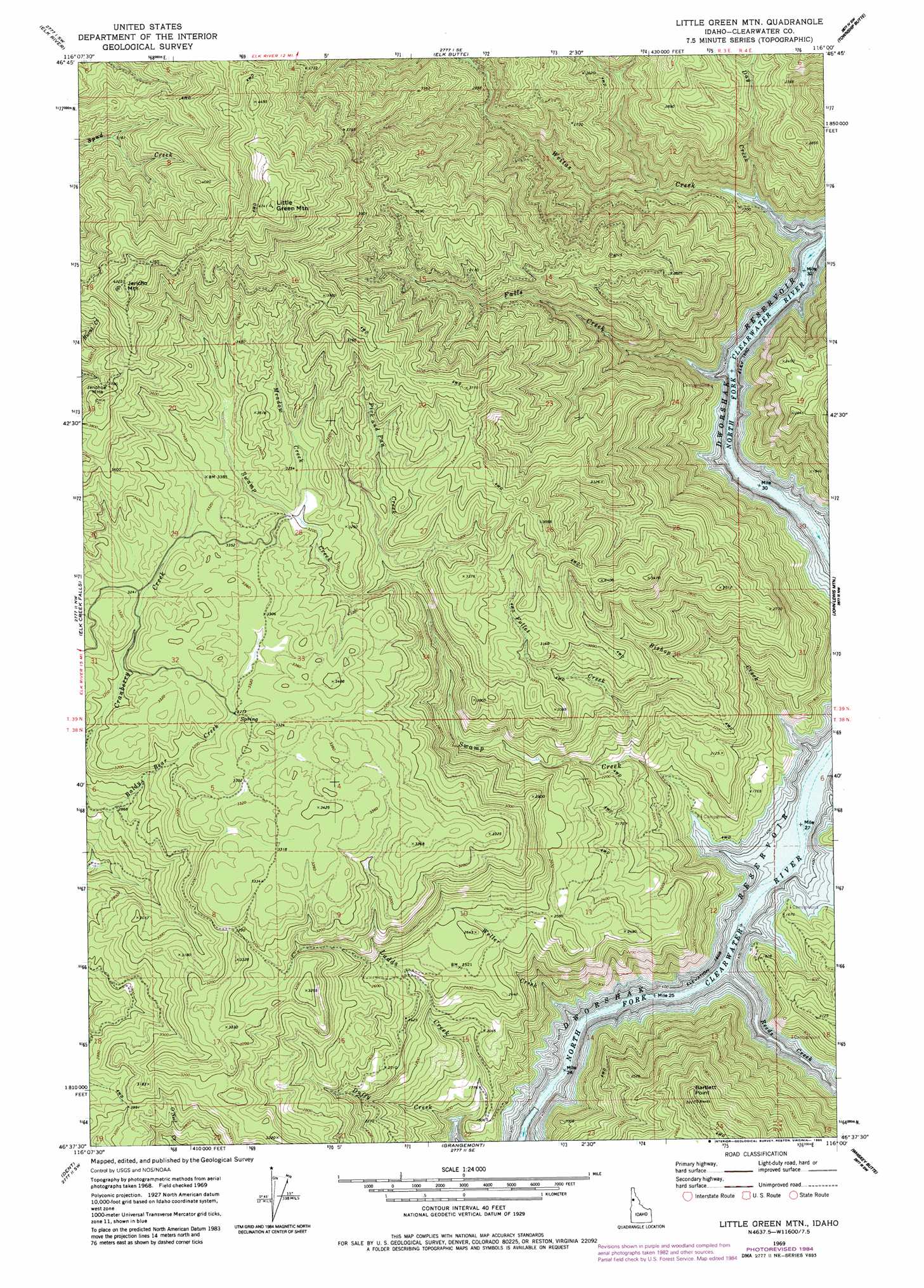
USGS Topo Quad 46116f1 - 1:24,000 scale
| Topo Map Name: | Little Green Mountain |
| USGS Topo Quad ID: | 46116f1 |
| Print Size: | ca. 21 1/4" wide x 27" high |
| Southeast Coordinates: | 46.625° N latitude / 116° W longitude |
| Map Center Coordinates: | 46.6875° N latitude / 116.0625° W longitude |
| U.S. State: | ID |
| Filename: | o46116f1.jpg |
| Download Map JPG Image: | Little Green Mountain topo map 1:24,000 scale |
| Map Type: | Topographic |
| Topo Series: | 7.5´ |
| Map Scale: | 1:24,000 |
| Source of Map Images: | United States Geological Survey (USGS) |
| Alternate Map Versions: |
Little Green Mountain ID 1969, updated 1973 Download PDF Buy paper map Little Green Mountain ID 1969, updated 1982 Download PDF Buy paper map Little Green Mtn. ID 1969, updated 1985 Download PDF Buy paper map Little Green Mountain ID 1994, updated 1997 Download PDF Buy paper map Little Green Mountain ID 2011 Download PDF Buy paper map Little Green Mountain ID 2014 Download PDF Buy paper map |
| FStopo: | US Forest Service topo Little Green Mountain is available: Download FStopo PDF Download FStopo TIF |
1:24,000 Topo Quads surrounding Little Green Mountain
Bechtel Butte |
Anthony Peak |
Grice Ridge |
Pinchot Butte |
Little Goat Mountains |
Mcgary Butte |
Elk River |
Elk Butte |
Township Butte |
Bertha Hill |
Alderman Ridge |
Elk Creek Falls |
Little Green Mountain |
John Lewis Mountain |
Headquarters |
Ahsahka |
Dent |
Grangemont |
Whiskey Butte |
Jaype |
Orofino West |
Orofino East |
Rudo |
Weippe North |
Pierce |
> Back to 46116e1 at 1:100,000 scale
> Back to 46116a1 at 1:250,000 scale
> Back to U.S. Topo Maps home
Little Green Mountain topo map: Gazetteer
Little Green Mountain: Islands
Big Island (historical) elevation 489m 1604′Little Green Mountain: Mines
Jericho Mine elevation 1134m 3720′Little Green Mountain: Streams
Bishop Creek elevation 489m 1604′Caldwell Creek elevation 489m 1604′
Day Creek elevation 489m 1604′
Duffy Creek elevation 489m 1604′
Falls Creek elevation 489m 1604′
Follet Creek elevation 629m 2063′
Meadow Creek elevation 975m 3198′
Pick and Pan Creek elevation 888m 2913′
Reeds Creek elevation 489m 1604′
Swamp Creek elevation 489m 1604′
Weitas Creek elevation 489m 1604′
Weller Creek elevation 489m 1604′
Little Green Mountain: Summits
Bartlett Point elevation 978m 3208′Jericho Mountain elevation 1334m 4376′
Little Green Mountain elevation 1443m 4734′
Little Green Mountain digital topo map on disk
Buy this Little Green Mountain topo map showing relief, roads, GPS coordinates and other geographical features, as a high-resolution digital map file on DVD: