Alderman Ridge Topo Map Idaho
To zoom in, hover over the map of Alderman Ridge
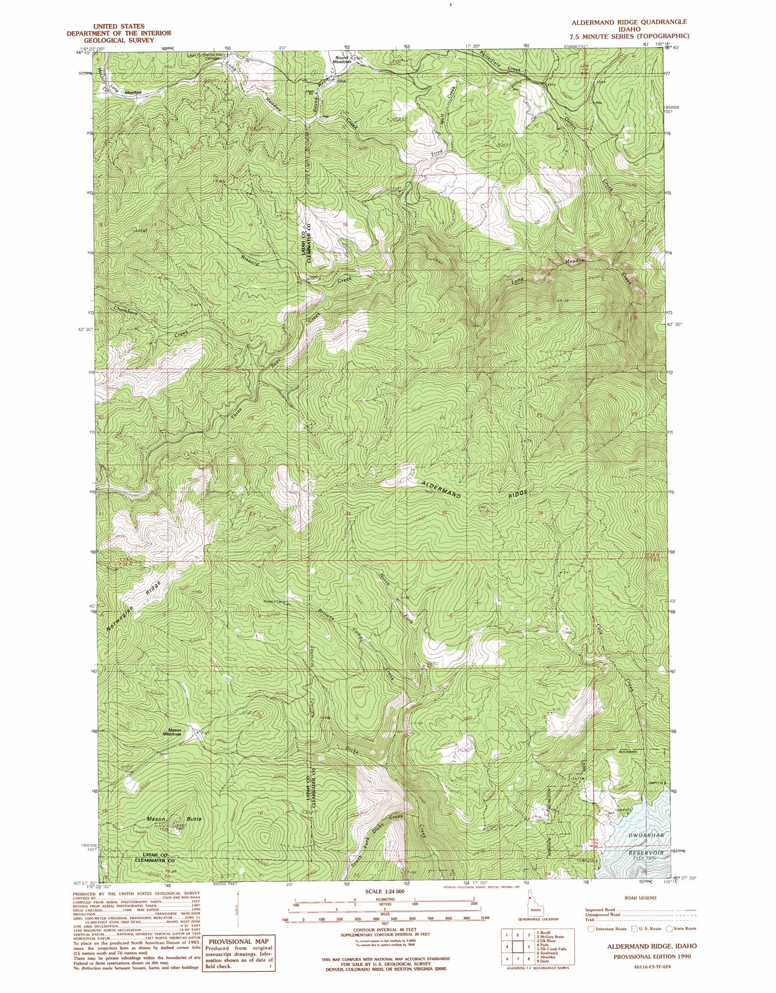
USGS Topo Quad 46116f3 - 1:24,000 scale
| Topo Map Name: | Alderman Ridge |
| USGS Topo Quad ID: | 46116f3 |
| Print Size: | ca. 21 1/4" wide x 27" high |
| Southeast Coordinates: | 46.625° N latitude / 116.25° W longitude |
| Map Center Coordinates: | 46.6875° N latitude / 116.3125° W longitude |
| U.S. State: | ID |
| Filename: | o46116f3.jpg |
| Download Map JPG Image: | Alderman Ridge topo map 1:24,000 scale |
| Map Type: | Topographic |
| Topo Series: | 7.5´ |
| Map Scale: | 1:24,000 |
| Source of Map Images: | United States Geological Survey (USGS) |
| Alternate Map Versions: |
Aldermand Ridge ID 1990, updated 1991 Download PDF Buy paper map Aldermand Ridge ID 1994, updated 1997 Download PDF Buy paper map Aldermand Ridge ID 2011 Download PDF Buy paper map Aldermand Ridge ID 2014 Download PDF Buy paper map |
| FStopo: | US Forest Service topo Aldermand Ridge is available: Download FStopo PDF Download FStopo TIF |
1:24,000 Topo Quads surrounding Alderman Ridge
Sand Mountain |
Abes Knob |
Bechtel Butte |
Anthony Peak |
Grice Ridge |
Deary |
Bovill |
Mcgary Butte |
Elk River |
Elk Butte |
Texas Ridge |
Park |
Alderman Ridge |
Elk Creek Falls |
Little Green Mountain |
Lenore |
Southwick |
Ahsahka |
Dent |
Grangemont |
Gifford |
Peck |
Orofino West |
Orofino East |
Rudo |
> Back to 46116e1 at 1:100,000 scale
> Back to 46116a1 at 1:250,000 scale
> Back to U.S. Topo Maps home
Alderman Ridge topo map: Gazetteer
Alderman Ridge: Flats
Long Meadow elevation 881m 2890′Mason Meadows elevation 922m 3024′
Round Meadows elevation 876m 2874′
Alderman Ridge: Ridges
Aldermand Ridge elevation 1119m 3671′Norwegian Ridge elevation 1140m 3740′
Alderman Ridge: Streams
Browns Camp Creek elevation 797m 2614′Butterfield Creek elevation 892m 2926′
Chambers Creek elevation 847m 2778′
Cole Creek elevation 489m 1604′
McGary Creek elevation 885m 2903′
North Fork Dicks Creek elevation 689m 2260′
Oviatt Creek elevation 719m 2358′
Riswold Creek elevation 813m 2667′
Round Meadow Creek elevation 872m 2860′
South Fork Dicks Creek elevation 604m 1981′
Three Bear Creek elevation 786m 2578′
Tired Wolf Creek elevation 824m 2703′
Alderman Ridge: Summits
Mason Butte elevation 1114m 3654′Alderman Ridge digital topo map on disk
Buy this Alderman Ridge topo map showing relief, roads, GPS coordinates and other geographical features, as a high-resolution digital map file on DVD: