Park Topo Map Idaho
To zoom in, hover over the map of Park
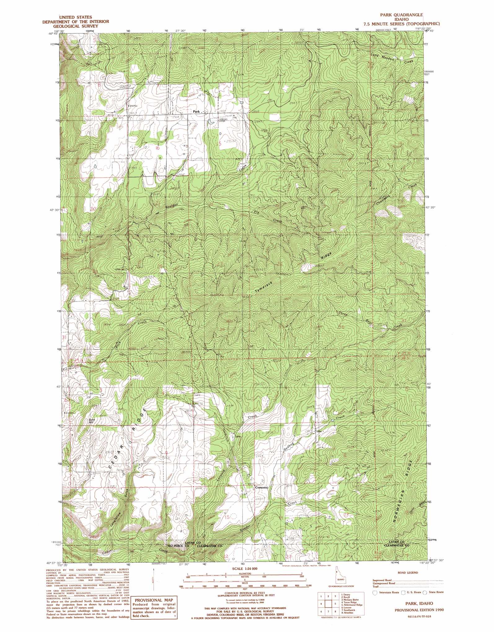
USGS Topo Quad 46116f4 - 1:24,000 scale
| Topo Map Name: | Park |
| USGS Topo Quad ID: | 46116f4 |
| Print Size: | ca. 21 1/4" wide x 27" high |
| Southeast Coordinates: | 46.625° N latitude / 116.375° W longitude |
| Map Center Coordinates: | 46.6875° N latitude / 116.4375° W longitude |
| U.S. State: | ID |
| Filename: | o46116f4.jpg |
| Download Map JPG Image: | Park topo map 1:24,000 scale |
| Map Type: | Topographic |
| Topo Series: | 7.5´ |
| Map Scale: | 1:24,000 |
| Source of Map Images: | United States Geological Survey (USGS) |
| Alternate Map Versions: |
Park ID 1990, updated 1991 Download PDF Buy paper map Park ID 1994, updated 1997 Download PDF Buy paper map Park ID 1994, updated 1997 Download PDF Buy paper map Park ID 2011 Download PDF Buy paper map Park ID 2014 Download PDF Buy paper map |
| FStopo: | US Forest Service topo Park is available: Download FStopo PDF Download FStopo TIF |
1:24,000 Topo Quads surrounding Park
Harvard |
Sand Mountain |
Abes Knob |
Bechtel Butte |
Anthony Peak |
Stanford |
Deary |
Bovill |
Mcgary Butte |
Elk River |
Little Bear Ridge |
Texas Ridge |
Park |
Alderman Ridge |
Elk Creek Falls |
Juliaetta |
Lenore |
Southwick |
Ahsahka |
Dent |
Culdesac North |
Gifford |
Peck |
Orofino West |
Orofino East |
> Back to 46116e1 at 1:100,000 scale
> Back to 46116a1 at 1:250,000 scale
> Back to U.S. Topo Maps home
Park topo map: Gazetteer
Park: Populated Places
Aspendale elevation 864m 2834′Crescent elevation 866m 2841′
Linden elevation 828m 2716′
Park: Ridges
Cedar Ridge elevation 869m 2851′Tamarack Ridge elevation 1232m 4041′
Park: Streams
Bedbug Creek elevation 855m 2805′Kauder Creek elevation 730m 2395′
Leopold Creek elevation 748m 2454′
Pig Creek elevation 793m 2601′
Park: Summits
Gold Hill elevation 976m 3202′Park: Valleys
Longfellow Gulch elevation 710m 2329′Park digital topo map on disk
Buy this Park topo map showing relief, roads, GPS coordinates and other geographical features, as a high-resolution digital map file on DVD: