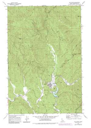
Elk River Topo Map Idaho
To zoom in, hover over the map of Elk River
USGS Topo Quad 46116g2 - 1:24,000 scale
| Topo Map Name: | Elk River |
| USGS Topo Quad ID: | 46116g2 |
| Print Size: | ca. 21 1/4" wide x 27" high |
| Southeast Coordinates: | 46.75° N latitude / 116.125° W longitude |
| Map Center Coordinates: | 46.8125° N latitude / 116.1875° W longitude |
| U.S. State: | ID |
| Filename: | o46116g2.jpg |
| Download Map JPG Image: | Elk River topo map 1:24,000 scale |
| Map Type: | Topographic |
| Topo Series: | 7.5´ |
| Map Scale: | 1:24,000 |
| Source of Map Images: | United States Geological Survey (USGS) |
| Alternate Map Versions: |
Elk River ID 1969, updated 1973 Download PDF Buy paper map Elk River ID 1969, updated 1985 Download PDF Buy paper map Elk River ID 1994, updated 1997 Download PDF Buy paper map Elk River ID 2011 Download PDF Buy paper map Elk River ID 2014 Download PDF Buy paper map |
| FStopo: | US Forest Service topo Elk River is available: Download FStopo PDF Download FStopo TIF |
1:24,000 Topo Quads surrounding Elk River
> Back to 46116e1 at 1:100,000 scale
> Back to 46116a1 at 1:250,000 scale
> Back to U.S. Topo Maps home
Elk River topo map: Gazetteer
Elk River: Airports
Elk River Airport elevation 861m 2824′Elk River: Dams
Elk River Dam elevation 860m 2821′Elk River: Flats
Christianson Meadows elevation 910m 2985′Robideaux Meadows elevation 857m 2811′
Elk River: Populated Places
Elk River elevation 870m 2854′Elk River: Reservoirs
Elk Creek Reservoir elevation 860m 2821′Elk River: Ridges
Anderson Ridge elevation 1039m 3408′Elk River: Streams
Cameron Creek elevation 850m 2788′Deer Creek elevation 866m 2841′
Ikes Creek elevation 1022m 3353′
Johnson Creek elevation 905m 2969′
Morris Creek elevation 905m 2969′
Partridge Creek elevation 860m 2821′
Pete Creek elevation 861m 2824′
Seastem Creek elevation 857m 2811′
Shattuck Creek elevation 850m 2788′
Shite Creek elevation 1029m 3375′
West Fork Elk Creek elevation 1013m 3323′
West Fork Lindley Creek elevation 885m 2903′
Elk River: Summits
Shattuck Butte elevation 1384m 4540′Windy Point elevation 1691m 5547′
Elk River digital topo map on disk
Buy this Elk River topo map showing relief, roads, GPS coordinates and other geographical features, as a high-resolution digital map file on DVD:


