Anthony Peak Topo Map Idaho
To zoom in, hover over the map of Anthony Peak
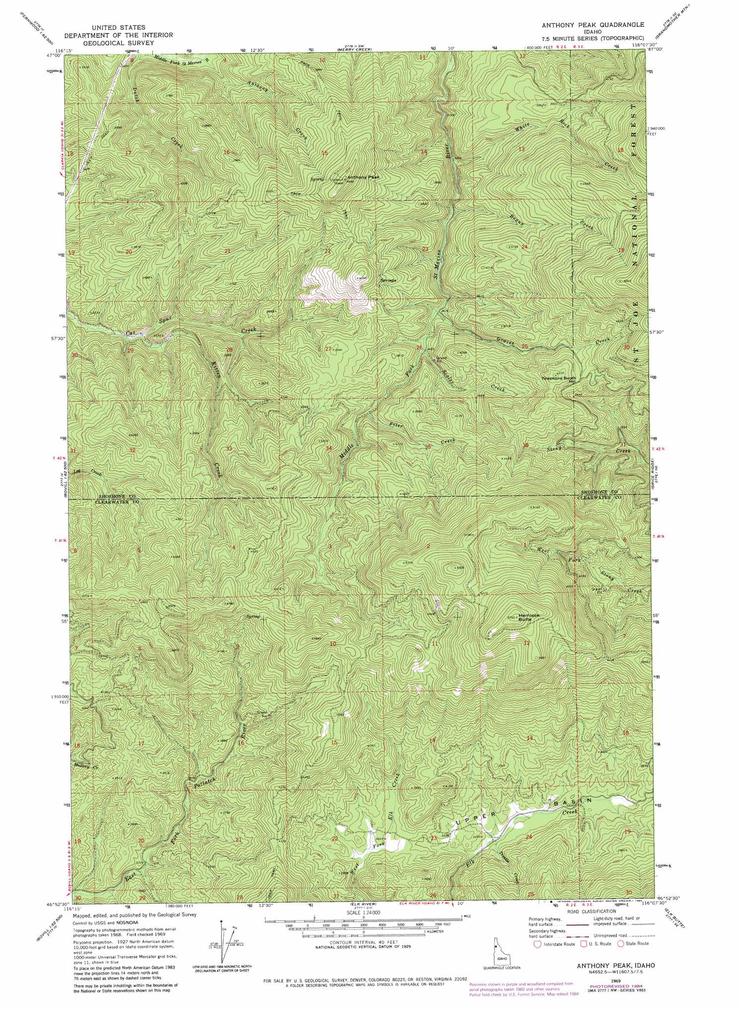
USGS Topo Quad 46116h2 - 1:24,000 scale
| Topo Map Name: | Anthony Peak |
| USGS Topo Quad ID: | 46116h2 |
| Print Size: | ca. 21 1/4" wide x 27" high |
| Southeast Coordinates: | 46.875° N latitude / 116.125° W longitude |
| Map Center Coordinates: | 46.9375° N latitude / 116.1875° W longitude |
| U.S. State: | ID |
| Filename: | o46116h2.jpg |
| Download Map JPG Image: | Anthony Peak topo map 1:24,000 scale |
| Map Type: | Topographic |
| Topo Series: | 7.5´ |
| Map Scale: | 1:24,000 |
| Source of Map Images: | United States Geological Survey (USGS) |
| Alternate Map Versions: |
Anthony Peak ID 1969, updated 1973 Download PDF Buy paper map Anthony Peak ID 1969, updated 1984 Download PDF Buy paper map Anthony Peak ID 1994, updated 1997 Download PDF Buy paper map Anthony Peak ID 2011 Download PDF Buy paper map Anthony Peak ID 2013 Download PDF Buy paper map |
| FStopo: | US Forest Service topo Anthony Peak is available: Download FStopo PDF Download FStopo TIF |
1:24,000 Topo Quads surrounding Anthony Peak
Santa |
Crystal Peak |
Huckleberry Mountain |
Marble Mountain |
Hoyt Mountain |
Fernwood |
Clarkia |
Merry Creek |
Grandmother Mountain |
Widow Mountain |
Abes Knob |
Bechtel Butte |
Anthony Peak |
Grice Ridge |
Pinchot Butte |
Bovill |
Mcgary Butte |
Elk River |
Elk Butte |
Township Butte |
Park |
Alderman Ridge |
Elk Creek Falls |
Little Green Mountain |
John Lewis Mountain |
> Back to 46116e1 at 1:100,000 scale
> Back to 46116a1 at 1:250,000 scale
> Back to U.S. Topo Maps home
Anthony Peak topo map: Gazetteer
Anthony Peak: Basins
Upper Basin elevation 1072m 3517′Anthony Peak: Streams
Anthony Creek elevation 884m 2900′Braun Creek elevation 1013m 3323′
Filer Creek elevation 1093m 3585′
Graves Creek elevation 1044m 3425′
Kitten Creek elevation 922m 3024′
Scaler Creek elevation 1057m 3467′
Trestle Creek elevation 1059m 3474′
White Rock Creek elevation 997m 3270′
Anthony Peak: Summits
Anthony Peak elevation 1408m 4619′Hemlock Butte elevation 1747m 5731′
Telephone Booth Hill elevation 1317m 4320′
Anthony Peak digital topo map on disk
Buy this Anthony Peak topo map showing relief, roads, GPS coordinates and other geographical features, as a high-resolution digital map file on DVD: