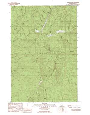
Sand Mountain Topo Map Idaho
To zoom in, hover over the map of Sand Mountain
USGS Topo Quad 46116h5 - 1:24,000 scale
| Topo Map Name: | Sand Mountain |
| USGS Topo Quad ID: | 46116h5 |
| Print Size: | ca. 21 1/4" wide x 27" high |
| Southeast Coordinates: | 46.875° N latitude / 116.5° W longitude |
| Map Center Coordinates: | 46.9375° N latitude / 116.5625° W longitude |
| U.S. State: | ID |
| Filename: | o46116h5.jpg |
| Download Map JPG Image: | Sand Mountain topo map 1:24,000 scale |
| Map Type: | Topographic |
| Topo Series: | 7.5´ |
| Map Scale: | 1:24,000 |
| Source of Map Images: | United States Geological Survey (USGS) |
| Alternate Map Versions: |
Sand Mountain ID 1990, updated 1991 Download PDF Buy paper map Sand Mountain ID 1994, updated 1997 Download PDF Buy paper map Sand Mountain ID 1994, updated 1997 Download PDF Buy paper map Sand Mountain ID 2011 Download PDF Buy paper map Sand Mountain ID 2013 Download PDF Buy paper map |
| FStopo: | US Forest Service topo Sand Mountain is available: Download FStopo PDF Download FStopo TIF |
1:24,000 Topo Quads surrounding Sand Mountain
> Back to 46116e1 at 1:100,000 scale
> Back to 46116a1 at 1:250,000 scale
> Back to U.S. Topo Maps home
Sand Mountain topo map: Gazetteer
Sand Mountain: Flats
Graves Meadow elevation 896m 2939′Sand Mountain: Mines
Doer Mine elevation 1071m 3513′Last Chance Mine elevation 1094m 3589′
Luella Mine elevation 1061m 3480′
Olson Mine elevation 1148m 3766′
Sand Mountain: Ridges
Strychnine Ridge elevation 1133m 3717′Sand Mountain: Streams
Big Sand Creek elevation 846m 2775′Bluejacket Creek elevation 849m 2785′
Bonami Creek elevation 890m 2919′
Disalto Creek elevation 864m 2834′
Dual Creek elevation 934m 3064′
Graves Creek elevation 891m 2923′
Headlong Creek elevation 847m 2778′
Ipsoot Creek elevation 948m 3110′
Johnson Creek elevation 903m 2962′
Mizpah Creek elevation 912m 2992′
North Fork Palouse River elevation 870m 2854′
Pardus Creek elevation 1016m 3333′
Piccolo Creek elevation 913m 2995′
Poorman Creek elevation 859m 2818′
Secunda Creek elevation 895m 2936′
Slate Creek elevation 927m 3041′
Stephens Creek elevation 908m 2979′
Torpid Creek elevation 912m 2992′
Triplet Creek elevation 963m 3159′
Yakala Creek elevation 935m 3067′
Sand Mountain: Summits
Beals Butte elevation 1490m 4888′Mica Mountain elevation 1481m 4858′
Sand Mountain elevation 1506m 4940′
Sand Mountain: Trails
Sand Mountain Lookout Trail elevation 1224m 4015′Sand Mountain: Valleys
Banks Gulch elevation 919m 3015′Beagle Gulch elevation 917m 3008′
California Gulch elevation 936m 3070′
Cleveland Gulch elevation 936m 3070′
Excavation Gulch elevation 965m 3166′
Greenhorn Gulch elevation 884m 2900′
Hoodoo Gulch elevation 883m 2896′
Linn Gulch elevation 866m 2841′
Wagner Gulch elevation 893m 2929′
Sand Mountain digital topo map on disk
Buy this Sand Mountain topo map showing relief, roads, GPS coordinates and other geographical features, as a high-resolution digital map file on DVD:


