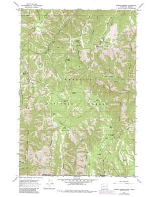
Godman Spring Topo Map Washington
To zoom in, hover over the map of Godman Spring
USGS Topo Quad 46117a7 - 1:24,000 scale
| Topo Map Name: | Godman Spring |
| USGS Topo Quad ID: | 46117a7 |
| Print Size: | ca. 21 1/4" wide x 27" high |
| Southeast Coordinates: | 46° N latitude / 117.75° W longitude |
| Map Center Coordinates: | 46.0625° N latitude / 117.8125° W longitude |
| U.S. States: | WA, OR |
| Filename: | o46117a7.jpg |
| Download Map JPG Image: | Godman Spring topo map 1:24,000 scale |
| Map Type: | Topographic |
| Topo Series: | 7.5´ |
| Map Scale: | 1:24,000 |
| Source of Map Images: | United States Geological Survey (USGS) |
| Alternate Map Versions: |
Godman Spring WA 1967, updated 1972 Download PDF Buy paper map Godman Spring WA 1967, updated 1983 Download PDF Buy paper map Godman Spring WA 1967, updated 1983 Download PDF Buy paper map Godman Spring WA 1995, updated 1998 Download PDF Buy paper map Godman Spring WA 2011 Download PDF Buy paper map Godman Spring WA 2014 Download PDF Buy paper map |
| FStopo: | US Forest Service topo Godman Spring is available: Download FStopo PDF Download FStopo TIF |
1:24,000 Topo Quads surrounding Godman Spring
> Back to 46117a1 at 1:100,000 scale
> Back to 46116a1 at 1:250,000 scale
> Back to U.S. Topo Maps home
Godman Spring topo map: Gazetteer
Godman Spring: Areas
Rainbow Creek Research Natural Area elevation 1230m 4035′Godman Spring: Flats
Burnt Flat elevation 1797m 5895′Godman Spring: Ridges
Beaver Ridge elevation 1685m 5528′Beaver Ridge elevation 1771m 5810′
Buck Ridge elevation 1628m 5341′
Dexter Ridge elevation 1662m 5452′
Little Turkey Tail elevation 1754m 5754′
Middle Point Ridge elevation 1734m 5688′
Sawtooth Ridge elevation 1700m 5577′
Godman Spring: Springs
Berry Spring elevation 1730m 5675′Cavalier Spring elevation 1650m 5413′
Coyote Spring elevation 1527m 5009′
Deer Spring elevation 1587m 5206′
Dexter Spring elevation 1620m 5314′
Elwell Spring elevation 1647m 5403′
Godman Spring elevation 1734m 5688′
Lady Spring elevation 1811m 5941′
Manilla Spring elevation 1622m 5321′
Mead Spring elevation 1592m 5223′
Stayawhile Spring elevation 1640m 5380′
Twin Buttes Spring elevation 1627m 5337′
Wildcat Spring elevation 1539m 5049′
Zuger Spring elevation 1635m 5364′
Godman Spring: Streams
Deep Saddle Creek elevation 1088m 3569′Preacher Creek elevation 1044m 3425′
Rainbow Creek elevation 1032m 3385′
Godman Spring: Summits
Chase Mountain elevation 1721m 5646′Fuzzy Butte elevation 1732m 5682′
Sugarloaf elevation 1433m 4701′
Twin Buttes elevation 1724m 5656′
Godman Spring: Trails
Dexter Ridge Trail elevation 1663m 5456′Grizzly Bear Trail elevation 1528m 5013′
Sawtooth Trail elevation 1727m 5666′
Slick Ear Trail elevation 1560m 5118′
West Butte Creek Trail elevation 1096m 3595′
Godman Spring: Valleys
Happy Valley elevation 1224m 4015′Godman Spring digital topo map on disk
Buy this Godman Spring topo map showing relief, roads, GPS coordinates and other geographical features, as a high-resolution digital map file on DVD:


