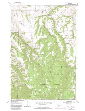
Rose Springs Topo Map Washington
To zoom in, hover over the map of Rose Springs
USGS Topo Quad 46117c5 - 1:24,000 scale
| Topo Map Name: | Rose Springs |
| USGS Topo Quad ID: | 46117c5 |
| Print Size: | ca. 21 1/4" wide x 27" high |
| Southeast Coordinates: | 46.25° N latitude / 117.5° W longitude |
| Map Center Coordinates: | 46.3125° N latitude / 117.5625° W longitude |
| U.S. State: | WA |
| Filename: | o46117c5.jpg |
| Download Map JPG Image: | Rose Springs topo map 1:24,000 scale |
| Map Type: | Topographic |
| Topo Series: | 7.5´ |
| Map Scale: | 1:24,000 |
| Source of Map Images: | United States Geological Survey (USGS) |
| Alternate Map Versions: |
Rose Springs WA 1967, updated 1971 Download PDF Buy paper map Rose Springs WA 1967, updated 1982 Download PDF Buy paper map Rose Springs WA 1967, updated 1983 Download PDF Buy paper map Rose Springs WA 1995, updated 1998 Download PDF Buy paper map Rose Springs WA 2011 Download PDF Buy paper map Rose Springs WA 2013 Download PDF Buy paper map |
| FStopo: | US Forest Service topo Rose Springs is available: Download FStopo PDF Download FStopo TIF |
1:24,000 Topo Quads surrounding Rose Springs
> Back to 46117a1 at 1:100,000 scale
> Back to 46116a1 at 1:250,000 scale
> Back to U.S. Topo Maps home
Rose Springs topo map: Gazetteer
Rose Springs: Cliffs
Abels Point elevation 1599m 5246′Rose Springs: Lakes
Baker Pond elevation 1230m 4035′Rose Springs: Mines
Red Hill Gravel Pit elevation 1136m 3727′Rose Springs: Populated Places
Rose Springs elevation 1425m 4675′Rose Springs: Ridges
Abels Ridge elevation 1417m 4648′Martin Ridge elevation 1444m 4737′
Scoggin Ridge elevation 1382m 4534′
Stevens Ridge elevation 1245m 4084′
Welch Ridge elevation 1404m 4606′
Rose Springs: Springs
Alder Thicket Spring elevation 1532m 5026′Cold Spring elevation 1354m 4442′
Government Spring elevation 1500m 4921′
Horseshoe Spring elevation 1391m 4563′
Lanzie Spring elevation 1464m 4803′
Oliphant Spring elevation 1572m 5157′
Rose Spring elevation 1425m 4675′
Ruchert Spring elevation 1483m 4865′
Sawmill Spring elevation 1372m 4501′
Twin Spring elevation 1451m 4760′
Rose Springs: Streams
Dry Pataha Creek elevation 935m 3067′Rose Springs: Summits
Calloway Hill elevation 1130m 3707′Tatman Mountain elevation 1086m 3562′
Rose Springs: Valleys
Arbothknott Canyon elevation 1107m 3631′Rose Springs digital topo map on disk
Buy this Rose Springs topo map showing relief, roads, GPS coordinates and other geographical features, as a high-resolution digital map file on DVD:


