Cahill Mountain Topo Map Washington
To zoom in, hover over the map of Cahill Mountain
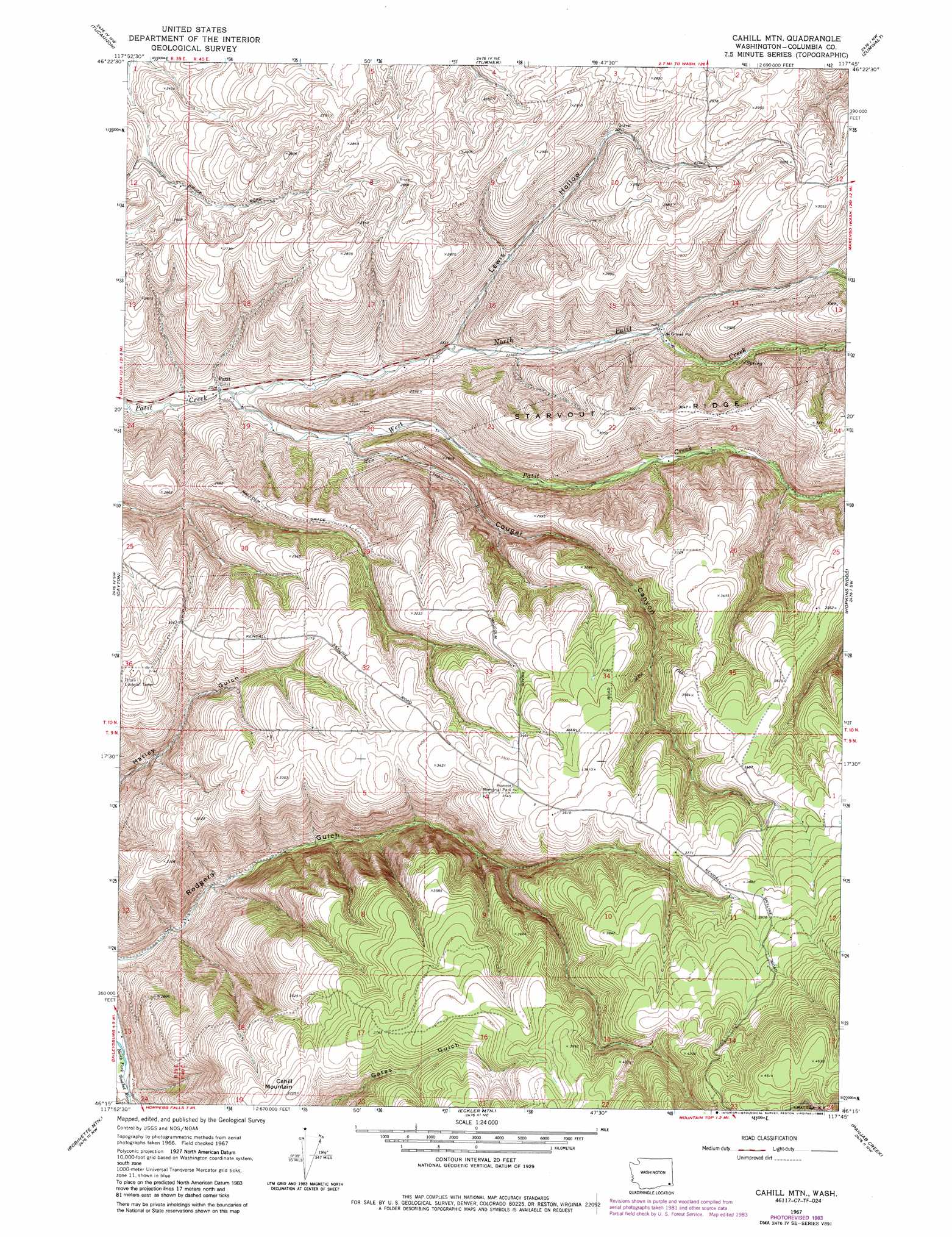
USGS Topo Quad 46117c7 - 1:24,000 scale
| Topo Map Name: | Cahill Mountain |
| USGS Topo Quad ID: | 46117c7 |
| Print Size: | ca. 21 1/4" wide x 27" high |
| Southeast Coordinates: | 46.25° N latitude / 117.75° W longitude |
| Map Center Coordinates: | 46.3125° N latitude / 117.8125° W longitude |
| U.S. State: | WA |
| Filename: | o46117c7.jpg |
| Download Map JPG Image: | Cahill Mountain topo map 1:24,000 scale |
| Map Type: | Topographic |
| Topo Series: | 7.5´ |
| Map Scale: | 1:24,000 |
| Source of Map Images: | United States Geological Survey (USGS) |
| Alternate Map Versions: |
Cahill Mtn WA 1967, updated 1971 Download PDF Buy paper map Cahill Mountain WA 1967, updated 1985 Download PDF Buy paper map Cahill Mtn WA 1976, updated 1980 Download PDF Buy paper map Cahill Mountain WA 1995, updated 1998 Download PDF Buy paper map Cahill Mountain WA 2011 Download PDF Buy paper map Cahill Mountain WA 2013 Download PDF Buy paper map |
| FStopo: | US Forest Service topo Cahill Mountain is available: Download FStopo PDF Download FStopo TIF |
1:24,000 Topo Quads surrounding Cahill Mountain
Starbuck East |
Delaney |
Dodge |
Falling Springs |
Gould City |
Kellogg Creek |
Tucannon |
Turner |
Zumwalt |
Pomeroy |
Huntsville |
Dayton |
Cahill Mountain |
Hopkins Ridge |
Rose Springs |
Coppei |
Robinette Mountain |
Eckler Mountain |
Panjab Creek |
Stentz Spring |
Kooskooskie |
Deadman Peak |
Godman Spring |
Oregon Butte |
Diamond Peak |
> Back to 46117a1 at 1:100,000 scale
> Back to 46116a1 at 1:250,000 scale
> Back to U.S. Topo Maps home
Cahill Mountain topo map: Gazetteer
Cahill Mountain: Populated Places
Patit elevation 617m 2024′Cahill Mountain: Ridges
Starvout Ridge elevation 931m 3054′Cahill Mountain: Streams
North Patit Creek elevation 616m 2020′West Patit Creek elevation 616m 2020′
Cahill Mountain: Summits
Cahill Mountain elevation 1129m 3704′Cahill Mountain: Valleys
Cougar Canyon elevation 658m 2158′Lewis Hollow elevation 679m 2227′
Cahill Mountain digital topo map on disk
Buy this Cahill Mountain topo map showing relief, roads, GPS coordinates and other geographical features, as a high-resolution digital map file on DVD: