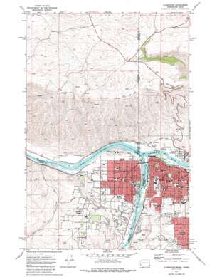
Clarkston Topo Map Washington
To zoom in, hover over the map of Clarkston
USGS Topo Quad 46117d1 - 1:24,000 scale
| Topo Map Name: | Clarkston |
| USGS Topo Quad ID: | 46117d1 |
| Print Size: | ca. 21 1/4" wide x 27" high |
| Southeast Coordinates: | 46.375° N latitude / 117° W longitude |
| Map Center Coordinates: | 46.4375° N latitude / 117.0625° W longitude |
| U.S. States: | WA, ID |
| Filename: | o46117d1.jpg |
| Download Map JPG Image: | Clarkston topo map 1:24,000 scale |
| Map Type: | Topographic |
| Topo Series: | 7.5´ |
| Map Scale: | 1:24,000 |
| Source of Map Images: | United States Geological Survey (USGS) |
| Alternate Map Versions: |
Clarkston WA 1971, updated 1974 Download PDF Buy paper map Clarkston WA 1971, updated 1986 Download PDF Buy paper map Clarkston WA 1975, updated 1977 Download PDF Buy paper map Clarkston WA 2011 Download PDF Buy paper map Clarkston WA 2014 Download PDF Buy paper map |
1:24,000 Topo Quads surrounding Clarkston
> Back to 46117a1 at 1:100,000 scale
> Back to 46116a1 at 1:250,000 scale
> Back to U.S. Topo Maps home
Clarkston topo map: Gazetteer
Clarkston: Airports
Asotin County Heliport elevation 235m 770′O and M Facilities Heliport elevation 227m 744′
Snake River Seaplane Base elevation 267m 875′
Clarkston: Bridges
Clearwater River Memorial Bridge elevation 223m 731′Clarkston: Dams
Sunset Palisades Dam elevation 248m 813′Clarkston: Islands
Holbrook Island elevation 226m 741′Clarkston: Parks
Beachview Park elevation 227m 744′Foster Park elevation 245m 803′
Swallows Park elevation 227m 744′
Vernon Park elevation 257m 843′
Vollmer Park elevation 252m 826′
Clarkston: Populated Places
Clarkston elevation 246m 807′Clarkston Heights elevation 356m 1167′
Highland elevation 287m 941′
Lewiston elevation 227m 744′
North Lewiston elevation 230m 754′
Transfer elevation 226m 741′
Vineland elevation 275m 902′
West Clarkston elevation 258m 846′
Clarkston: Streams
Clearwater River elevation 226m 741′Dry Creek elevation 226m 741′
Clarkston digital topo map on disk
Buy this Clarkston topo map showing relief, roads, GPS coordinates and other geographical features, as a high-resolution digital map file on DVD:


