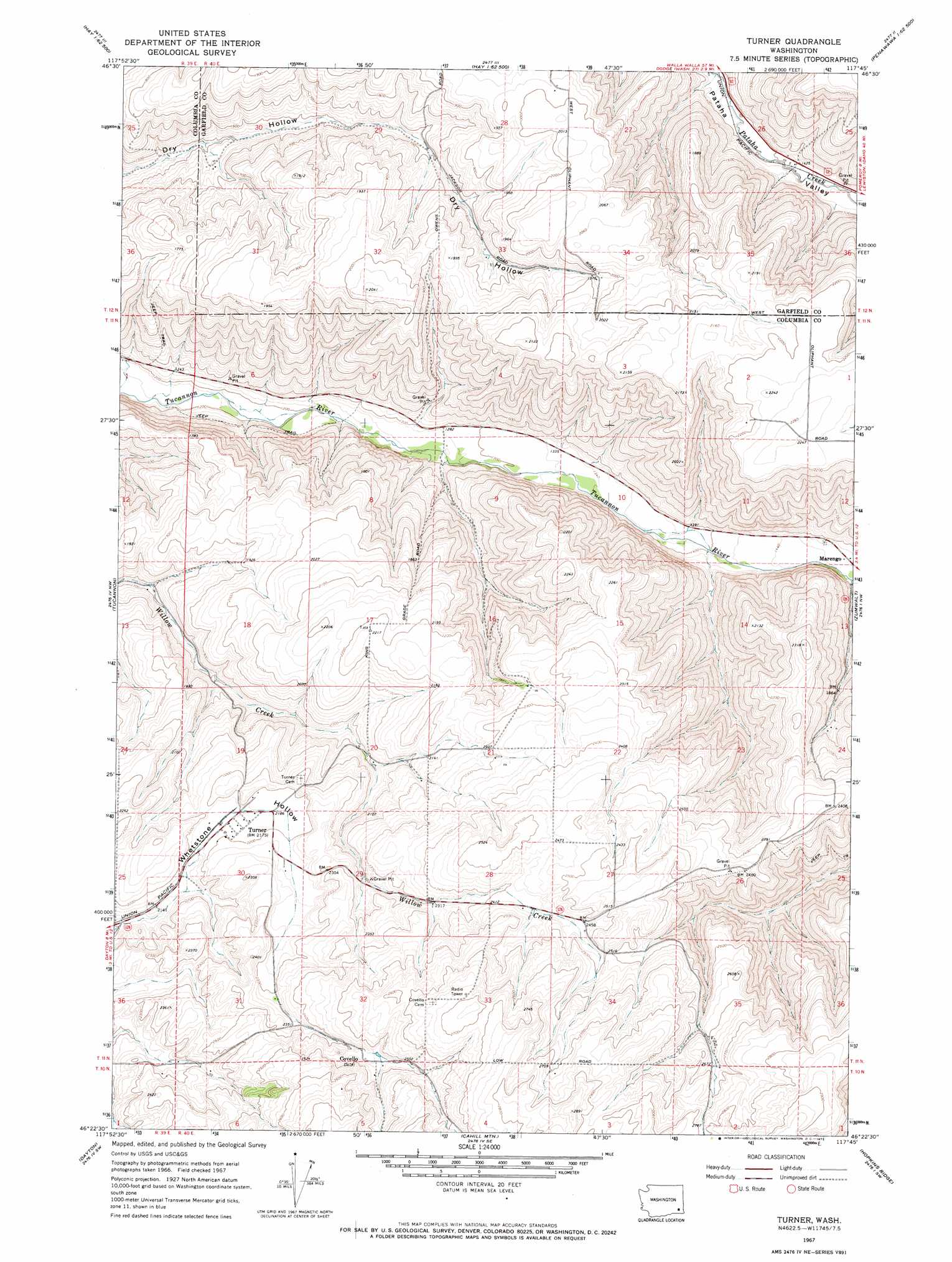
Turner Topo Map Washington
To zoom in, hover over the map of Turner
USGS Topo Quad 46117d7 - 1:24,000 scale
| Topo Map Name: | Turner |
| USGS Topo Quad ID: | 46117d7 |
| Print Size: | ca. 21 1/4" wide x 27" high |
| Southeast Coordinates: | 46.375° N latitude / 117.75° W longitude |
| Map Center Coordinates: | 46.4375° N latitude / 117.8125° W longitude |
| U.S. State: | WA |
| Filename: | o46117d7.jpg |
| Download Map JPG Image: | Turner topo map 1:24,000 scale |
| Map Type: | Topographic |
| Topo Series: | 7.5´ |
| Map Scale: | 1:24,000 |
| Source of Map Images: | United States Geological Survey (USGS) |
| Alternate Map Versions: |
Turner WA 1967, updated 1971 Download PDF Buy paper map Turner WA 1967, updated 1971 Download PDF Buy paper map Turner WA 2011 Download PDF Buy paper map Turner WA 2013 Download PDF Buy paper map |
1:24,000 Topo Quads surrounding Turner
Hooper Lake |
Hay |
Central Ferry |
Ping |
Wades Bar |
Starbuck East |
Delaney |
Dodge |
Falling Springs |
Gould City |
Kellogg Creek |
Tucannon |
Turner |
Zumwalt |
Pomeroy |
Huntsville |
Dayton |
Cahill Mountain |
Hopkins Ridge |
Rose Springs |
Coppei |
Robinette Mountain |
Eckler Mountain |
Panjab Creek |
Stentz Spring |
> Back to 46117a1 at 1:100,000 scale
> Back to 46116a1 at 1:250,000 scale
> Back to U.S. Topo Maps home
Turner digital topo map on disk
Buy this Turner topo map showing relief, roads, GPS coordinates and other geographical features, as a high-resolution digital map file on DVD: