Tucannon Topo Map Washington
To zoom in, hover over the map of Tucannon
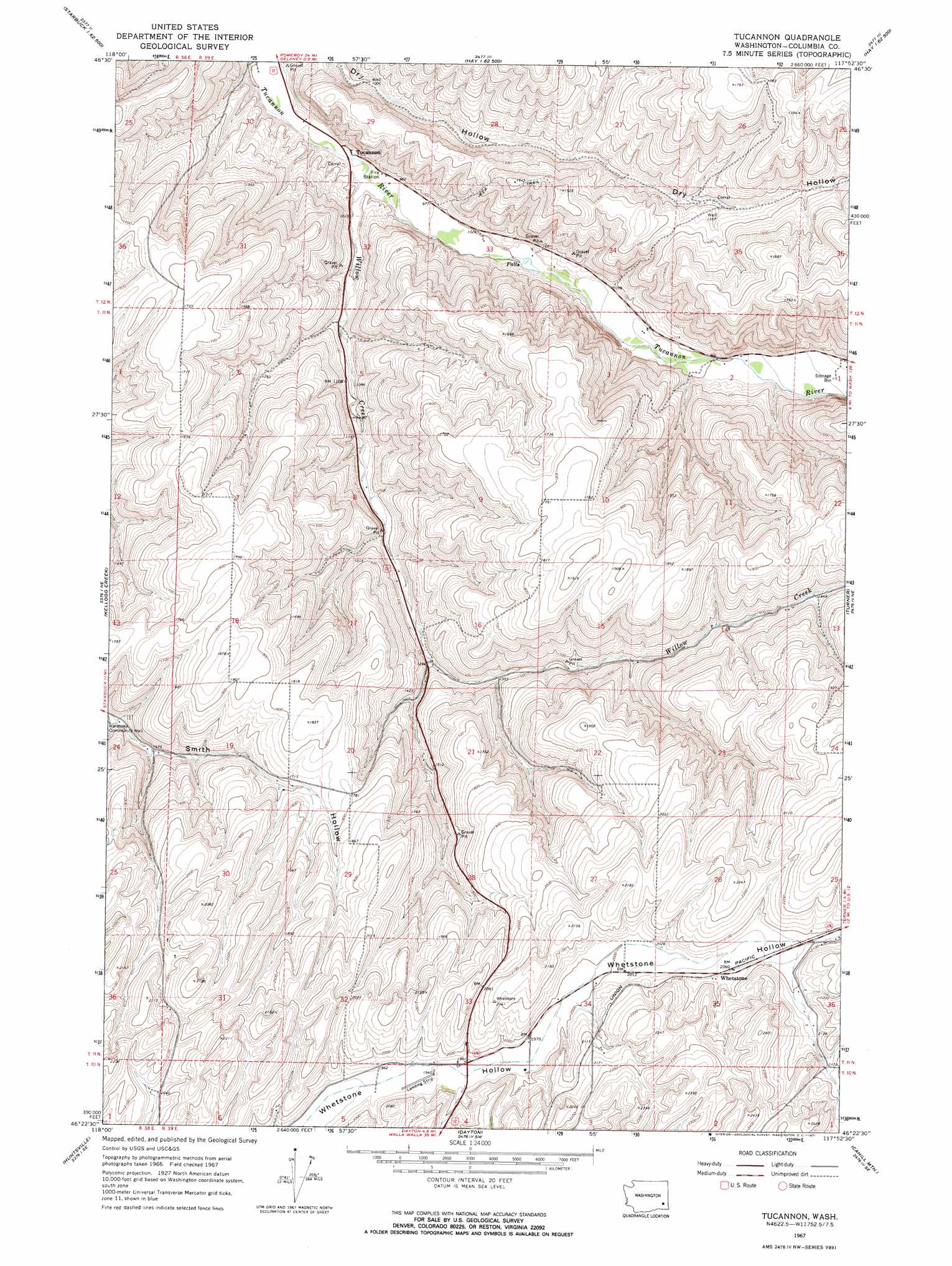
USGS Topo Quad 46117d8 - 1:24,000 scale
| Topo Map Name: | Tucannon |
| USGS Topo Quad ID: | 46117d8 |
| Print Size: | ca. 21 1/4" wide x 27" high |
| Southeast Coordinates: | 46.375° N latitude / 117.875° W longitude |
| Map Center Coordinates: | 46.4375° N latitude / 117.9375° W longitude |
| U.S. State: | WA |
| Filename: | o46117d8.jpg |
| Download Map JPG Image: | Tucannon topo map 1:24,000 scale |
| Map Type: | Topographic |
| Topo Series: | 7.5´ |
| Map Scale: | 1:24,000 |
| Source of Map Images: | United States Geological Survey (USGS) |
| Alternate Map Versions: |
Tucannon WA 1967, updated 1971 Download PDF Buy paper map Tucannon WA 2011 Download PDF Buy paper map Tucannon WA 2013 Download PDF Buy paper map |
1:24,000 Topo Quads surrounding Tucannon
Palouse Falls |
Hooper Lake |
Hay |
Central Ferry |
Ping |
Starbuck West |
Starbuck East |
Delaney |
Dodge |
Falling Springs |
Waitsburg Nw |
Kellogg Creek |
Tucannon |
Turner |
Zumwalt |
Waitsburg |
Huntsville |
Dayton |
Cahill Mountain |
Hopkins Ridge |
Dixie |
Coppei |
Robinette Mountain |
Eckler Mountain |
Panjab Creek |
> Back to 46117a1 at 1:100,000 scale
> Back to 46116a1 at 1:250,000 scale
> Back to U.S. Topo Maps home
Tucannon topo map: Gazetteer
Tucannon: Airports
Dayton Airport elevation 594m 1948′Tucannon: Populated Places
Tucannon elevation 284m 931′Whetstone elevation 628m 2060′
Tucannon: Streams
Willow Creek elevation 287m 941′Tucannon digital topo map on disk
Buy this Tucannon topo map showing relief, roads, GPS coordinates and other geographical features, as a high-resolution digital map file on DVD: