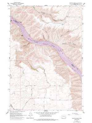
Granite Point Topo Map Washington
To zoom in, hover over the map of Granite Point
USGS Topo Quad 46117e3 - 1:24,000 scale
| Topo Map Name: | Granite Point |
| USGS Topo Quad ID: | 46117e3 |
| Print Size: | ca. 21 1/4" wide x 27" high |
| Southeast Coordinates: | 46.5° N latitude / 117.25° W longitude |
| Map Center Coordinates: | 46.5625° N latitude / 117.3125° W longitude |
| U.S. State: | WA |
| Filename: | o46117e3.jpg |
| Download Map JPG Image: | Granite Point topo map 1:24,000 scale |
| Map Type: | Topographic |
| Topo Series: | 7.5´ |
| Map Scale: | 1:24,000 |
| Source of Map Images: | United States Geological Survey (USGS) |
| Alternate Map Versions: |
Bishop WA 1964, updated 1965 Download PDF Buy paper map Granite Point WA 1964, updated 1977 Download PDF Buy paper map Granite Point WA 2011 Download PDF Buy paper map Granite Point WA 2013 Download PDF Buy paper map |
1:24,000 Topo Quads surrounding Granite Point
> Back to 46117e1 at 1:100,000 scale
> Back to 46116a1 at 1:250,000 scale
> Back to U.S. Topo Maps home
Granite Point topo map: Gazetteer
Granite Point: Arches
Devils Eye elevation 412m 1351′Granite Point: Bars
Bishop Bar elevation 226m 741′Kelly Bar elevation 226m 741′
Granite Point: Bays
Knoxway Bay elevation 226m 741′Granite Point: Cliffs
Granite Point elevation 229m 751′Granite Point: Plains
Rim Rock Plateau elevation 726m 2381′Granite Point: Streams
Pewawai Creek elevation 228m 748′Granite Point: Summits
Castle Rock elevation 500m 1640′Granite Point: Valleys
Keith Canyon elevation 234m 767′Kluge Canyon elevation 226m 741′
Knoxway Canyon elevation 246m 807′
Suicide Canyon elevation 229m 751′
Truax Canyon elevation 226m 741′
Water Canyon elevation 229m 751′
Woodruff Canyon elevation 471m 1545′
Yakawawa Canyon elevation 226m 741′
Granite Point digital topo map on disk
Buy this Granite Point topo map showing relief, roads, GPS coordinates and other geographical features, as a high-resolution digital map file on DVD:


