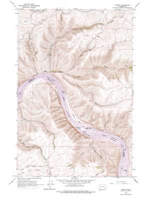
Almota Topo Map Washington
To zoom in, hover over the map of Almota
USGS Topo Quad 46117f4 - 1:24,000 scale
| Topo Map Name: | Almota |
| USGS Topo Quad ID: | 46117f4 |
| Print Size: | ca. 21 1/4" wide x 27" high |
| Southeast Coordinates: | 46.625° N latitude / 117.375° W longitude |
| Map Center Coordinates: | 46.6875° N latitude / 117.4375° W longitude |
| U.S. State: | WA |
| Filename: | o46117f4.jpg |
| Download Map JPG Image: | Almota topo map 1:24,000 scale |
| Map Type: | Topographic |
| Topo Series: | 7.5´ |
| Map Scale: | 1:24,000 |
| Source of Map Images: | United States Geological Survey (USGS) |
| Alternate Map Versions: |
Almota WA 1964, updated 1965 Download PDF Buy paper map Almota WA 1964, updated 1977 Download PDF Buy paper map Almota WA 2011 Download PDF Buy paper map Almota WA 2013 Download PDF Buy paper map |
1:24,000 Topo Quads surrounding Almota
> Back to 46117e1 at 1:100,000 scale
> Back to 46116a1 at 1:250,000 scale
> Back to U.S. Topo Maps home
Almota topo map: Gazetteer
Almota: Airports
Lower Granite Dam Heliport elevation 196m 643′Lower Granite State Airport elevation 209m 685′
Whitman Community Hospital Heliport elevation 209m 685′
Almota: Bars
Davis Bar elevation 231m 757′Almota: Bays
Wawawai Bay elevation 226m 741′Almota: Cliffs
Devils Slide elevation 624m 2047′Almota: Dams
Lower Granite Lake Dam elevation 227m 744′Almota: Islands
Log Cabin Island elevation 196m 643′Almota: Populated Places
Almota elevation 201m 659′Mayview elevation 671m 2201′
Wawawai (historical) elevation 226m 741′
Almota: Reservoirs
Lower Granite Lake elevation 227m 744′Almota: Slopes
Hungate Grade elevation 394m 1292′Moys Grade elevation 430m 1410′
Almota: Streams
Almota Creek elevation 199m 652′Little Almota Creek elevation 196m 643′
Thorn Thicket Creek elevation 228m 748′
Almota: Valleys
Buck Canyon elevation 226m 741′MacMurry Canyon elevation 232m 761′
Offield Canyon elevation 226m 741′
Stine Gulch elevation 196m 643′
Almota digital topo map on disk
Buy this Almota topo map showing relief, roads, GPS coordinates and other geographical features, as a high-resolution digital map file on DVD:


