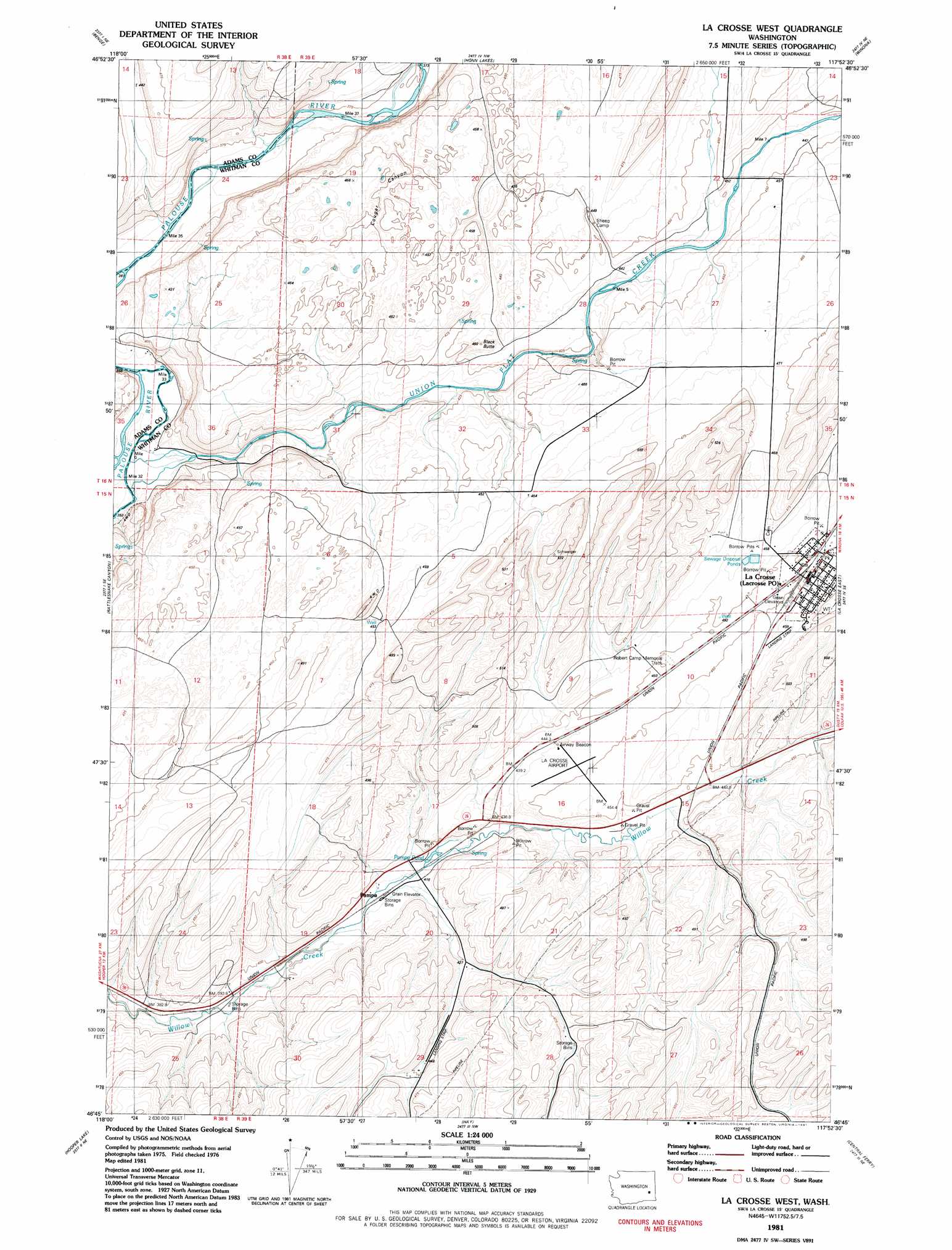
La Crosse West Topo Map Washington
To zoom in, hover over the map of La Crosse West
USGS Topo Quad 46117g8 - 1:24,000 scale
| Topo Map Name: | La Crosse West |
| USGS Topo Quad ID: | 46117g8 |
| Print Size: | ca. 21 1/4" wide x 27" high |
| Southeast Coordinates: | 46.75° N latitude / 117.875° W longitude |
| Map Center Coordinates: | 46.8125° N latitude / 117.9375° W longitude |
| U.S. State: | WA |
| Filename: | o46117g8.jpg |
| Download Map JPG Image: | La Crosse West topo map 1:24,000 scale |
| Map Type: | Topographic |
| Topo Series: | 7.5´ |
| Map Scale: | 1:24,000 |
| Source of Map Images: | United States Geological Survey (USGS) |
| Alternate Map Versions: |
La Crosse West WA 1981, updated 1981 Download PDF Buy paper map La Crosse West WA 2011 Download PDF Buy paper map La Crosse West WA 2014 Download PDF Buy paper map |
1:24,000 Topo Quads surrounding La Crosse West
Marengo |
Macall |
Revere |
Texas Lake |
Ewan |
Coyote Butte |
Benge |
Honn Lakes |
Winona |
Endicott |
Hooper |
Rattlesnake Canyon |
La Crosse West |
La Crosse East |
Dusty |
Palouse Falls |
Hooper Lake |
Hay |
Central Ferry |
Ping |
Starbuck West |
Starbuck East |
Delaney |
Dodge |
Falling Springs |
> Back to 46117e1 at 1:100,000 scale
> Back to 46116a1 at 1:250,000 scale
> Back to U.S. Topo Maps home
La Crosse West topo map: Gazetteer
La Crosse West: Airports
La Crosse Airport elevation 450m 1476′La Crosse West: Channels
Cougar Canyon elevation 446m 1463′La Crosse West: Lakes
Pampa Pond elevation 419m 1374′La Crosse West: Parks
Robert Camp Memorial Track elevation 451m 1479′La Crosse West: Populated Places
La Crosse elevation 451m 1479′Pampa elevation 415m 1361′
La Crosse West: Springs
Lehrbas Spring elevation 440m 1443′La Crosse West: Streams
Union Flat Creek elevation 356m 1167′La Crosse West: Summits
Black Butte elevation 450m 1476′La Crosse West digital topo map on disk
Buy this La Crosse West topo map showing relief, roads, GPS coordinates and other geographical features, as a high-resolution digital map file on DVD: