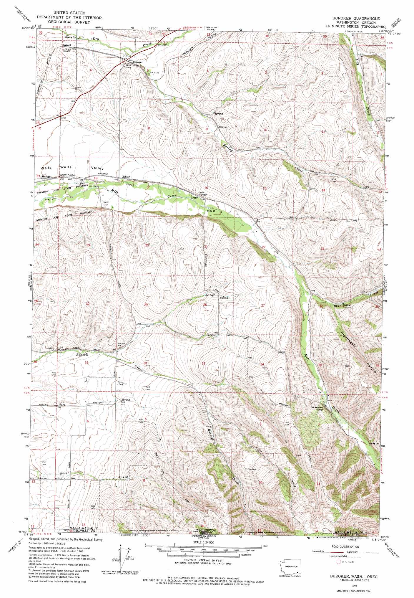
Buroker Topo Map Washington
To zoom in, hover over the map of Buroker
USGS Topo Quad 46118a2 - 1:24,000 scale
| Topo Map Name: | Buroker |
| USGS Topo Quad ID: | 46118a2 |
| Print Size: | ca. 21 1/4" wide x 27" high |
| Southeast Coordinates: | 46° N latitude / 118.125° W longitude |
| Map Center Coordinates: | 46.0625° N latitude / 118.1875° W longitude |
| U.S. States: | WA, OR |
| Filename: | o46118a2.jpg |
| Download Map JPG Image: | Buroker topo map 1:24,000 scale |
| Map Type: | Topographic |
| Topo Series: | 7.5´ |
| Map Scale: | 1:24,000 |
| Source of Map Images: | United States Geological Survey (USGS) |
| Alternate Map Versions: |
Buroker WA 1966, updated 1967 Download PDF Buy paper map Buroker WA 1966, updated 1983 Download PDF Buy paper map Buroker WA 2011 Download PDF Buy paper map Buroker WA 2014 Download PDF Buy paper map |
1:24,000 Topo Quads surrounding Buroker
Harsha |
Prescott |
Waitsburg |
Huntsville |
Dayton |
Hadley |
Valley Grove |
Dixie |
Coppei |
Robinette Mountain |
College Place |
Walla Walla |
Buroker |
Kooskooskie |
Deadman Peak |
Milton-Freewater |
Bowlus Hill |
Peterson Ridge |
Big Meadows |
Bone Spring |
Athena |
Weston Mountain |
Blalock Mountain |
Tollgate |
Jubilee Lake |
> Back to 46118a1 at 1:100,000 scale
> Back to 46118a1 at 1:250,000 scale
> Back to U.S. Topo Maps home
Buroker topo map: Gazetteer
Buroker: Airports
Darcys Air Strip elevation 438m 1437′Buroker: Bridges
Wickersham Bridge elevation 559m 1833′Buroker: Populated Places
Buroker elevation 396m 1299′Harbert elevation 397m 1302′
Kibler elevation 430m 1410′
Sapolil elevation 387m 1269′
Thomas elevation 553m 1814′
Tracy elevation 460m 1509′
Buroker: Streams
Blue Creek elevation 503m 1650′Spring Creek elevation 385m 1263′
Buroker: Valleys
Nightingale Canyon elevation 545m 1788′Buroker digital topo map on disk
Buy this Buroker topo map showing relief, roads, GPS coordinates and other geographical features, as a high-resolution digital map file on DVD: