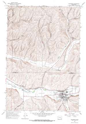
Waitsburg Topo Map Washington
To zoom in, hover over the map of Waitsburg
USGS Topo Quad 46118c2 - 1:24,000 scale
| Topo Map Name: | Waitsburg |
| USGS Topo Quad ID: | 46118c2 |
| Print Size: | ca. 21 1/4" wide x 27" high |
| Southeast Coordinates: | 46.25° N latitude / 118.125° W longitude |
| Map Center Coordinates: | 46.3125° N latitude / 118.1875° W longitude |
| U.S. State: | WA |
| Filename: | o46118c2.jpg |
| Download Map JPG Image: | Waitsburg topo map 1:24,000 scale |
| Map Type: | Topographic |
| Topo Series: | 7.5´ |
| Map Scale: | 1:24,000 |
| Source of Map Images: | United States Geological Survey (USGS) |
| Alternate Map Versions: |
Waitsburg WA 1967, updated 1971 Download PDF Buy paper map Waitsburg WA 2011 Download PDF Buy paper map Waitsburg WA 2014 Download PDF Buy paper map |
1:24,000 Topo Quads surrounding Waitsburg
> Back to 46118a1 at 1:100,000 scale
> Back to 46118a1 at 1:250,000 scale
> Back to U.S. Topo Maps home
Waitsburg topo map: Gazetteer
Waitsburg: Airports
Weller Canyon Airport elevation 398m 1305′Waitsburg: Parks
Preston Park elevation 384m 1259′Waitsburg: Populated Places
Bolles elevation 354m 1161′McKay elevation 473m 1551′
Menoken elevation 397m 1302′
Waitsburg elevation 385m 1263′
Waitsburg: Springs
Fountain Springs elevation 505m 1656′Waitsburg: Streams
Coppei Creek elevation 372m 1220′Wilson Creek elevation 385m 1263′
Waitsburg: Valleys
McKay Hollow elevation 385m 1263′Weller Canyon elevation 392m 1286′
Whoopemup Hollow elevation 399m 1309′
Waitsburg digital topo map on disk
Buy this Waitsburg topo map showing relief, roads, GPS coordinates and other geographical features, as a high-resolution digital map file on DVD:


