Pleasant View Topo Map Washington
To zoom in, hover over the map of Pleasant View
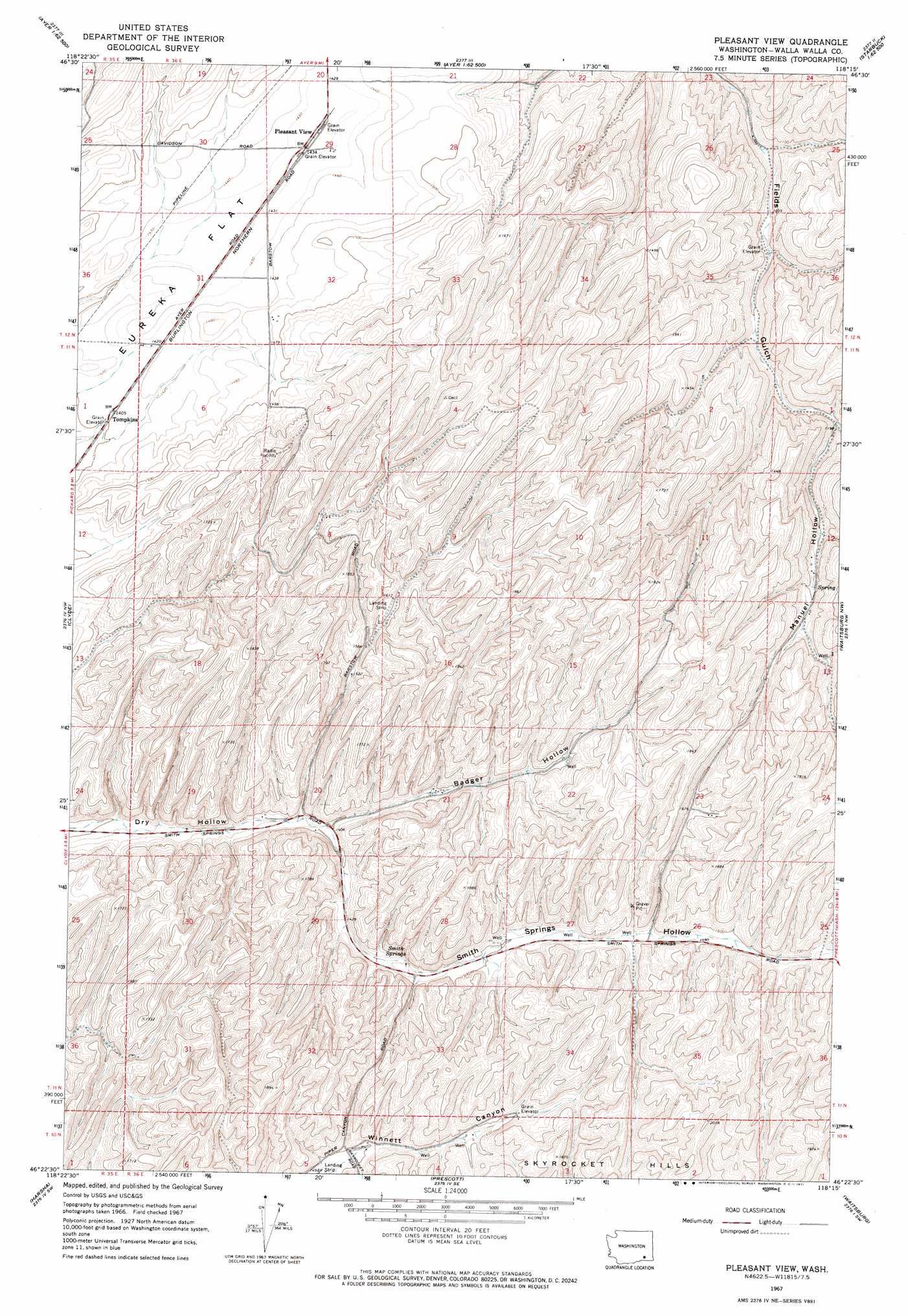
USGS Topo Quad 46118d3 - 1:24,000 scale
| Topo Map Name: | Pleasant View |
| USGS Topo Quad ID: | 46118d3 |
| Print Size: | ca. 21 1/4" wide x 27" high |
| Southeast Coordinates: | 46.375° N latitude / 118.25° W longitude |
| Map Center Coordinates: | 46.4375° N latitude / 118.3125° W longitude |
| U.S. State: | WA |
| Filename: | o46118d3.jpg |
| Download Map JPG Image: | Pleasant View topo map 1:24,000 scale |
| Map Type: | Topographic |
| Topo Series: | 7.5´ |
| Map Scale: | 1:24,000 |
| Source of Map Images: | United States Geological Survey (USGS) |
| Alternate Map Versions: |
Pleasant View WA 1967, updated 1971 Download PDF Buy paper map Pleasant View WA 2011 Download PDF Buy paper map Pleasant View WA 2014 Download PDF Buy paper map |
1:24,000 Topo Quads surrounding Pleasant View
Kahlotus |
Sperry |
Washtucna South |
Palouse Falls |
Hooper Lake |
Lower Monumental Dam |
Monumental Rock |
Ayer |
Starbuck West |
Starbuck East |
Elwood |
Clyde |
Pleasant View |
Waitsburg Nw |
Kellogg Creek |
Eureka |
Harsha |
Prescott |
Waitsburg |
Huntsville |
Rulo |
Hadley |
Valley Grove |
Dixie |
Coppei |
> Back to 46118a1 at 1:100,000 scale
> Back to 46118a1 at 1:250,000 scale
> Back to U.S. Topo Maps home
Pleasant View topo map: Gazetteer
Pleasant View: Populated Places
Tompkins elevation 430m 1410′Pleasant View: Springs
Smith Springs elevation 446m 1463′Pleasant View: Valleys
Badger Hollow elevation 428m 1404′Manuel Hollow elevation 365m 1197′
Smith Springs Hollow elevation 428m 1404′
Pleasant View digital topo map on disk
Buy this Pleasant View topo map showing relief, roads, GPS coordinates and other geographical features, as a high-resolution digital map file on DVD: