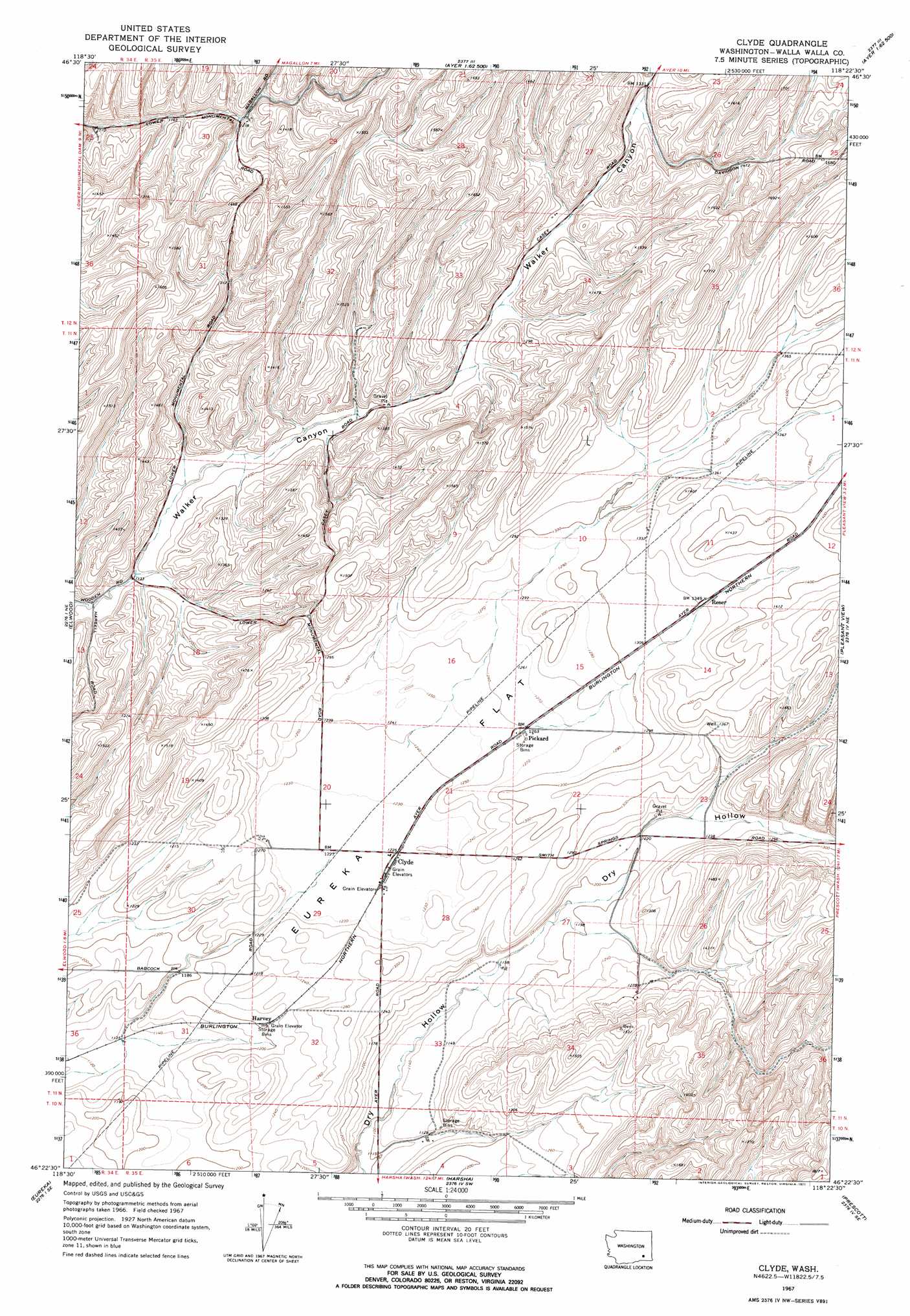
Clyde Topo Map Washington
To zoom in, hover over the map of Clyde
USGS Topo Quad 46118d4 - 1:24,000 scale
| Topo Map Name: | Clyde |
| USGS Topo Quad ID: | 46118d4 |
| Print Size: | ca. 21 1/4" wide x 27" high |
| Southeast Coordinates: | 46.375° N latitude / 118.375° W longitude |
| Map Center Coordinates: | 46.4375° N latitude / 118.4375° W longitude |
| U.S. State: | WA |
| Filename: | o46118d4.jpg |
| Download Map JPG Image: | Clyde topo map 1:24,000 scale |
| Map Type: | Topographic |
| Topo Series: | 7.5´ |
| Map Scale: | 1:24,000 |
| Source of Map Images: | United States Geological Survey (USGS) |
| Alternate Map Versions: |
Clyde WA 1967, updated 1971 Download PDF Buy paper map Clyde WA 1967, updated 1971 Download PDF Buy paper map Clyde WA 2011 Download PDF Buy paper map Clyde WA 2013 Download PDF Buy paper map |
1:24,000 Topo Quads surrounding Clyde
Sulphur Lake |
Kahlotus |
Sperry |
Washtucna South |
Palouse Falls |
Burr Canyon |
Lower Monumental Dam |
Monumental Rock |
Ayer |
Starbuck West |
Snake River |
Elwood |
Clyde |
Pleasant View |
Waitsburg Nw |
Page |
Eureka |
Harsha |
Prescott |
Waitsburg |
Welland |
Rulo |
Hadley |
Valley Grove |
Dixie |
> Back to 46118a1 at 1:100,000 scale
> Back to 46118a1 at 1:250,000 scale
> Back to U.S. Topo Maps home
Clyde digital topo map on disk
Buy this Clyde topo map showing relief, roads, GPS coordinates and other geographical features, as a high-resolution digital map file on DVD: