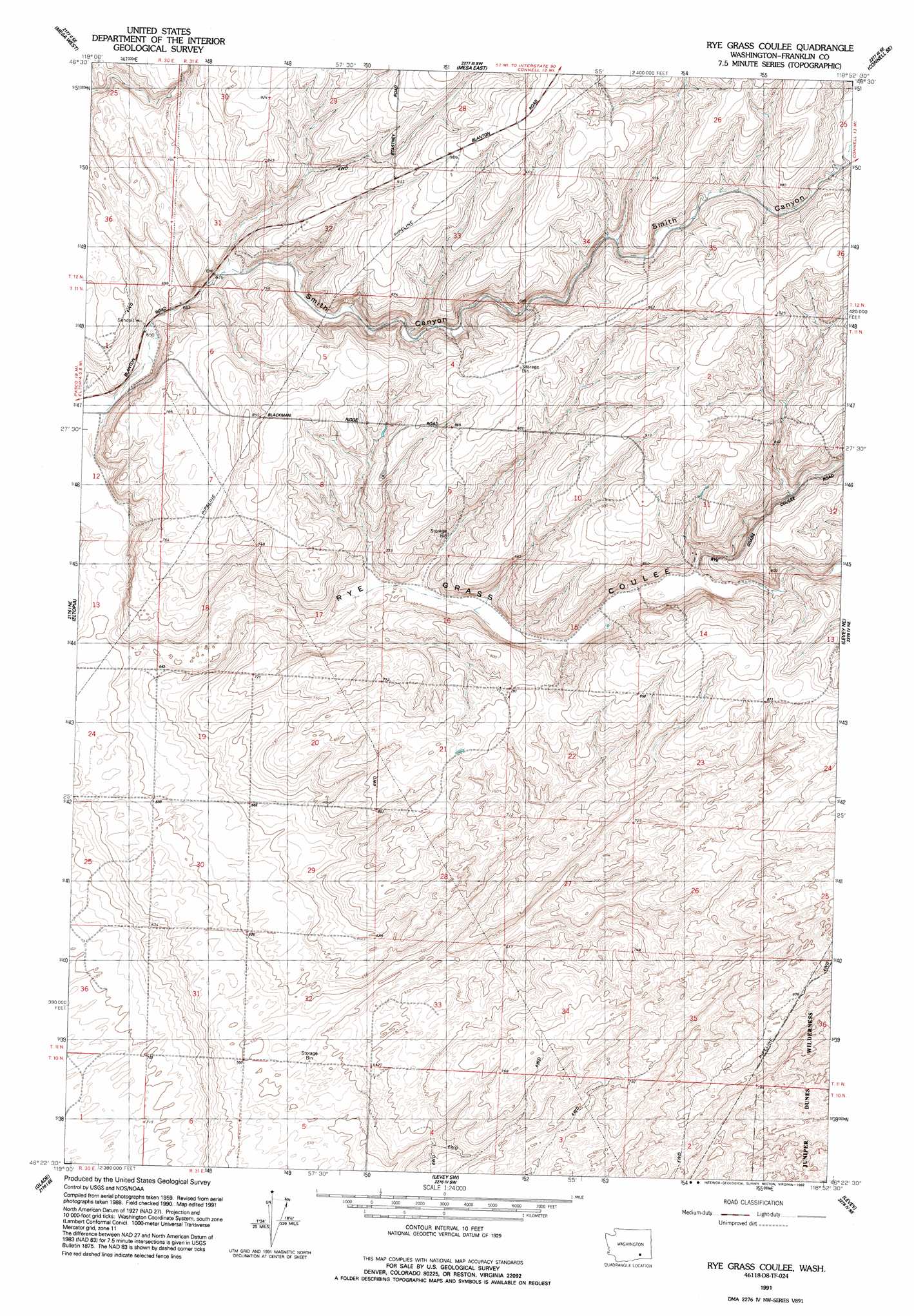
Rye Grass Coulee Topo Map Washington
To zoom in, hover over the map of Rye Grass Coulee
USGS Topo Quad 46118d8 - 1:24,000 scale
| Topo Map Name: | Rye Grass Coulee |
| USGS Topo Quad ID: | 46118d8 |
| Print Size: | ca. 21 1/4" wide x 27" high |
| Southeast Coordinates: | 46.375° N latitude / 118.875° W longitude |
| Map Center Coordinates: | 46.4375° N latitude / 118.9375° W longitude |
| U.S. State: | WA |
| Filename: | o46118d8.jpg |
| Download Map JPG Image: | Rye Grass Coulee topo map 1:24,000 scale |
| Map Type: | Topographic |
| Topo Series: | 7.5´ |
| Map Scale: | 1:24,000 |
| Source of Map Images: | United States Geological Survey (USGS) |
| Alternate Map Versions: |
Rye Grass Coulee WA 1963, updated 1965 Download PDF Buy paper map Rye Grass Coulee WA 1991, updated 1992 Download PDF Buy paper map Rye Grass Coulee WA 2011 Download PDF Buy paper map Rye Grass Coulee WA 2013 Download PDF Buy paper map |
1:24,000 Topo Quads surrounding Rye Grass Coulee
Eagle Lakes |
Scooteney Reservoir |
Frischknecht |
Connell |
Sulphur Lake |
Basin City |
Mesa West |
Mesa East |
Connell Se |
Burr Canyon |
Mathews Corner |
Eltopia |
Rye Grass Coulee |
Levey Ne |
Snake River |
Columbia Point |
Glade |
Levey Sw |
Levey Se |
Page |
Kennewick |
Pasco |
Humorist |
Slater |
Welland |
> Back to 46118a1 at 1:100,000 scale
> Back to 46118a1 at 1:250,000 scale
> Back to U.S. Topo Maps home
Rye Grass Coulee topo map: Gazetteer
Rye Grass Coulee: Airports
Columbia Ag 2 Airport elevation 216m 708′Rye Grass Coulee: Valleys
Rye Grass Coulee elevation 181m 593′Smith Canyon elevation 190m 623′
Rye Grass Coulee digital topo map on disk
Buy this Rye Grass Coulee topo map showing relief, roads, GPS coordinates and other geographical features, as a high-resolution digital map file on DVD: