Starbuck East Topo Map Washington
To zoom in, hover over the map of Starbuck East
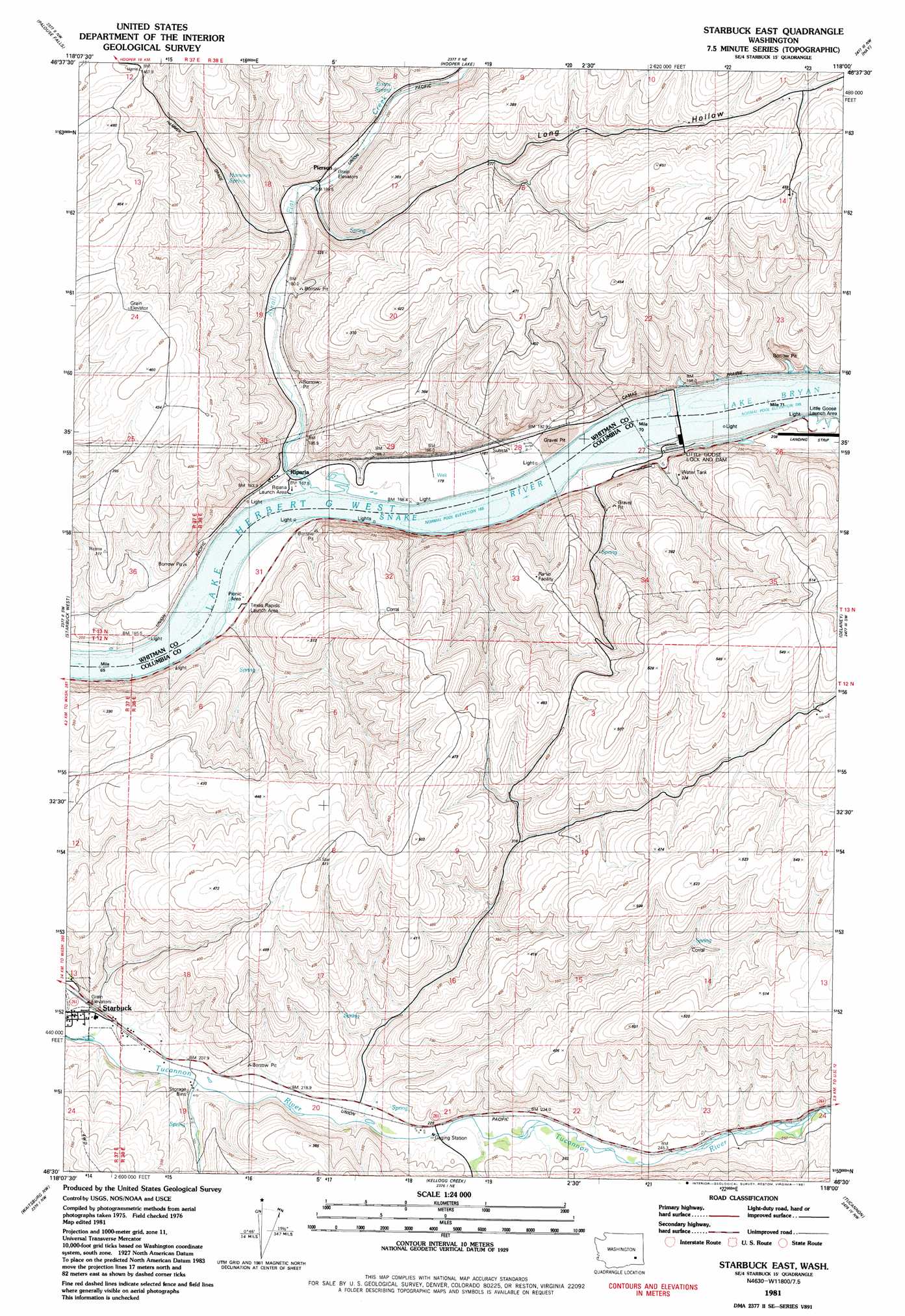
USGS Topo Quad 46118e1 - 1:24,000 scale
| Topo Map Name: | Starbuck East |
| USGS Topo Quad ID: | 46118e1 |
| Print Size: | ca. 21 1/4" wide x 27" high |
| Southeast Coordinates: | 46.5° N latitude / 118° W longitude |
| Map Center Coordinates: | 46.5625° N latitude / 118.0625° W longitude |
| U.S. State: | WA |
| Filename: | o46118e1.jpg |
| Download Map JPG Image: | Starbuck East topo map 1:24,000 scale |
| Map Type: | Topographic |
| Topo Series: | 7.5´ |
| Map Scale: | 1:24,000 |
| Source of Map Images: | United States Geological Survey (USGS) |
| Alternate Map Versions: |
Starbuck East WA 1981, updated 1981 Download PDF Buy paper map Starbuck East WA 2011 Download PDF Buy paper map Starbuck East WA 2013 Download PDF Buy paper map |
1:24,000 Topo Quads surrounding Starbuck East
Washtucna North |
Hooper |
Rattlesnake Canyon |
La Crosse West |
La Crosse East |
Washtucna South |
Palouse Falls |
Hooper Lake |
Hay |
Central Ferry |
Ayer |
Starbuck West |
Starbuck East |
Delaney |
Dodge |
Pleasant View |
Waitsburg Nw |
Kellogg Creek |
Tucannon |
Turner |
Prescott |
Waitsburg |
Huntsville |
Dayton |
Cahill Mountain |
> Back to 46118e1 at 1:100,000 scale
> Back to 46118a1 at 1:250,000 scale
> Back to U.S. Topo Maps home
Starbuck East topo map: Gazetteer
Starbuck East: Airports
Little Goose Dam Heliport elevation 165m 541′Little Goose Lock and Dam Airport elevation 201m 659′
Starbuck East: Bars
McGuire Shoal elevation 165m 541′Starbuck East: Dams
Little Goose Lock and Dam elevation 196m 643′Starbuck East: Populated Places
Riparia elevation 168m 551′Starbuck East: Reservoirs
Lake Bryan elevation 196m 643′Starbuck East: Springs
Evans Spring elevation 227m 744′Hammer Spring elevation 273m 895′
Starbuck East: Streams
Alkali Flat Creek elevation 165m 541′Starbuck East: Valleys
Long Hollow elevation 188m 616′Smith Hollow elevation 228m 748′
Starbuck East digital topo map on disk
Buy this Starbuck East topo map showing relief, roads, GPS coordinates and other geographical features, as a high-resolution digital map file on DVD: