Mesa East Topo Map Washington
To zoom in, hover over the map of Mesa East
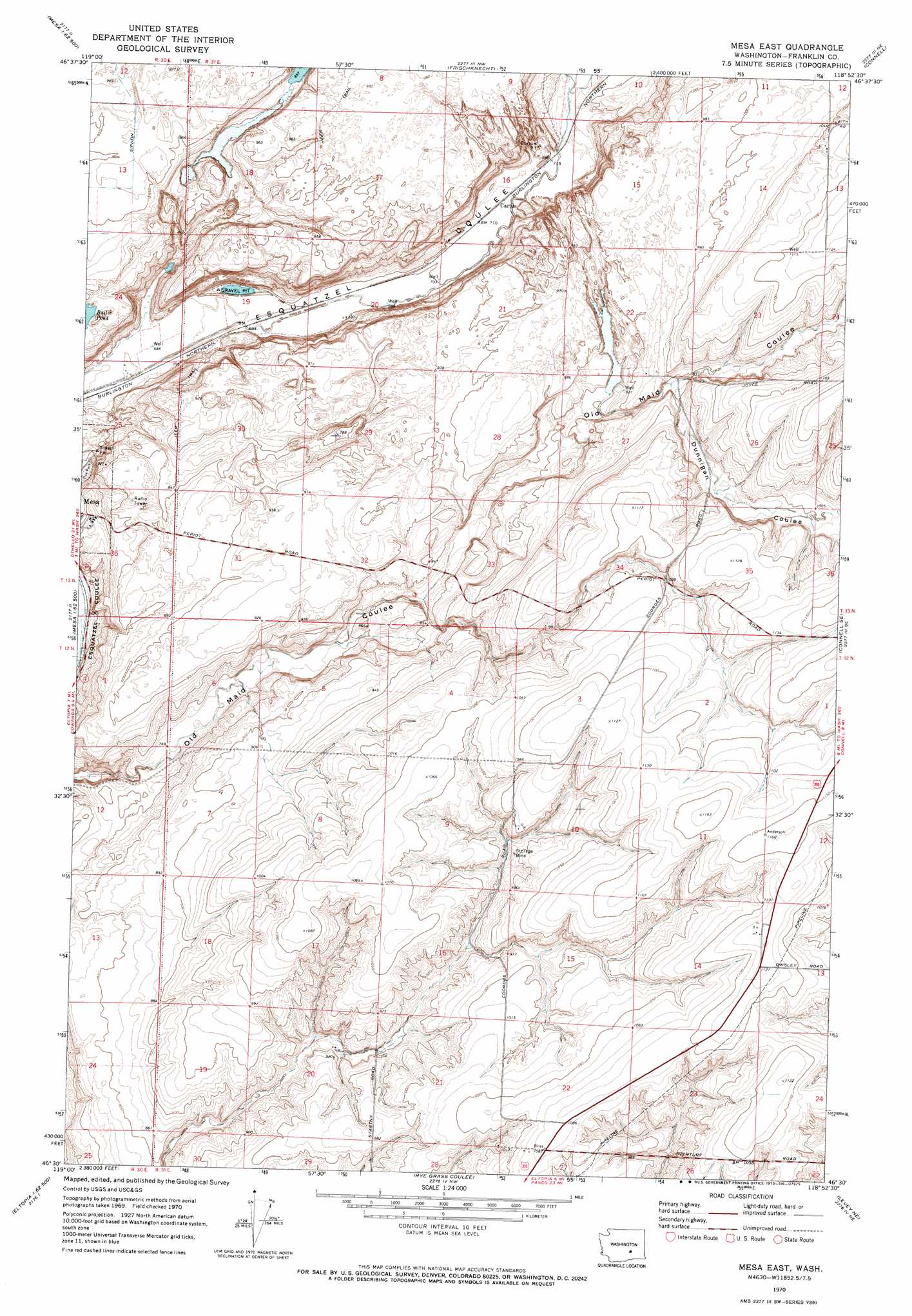
USGS Topo Quad 46118e8 - 1:24,000 scale
| Topo Map Name: | Mesa East |
| USGS Topo Quad ID: | 46118e8 |
| Print Size: | ca. 21 1/4" wide x 27" high |
| Southeast Coordinates: | 46.5° N latitude / 118.875° W longitude |
| Map Center Coordinates: | 46.5625° N latitude / 118.9375° W longitude |
| U.S. State: | WA |
| Filename: | o46118e8.jpg |
| Download Map JPG Image: | Mesa East topo map 1:24,000 scale |
| Map Type: | Topographic |
| Topo Series: | 7.5´ |
| Map Scale: | 1:24,000 |
| Source of Map Images: | United States Geological Survey (USGS) |
| Alternate Map Versions: |
Mesa East WA 1970, updated 1973 Download PDF Buy paper map Mesa East WA 2011 Download PDF Buy paper map Mesa East WA 2013 Download PDF Buy paper map |
1:24,000 Topo Quads surrounding Mesa East
Othello |
Bruce |
Shano |
Hatton |
Lind Sw |
Eagle Lakes |
Scooteney Reservoir |
Frischknecht |
Connell |
Sulphur Lake |
Basin City |
Mesa West |
Mesa East |
Connell Se |
Burr Canyon |
Mathews Corner |
Eltopia |
Rye Grass Coulee |
Levey Ne |
Snake River |
Columbia Point |
Glade |
Levey Sw |
Levey Se |
Page |
> Back to 46118e1 at 1:100,000 scale
> Back to 46118a1 at 1:250,000 scale
> Back to U.S. Topo Maps home
Mesa East topo map: Gazetteer
Mesa East: Populated Places
Cactus elevation 215m 705′Mesa East: Valleys
Dunnigan Coulee elevation 287m 941′Mesa East digital topo map on disk
Buy this Mesa East topo map showing relief, roads, GPS coordinates and other geographical features, as a high-resolution digital map file on DVD: