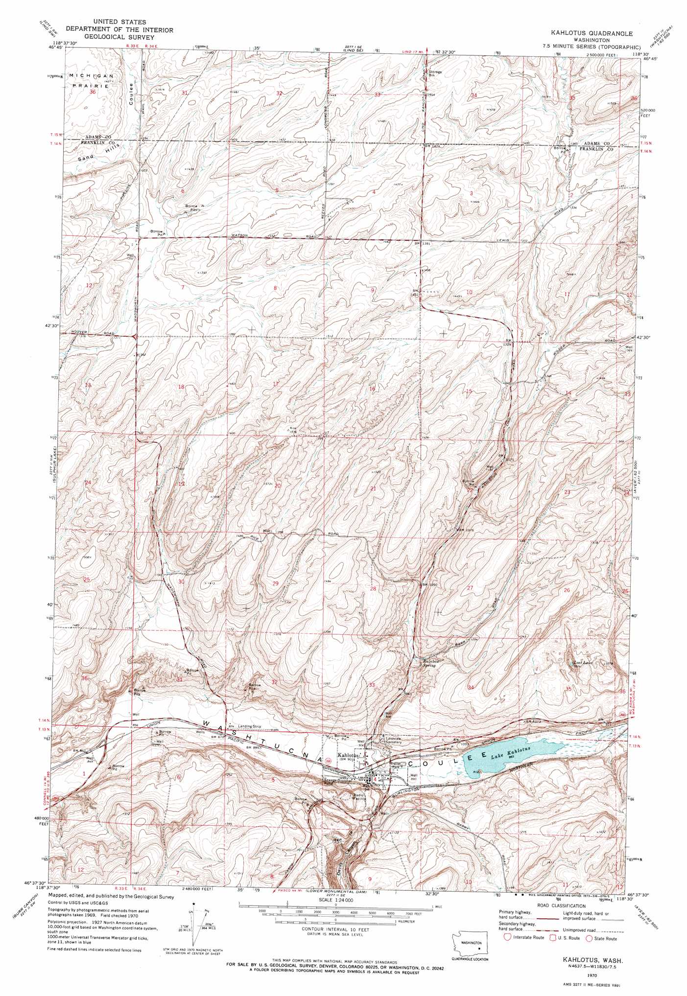
Kahlotus Topo Map Washington
To zoom in, hover over the map of Kahlotus
USGS Topo Quad 46118f5 - 1:24,000 scale
| Topo Map Name: | Kahlotus |
| USGS Topo Quad ID: | 46118f5 |
| Print Size: | ca. 21 1/4" wide x 27" high |
| Southeast Coordinates: | 46.625° N latitude / 118.5° W longitude |
| Map Center Coordinates: | 46.6875° N latitude / 118.5625° W longitude |
| U.S. State: | WA |
| Filename: | o46118f5.jpg |
| Download Map JPG Image: | Kahlotus topo map 1:24,000 scale |
| Map Type: | Topographic |
| Topo Series: | 7.5´ |
| Map Scale: | 1:24,000 |
| Source of Map Images: | United States Geological Survey (USGS) |
| Alternate Map Versions: |
Kahlotus WA 1970, updated 1973 Download PDF Buy paper map Kahlotus WA 2011 Download PDF Buy paper map Kahlotus WA 2014 Download PDF Buy paper map |
1:24,000 Topo Quads surrounding Kahlotus
Roxboro |
Providence |
Lind |
Pizarro |
Ralston |
Hatton |
Lind Sw |
Lind Se |
West Of Washtucna |
Washtucna North |
Connell |
Sulphur Lake |
Kahlotus |
Sperry |
Washtucna South |
Connell Se |
Burr Canyon |
Lower Monumental Dam |
Monumental Rock |
Ayer |
Levey Ne |
Snake River |
Elwood |
Clyde |
Pleasant View |
> Back to 46118e1 at 1:100,000 scale
> Back to 46118a1 at 1:250,000 scale
> Back to U.S. Topo Maps home
Kahlotus topo map: Gazetteer
Kahlotus: Airports
Peot Airport elevation 271m 889′Watson Airport elevation 424m 1391′
Kahlotus: Lakes
Lake Kahlotus elevation 266m 872′Lost Lake elevation 318m 1043′
Kahlotus: Populated Places
Kahlotus elevation 275m 902′Kahlotus: Springs
Rainbow Spring elevation 317m 1040′Kahlotus digital topo map on disk
Buy this Kahlotus topo map showing relief, roads, GPS coordinates and other geographical features, as a high-resolution digital map file on DVD: