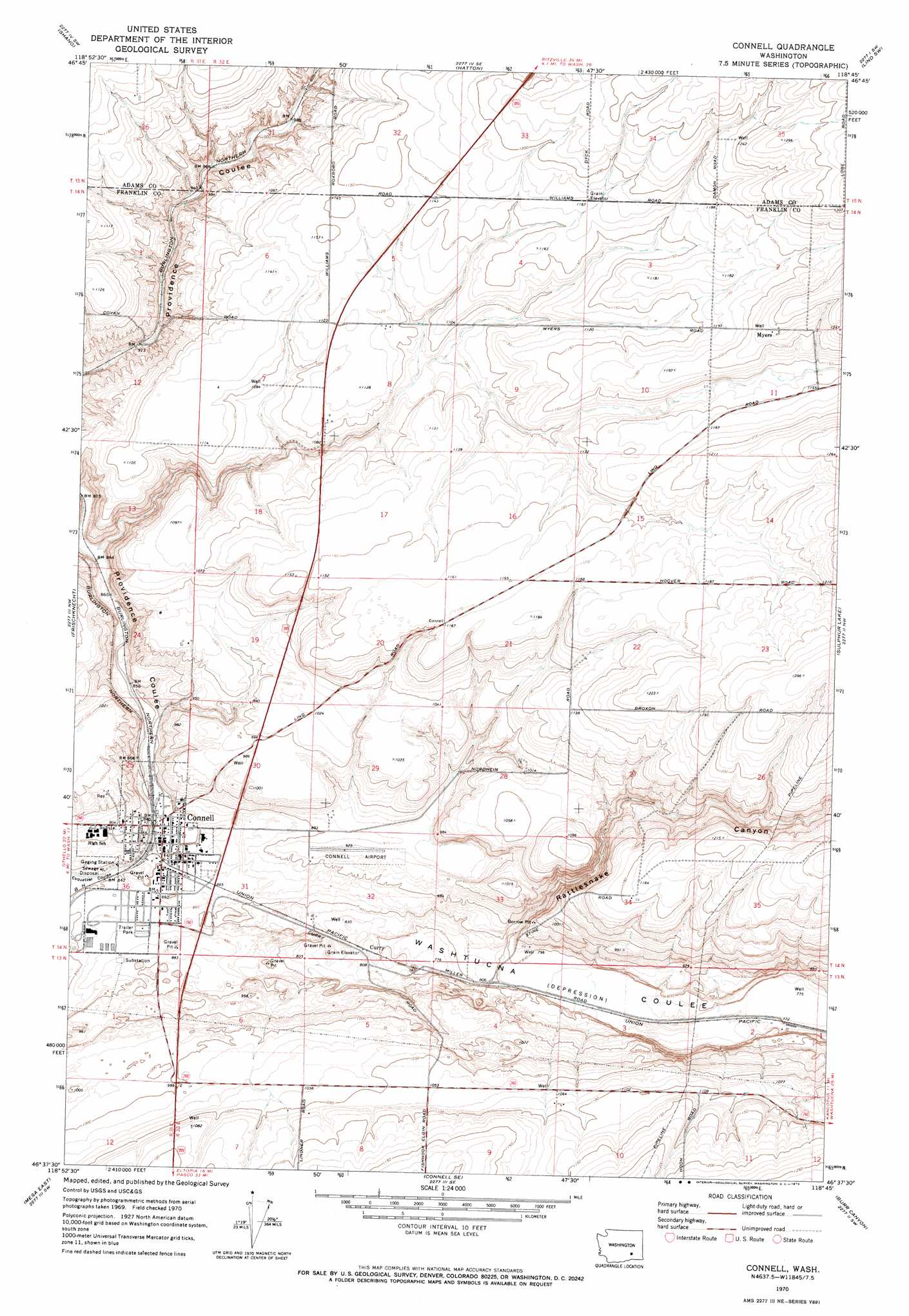
Connell Topo Map Washington
To zoom in, hover over the map of Connell
USGS Topo Quad 46118f7 - 1:24,000 scale
| Topo Map Name: | Connell |
| USGS Topo Quad ID: | 46118f7 |
| Print Size: | ca. 21 1/4" wide x 27" high |
| Southeast Coordinates: | 46.625° N latitude / 118.75° W longitude |
| Map Center Coordinates: | 46.6875° N latitude / 118.8125° W longitude |
| U.S. State: | WA |
| Filename: | o46118f7.jpg |
| Download Map JPG Image: | Connell topo map 1:24,000 scale |
| Map Type: | Topographic |
| Topo Series: | 7.5´ |
| Map Scale: | 1:24,000 |
| Source of Map Images: | United States Geological Survey (USGS) |
| Alternate Map Versions: |
Connell WA 1970, updated 1973 Download PDF Buy paper map Connell WA 2011 Download PDF Buy paper map Connell WA 2014 Download PDF Buy paper map |
1:24,000 Topo Quads surrounding Connell
Warden |
Hatton Nw |
Roxboro |
Providence |
Lind |
Bruce |
Shano |
Hatton |
Lind Sw |
Lind Se |
Scooteney Reservoir |
Frischknecht |
Connell |
Sulphur Lake |
Kahlotus |
Mesa West |
Mesa East |
Connell Se |
Burr Canyon |
Lower Monumental Dam |
Eltopia |
Rye Grass Coulee |
Levey Ne |
Snake River |
Elwood |
> Back to 46118e1 at 1:100,000 scale
> Back to 46118a1 at 1:250,000 scale
> Back to U.S. Topo Maps home
Connell topo map: Gazetteer
Connell: Airports
Connell City Airport elevation 278m 912′Connell: Parks
Pioneer Park elevation 265m 869′Striker Park elevation 263m 862′
Connell: Populated Places
Connell elevation 258m 846′Curry elevation 250m 820′
Myers elevation 379m 1243′
Connell: Valleys
Providence Coulee elevation 260m 853′Rattlesnake Canyon elevation 244m 800′
Connell digital topo map on disk
Buy this Connell topo map showing relief, roads, GPS coordinates and other geographical features, as a high-resolution digital map file on DVD: