Prosser Topo Map Washington
To zoom in, hover over the map of Prosser
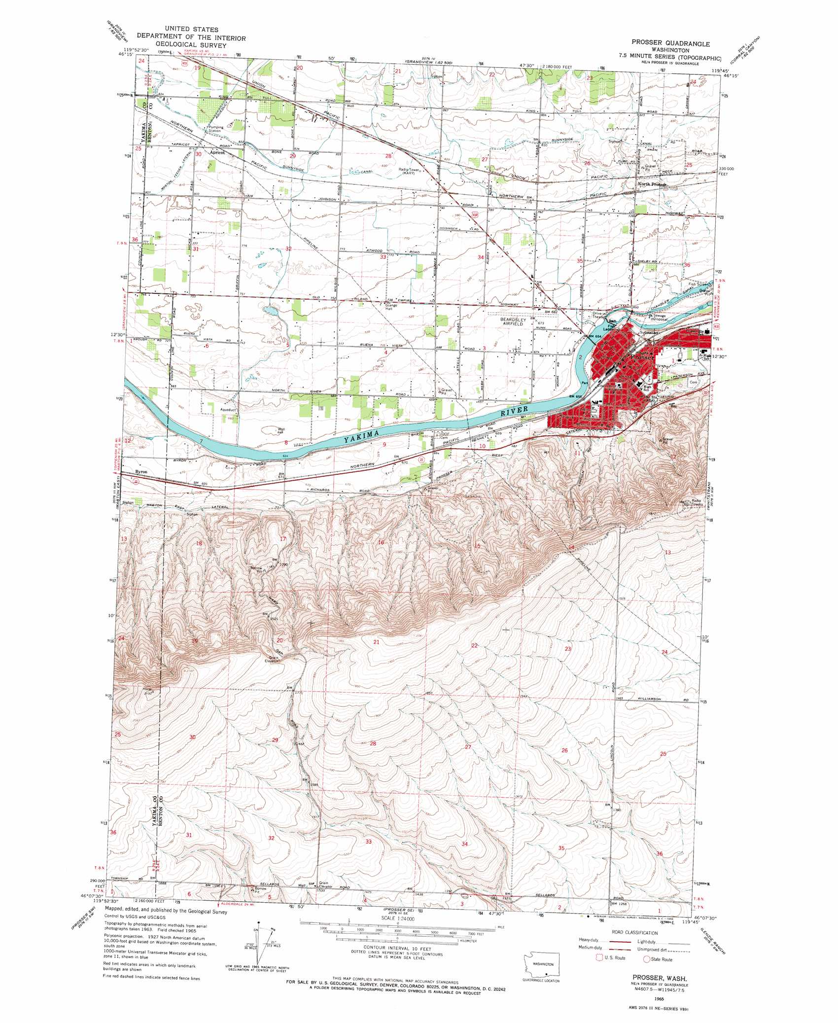
USGS Topo Quad 46119b7 - 1:24,000 scale
| Topo Map Name: | Prosser |
| USGS Topo Quad ID: | 46119b7 |
| Print Size: | ca. 21 1/4" wide x 27" high |
| Southeast Coordinates: | 46.125° N latitude / 119.75° W longitude |
| Map Center Coordinates: | 46.1875° N latitude / 119.8125° W longitude |
| U.S. State: | WA |
| Filename: | o46119b7.jpg |
| Download Map JPG Image: | Prosser topo map 1:24,000 scale |
| Map Type: | Topographic |
| Topo Series: | 7.5´ |
| Map Scale: | 1:24,000 |
| Source of Map Images: | United States Geological Survey (USGS) |
| Alternate Map Versions: |
Prosser WA 1965, updated 1966 Download PDF Buy paper map Prosser WA 1965, updated 1966 Download PDF Buy paper map Prosser WA 1965, updated 1987 Download PDF Buy paper map Prosser WA 2011 Download PDF Buy paper map Prosser WA 2013 Download PDF Buy paper map |
1:24,000 Topo Quads surrounding Prosser
Granger Ne |
Sulphur Spring |
Maiden Spring |
Snively Basin |
Iowa Flats |
Sunnyside |
Grandview |
Sagebrush Ridge |
Snipes Creek |
Corral Canyon |
Mabton West |
Mabton East |
Prosser |
Whitstran |
Whitstran Ne |
Tule Prong |
Prosser Sw |
Prosser Se |
Lenzie Ranch |
Whitstran Se |
Douty Canyon |
Phinny Hill |
Canoe Ridge |
Blalock Island |
Paterson |
> Back to 46119a1 at 1:100,000 scale
> Back to 46118a1 at 1:250,000 scale
> Back to U.S. Topo Maps home
Prosser topo map: Gazetteer
Prosser: Airports
Prosser Airport elevation 208m 682′Prosser Hospital Heliport elevation 217m 711′
Prosser: Canals
Mabton East Lateral elevation 230m 754′Mabton Feeder Lateral elevation 246m 807′
Prosser West Lateral elevation 218m 715′
Prosser West Lateral elevation 226m 741′
Prosser: Dams
Prosser Dam elevation 190m 623′Prosser: Parks
Farrand Park elevation 199m 652′Prosser: Populated Places
Apricot elevation 251m 823′Byron elevation 213m 698′
Kinneyville (historical) elevation 207m 679′
North Prosser elevation 230m 754′
Prosser elevation 203m 666′
Prosser: Ridges
Horse Heaven Hills elevation 523m 1715′Prosser digital topo map on disk
Buy this Prosser topo map showing relief, roads, GPS coordinates and other geographical features, as a high-resolution digital map file on DVD: