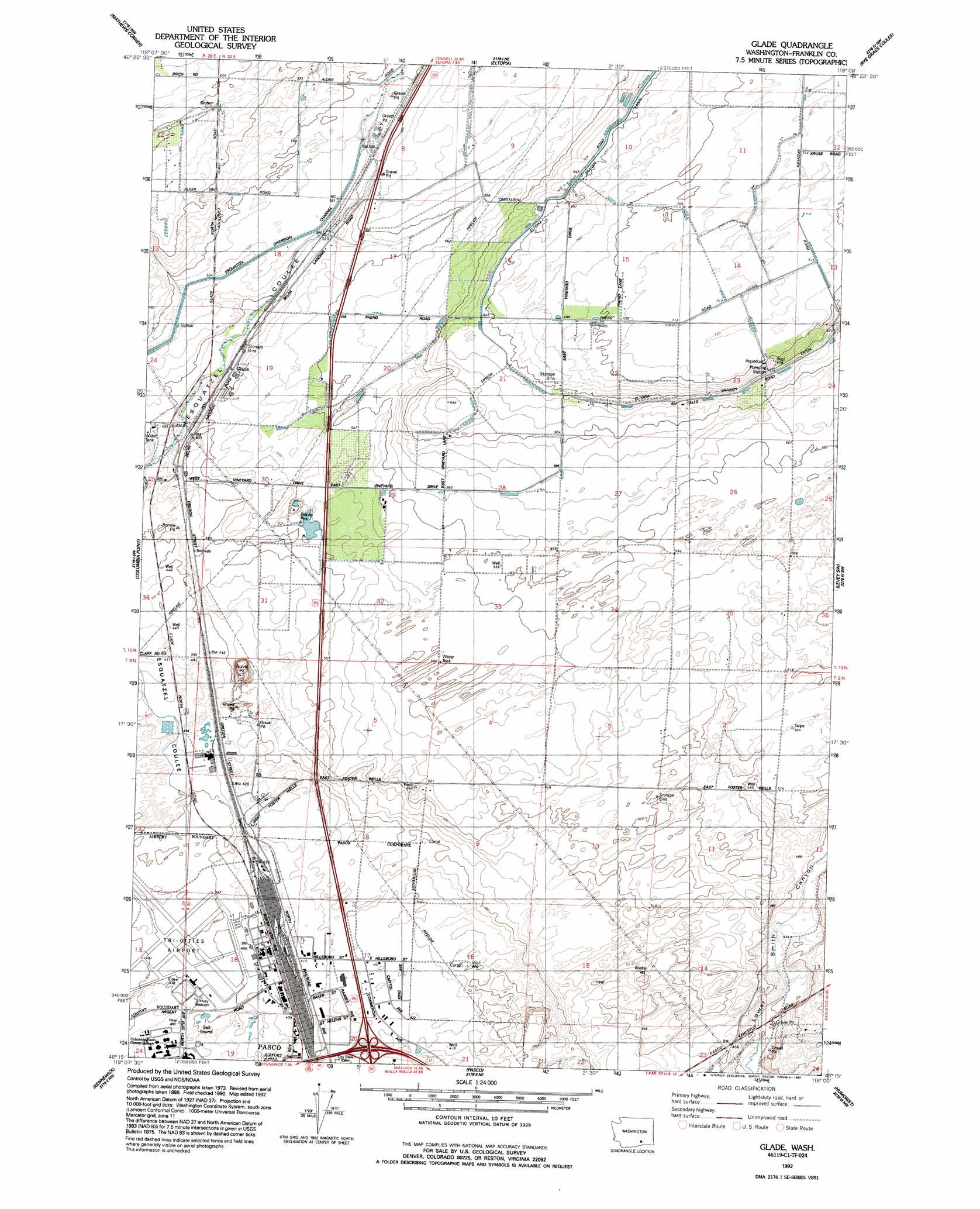
Glade Topo Map Washington
To zoom in, hover over the map of Glade
USGS Topo Quad 46119c1 - 1:24,000 scale
| Topo Map Name: | Glade |
| USGS Topo Quad ID: | 46119c1 |
| Print Size: | ca. 21 1/4" wide x 27" high |
| Southeast Coordinates: | 46.25° N latitude / 119° W longitude |
| Map Center Coordinates: | 46.3125° N latitude / 119.0625° W longitude |
| U.S. State: | WA |
| Filename: | o46119c1.jpg |
| Download Map JPG Image: | Glade topo map 1:24,000 scale |
| Map Type: | Topographic |
| Topo Series: | 7.5´ |
| Map Scale: | 1:24,000 |
| Source of Map Images: | United States Geological Survey (USGS) |
| Alternate Map Versions: |
Glade WA 1979, updated 1979 Download PDF Buy paper map Glade WA 1992, updated 1992 Download PDF Buy paper map Glade WA 2011 Download PDF Buy paper map Glade WA 2014 Download PDF Buy paper map |
1:24,000 Topo Quads surrounding Glade
Savage Island |
Basin City |
Mesa West |
Mesa East |
Connell Se |
Wooded Island |
Mathews Corner |
Eltopia |
Rye Grass Coulee |
Levey Ne |
Richland |
Columbia Point |
Glade |
Levey Sw |
Levey Se |
Badger Mountain |
Kennewick |
Pasco |
Humorist |
Slater |
Taylor Canyon |
Johnson Butte |
Nine Canyon |
Wallula |
Zangar Junction |
> Back to 46119a1 at 1:100,000 scale
> Back to 46118a1 at 1:250,000 scale
> Back to U.S. Topo Maps home
Glade topo map: Gazetteer
Glade: Airports
Tri-Cities Airport elevation 121m 396′Glade: Populated Places
Glade elevation 151m 495′Glade: Valleys
Esquatzel Coulee elevation 122m 400′Glade digital topo map on disk
Buy this Glade topo map showing relief, roads, GPS coordinates and other geographical features, as a high-resolution digital map file on DVD: