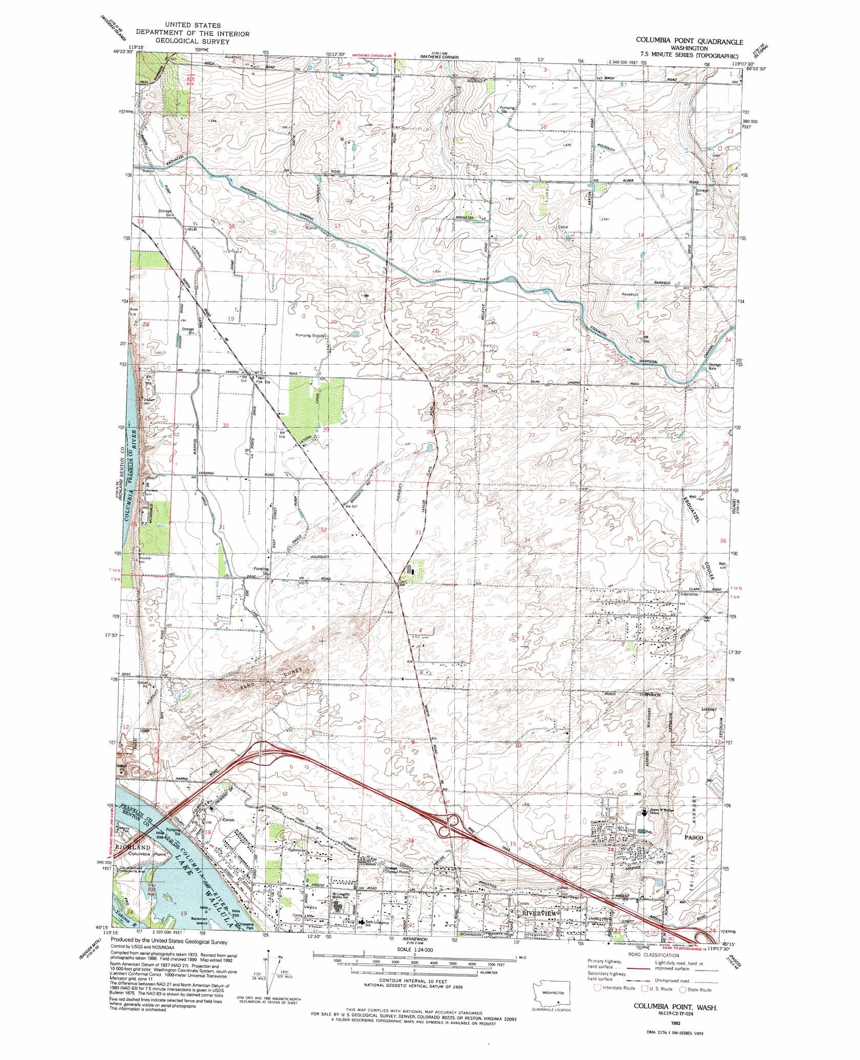
Columbia Point Topo Map Washington
To zoom in, hover over the map of Columbia Point
USGS Topo Quad 46119c2 - 1:24,000 scale
| Topo Map Name: | Columbia Point |
| USGS Topo Quad ID: | 46119c2 |
| Print Size: | ca. 21 1/4" wide x 27" high |
| Southeast Coordinates: | 46.25° N latitude / 119.125° W longitude |
| Map Center Coordinates: | 46.3125° N latitude / 119.1875° W longitude |
| U.S. State: | WA |
| Filename: | o46119c2.jpg |
| Download Map JPG Image: | Columbia Point topo map 1:24,000 scale |
| Map Type: | Topographic |
| Topo Series: | 7.5´ |
| Map Scale: | 1:24,000 |
| Source of Map Images: | United States Geological Survey (USGS) |
| Alternate Map Versions: |
Columbia Point WA 1978, updated 1978 Download PDF Buy paper map Columbia Point WA 1992, updated 1992 Download PDF Buy paper map Columbia Point WA 2011 Download PDF Buy paper map Columbia Point WA 2014 Download PDF Buy paper map |
1:24,000 Topo Quads surrounding Columbia Point
Hanford |
Savage Island |
Basin City |
Mesa West |
Mesa East |
Horn Rapids Dam |
Wooded Island |
Mathews Corner |
Eltopia |
Rye Grass Coulee |
Benton City |
Richland |
Columbia Point |
Glade |
Levey Sw |
Webber Canyon |
Badger Mountain |
Kennewick |
Pasco |
Humorist |
Prior Ranch |
Taylor Canyon |
Johnson Butte |
Nine Canyon |
Wallula |
> Back to 46119a1 at 1:100,000 scale
> Back to 46118a1 at 1:250,000 scale
> Back to U.S. Topo Maps home
Columbia Point topo map: Gazetteer
Columbia Point: Canals
Esquatzel Diversion Channel elevation 158m 518′Franklin County Irrigation Canal elevation 129m 423′
Pasco Pump Lateral Canal elevation 153m 501′
Columbia Point: Capes
Columbia Point elevation 110m 360′Columbia Point: Islands
Bateman Island elevation 105m 344′Columbia Point: Streams
Yakima River elevation 104m 341′Columbia Point digital topo map on disk
Buy this Columbia Point topo map showing relief, roads, GPS coordinates and other geographical features, as a high-resolution digital map file on DVD: