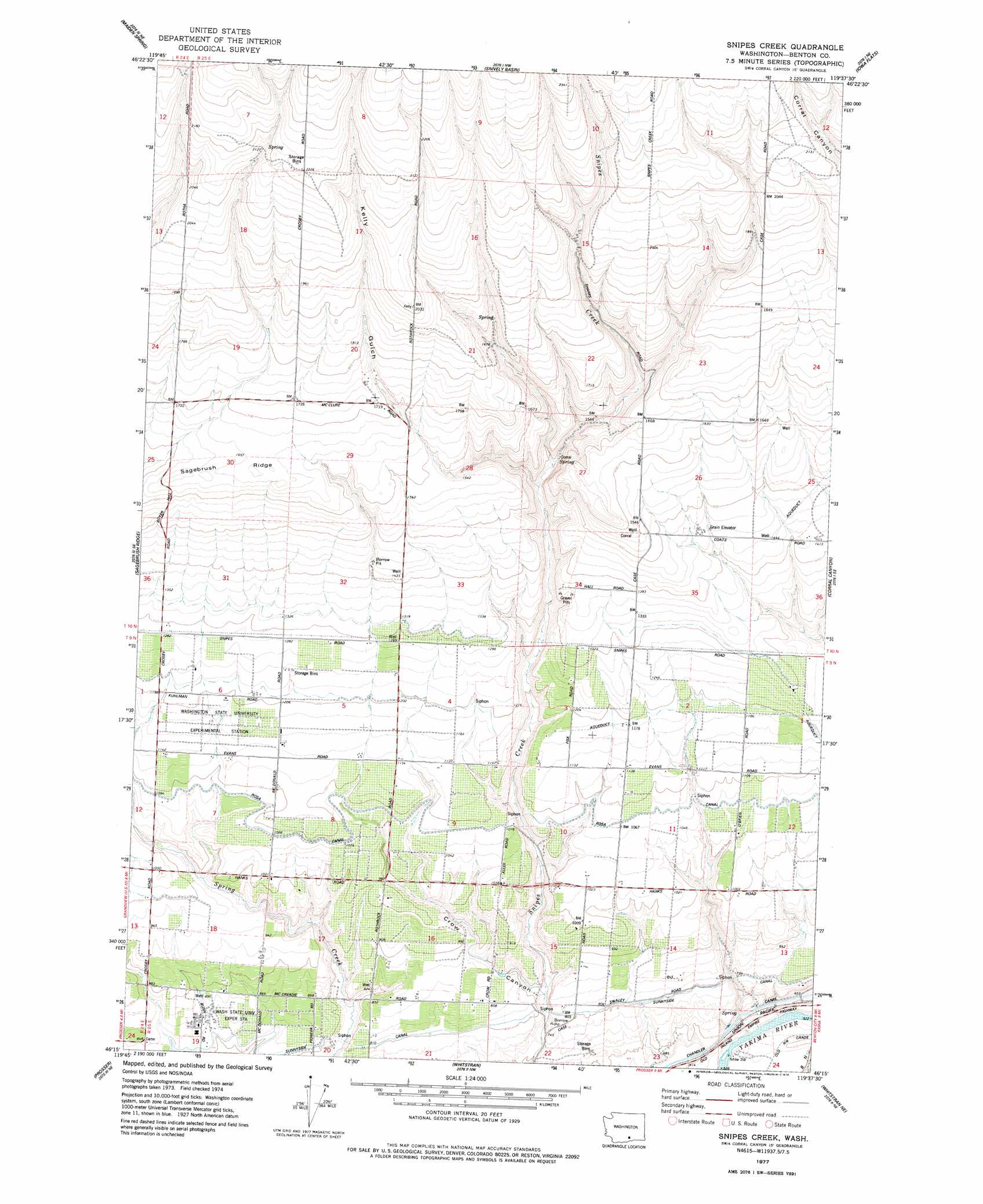
Snipes Creek Topo Map Washington
To zoom in, hover over the map of Snipes Creek
USGS Topo Quad 46119c6 - 1:24,000 scale
| Topo Map Name: | Snipes Creek |
| USGS Topo Quad ID: | 46119c6 |
| Print Size: | ca. 21 1/4" wide x 27" high |
| Southeast Coordinates: | 46.25° N latitude / 119.625° W longitude |
| Map Center Coordinates: | 46.3125° N latitude / 119.6875° W longitude |
| U.S. State: | WA |
| Filename: | o46119c6.jpg |
| Download Map JPG Image: | Snipes Creek topo map 1:24,000 scale |
| Map Type: | Topographic |
| Topo Series: | 7.5´ |
| Map Scale: | 1:24,000 |
| Source of Map Images: | United States Geological Survey (USGS) |
| Alternate Map Versions: |
Snipes Creek WA 1977, updated 1978 Download PDF Buy paper map Snipes Creek WA 2011 Download PDF Buy paper map Snipes Creek WA 2013 Download PDF Buy paper map |
1:24,000 Topo Quads surrounding Snipes Creek
Cairn Hope Peak |
Emerson Nipple |
Riverland |
Gable Butte |
Hanford |
Sulphur Spring |
Maiden Spring |
Snively Basin |
Iowa Flats |
Horn Rapids Dam |
Grandview |
Sagebrush Ridge |
Snipes Creek |
Corral Canyon |
Benton City |
Mabton East |
Prosser |
Whitstran |
Whitstran Ne |
Webber Canyon |
Prosser Sw |
Prosser Se |
Lenzie Ranch |
Whitstran Se |
Prior Ranch |
> Back to 46119a1 at 1:100,000 scale
> Back to 46118a1 at 1:250,000 scale
> Back to U.S. Topo Maps home
Snipes Creek topo map: Gazetteer
Snipes Creek: Ridges
Sagebrush Ridge elevation 508m 1666′Snipes Creek: Summits
Royer Hill elevation 480m 1574′Snipes Creek: Valleys
Crow Canyon elevation 235m 770′Kelly Gulch elevation 423m 1387′
Snipes Creek digital topo map on disk
Buy this Snipes Creek topo map showing relief, roads, GPS coordinates and other geographical features, as a high-resolution digital map file on DVD: